Thursday, December 23, 2021

Wind Wind Go Away

Note: Since my cell service is weak, and wifi is weaker…I am going to attempt to post this blog in several pieces.  I am hoping the signal is strong enough to add 2 or 3 pictures at a time, but…we shall see how that works.

We have spent most of the past two weeks pinned down by strong wind.  We stayed in Georgetown at Great Exuma, which is an interesting place (more on that a little later), for nine days waiting for a break in the winds.  Waves were forecasted anywhere from 5-10 feet during those 9 days…all numbers higher than we would prefer.  Since leaving Georgetown, on Monday, Dec. 20, we made a 25 mile trip to Calabash Bay at the northern tip of Long Island, then a 45 mile leg to Clarence Town.  

The two trips were polar opposites in terms of wave conditions…even though the forecast was identical on both days…yikes! My confidence in trusting the forecasted wave heights is shaken.  The problem we are facing at the moment is which forecast to believe.  On the day of our journey to Calabash Bay one forecast called for 4 ft waves, while two predicted 2 ft waves.  There were actually 0 ft waves…an amazingly beautiful day.  The next leg had the exact same forecasts from all three sources, however, we battled 4-6 foot waves on the nose for 8+ hours…ugh!  We now sit in Clarence Town, pinned down by strong winds again.

Thanks to Nations Online Project for the use of this map for educational purposes.

Just to review our journey thus far, for those of you unfamiliar with the geography of the Bahamas.  The purple line shows a rough interpretation (drawn with my finger while aboard a rocking boat) of our route, with yellow dots showing stops.  The green line shows future plans, if the wind should ever stop blowing.  We are now only three days away from our winter destination of Turks & Caicos, where we plan to spend two months of snorkeling bliss…best laid plans!

Back to our time in Georgetown…

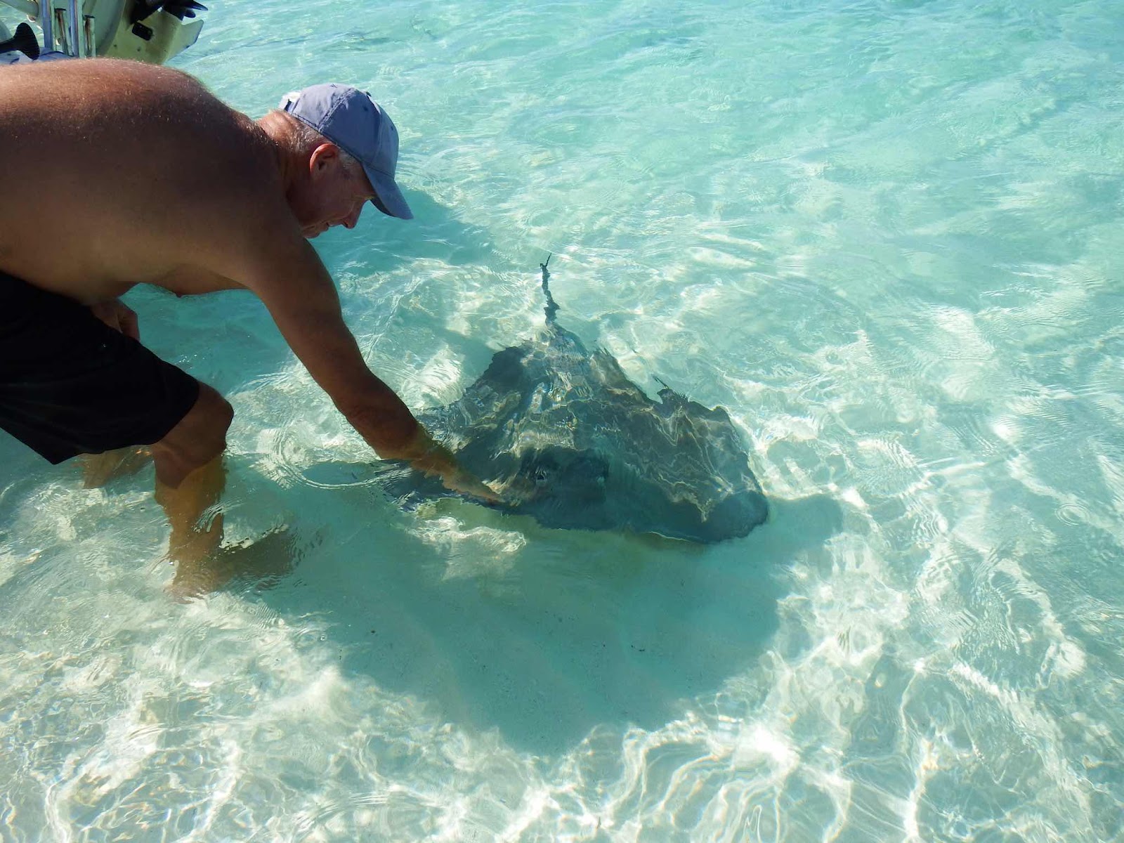
Clearly, feeding the rays at ‘Chat n Chill’ is a tourist attraction.  Keith just bent down to touch, he didn’t have food…he/she left disappointed!

So Georgetown is a cruisers destination.  Much like a popular campground in Florida, many people flock here to escape harsh winters and join a social community.  This cruiser community is very well established with a morning cruisers net (radio broadcast) that covers everything from classes, meetings, potlucks, give aways, announcements, and even a joke of the day.  I have been told that, at times, 500 boats have been in this harbour…luckily for us, there were probably only around 100 when we were there. 

I understand the social aspect that some people seek, and if spending their winters here is their dream…good for them.  What I don’t understand, however, is why people work so hard to find paradise, then have no qualms about destroying it!  During one of the morning nets, the announcements quickly went from water aerobics will meet on the beach at 9:00 to…”please me courteous and don’t dump your holding tanks (aka large amount of raw sewage) in the Harbour in the middle of the day when people are swimming, at least wait until night.” 😳!!
ARE YOU KIDDING ME RIGHT NOW!! (That is the yelling in my head).  I had to turn the radio off and walk away!  These people have the wherewithal to bring their boats hundreds of miles to this ‘paradise’ location, but can’t be bothered to move 3 miles offshore to dump tanks safely???  Unbelievable…get me out of here!


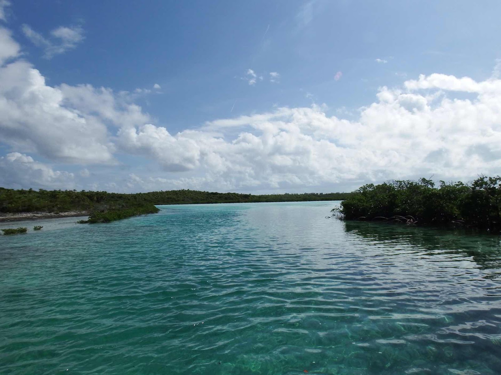
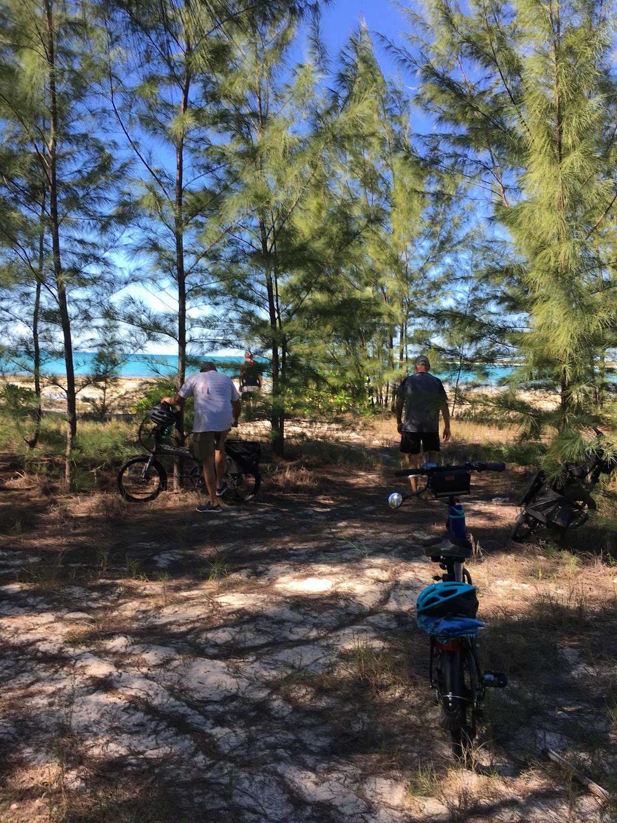
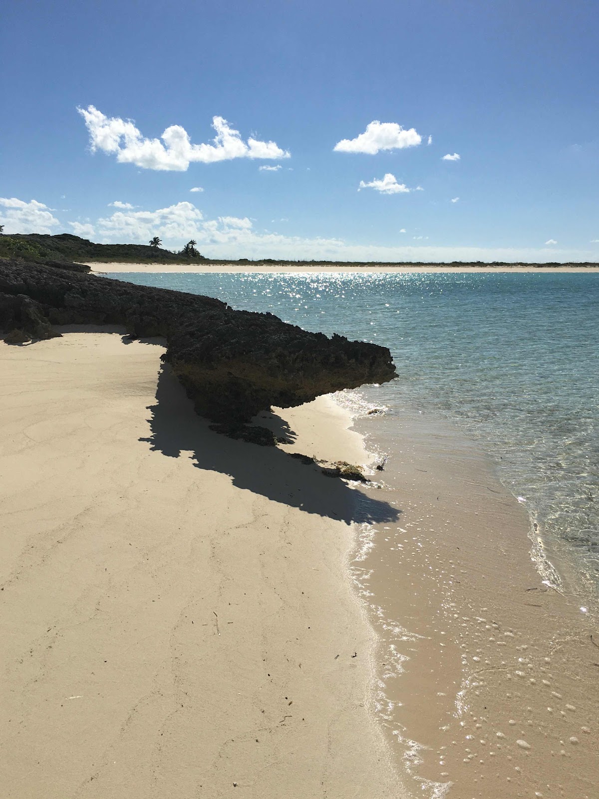
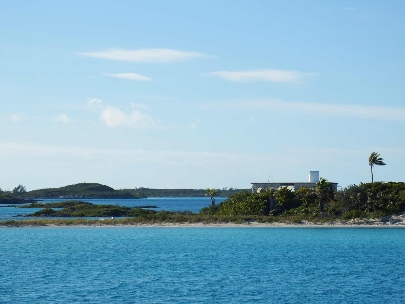
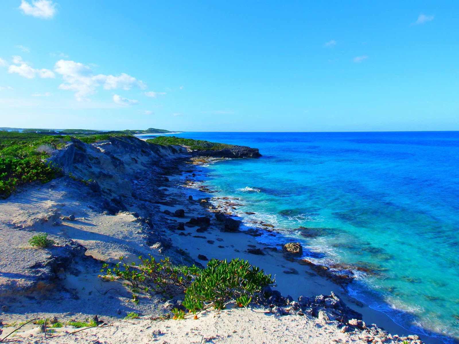
Since we weren’t going to be swimming in this harbor, we spent a nice afternoon hiking across the island to the ocean side.  Beautiful.


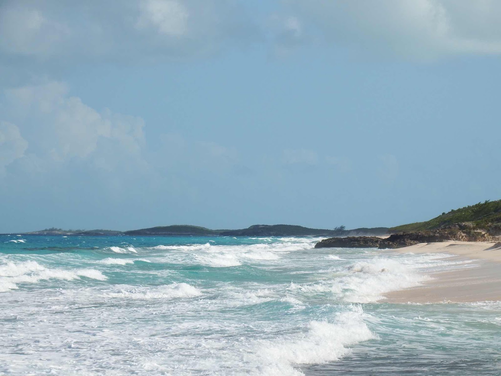
This one gives you a good idea of why we aren’t leaving the protection of this island.

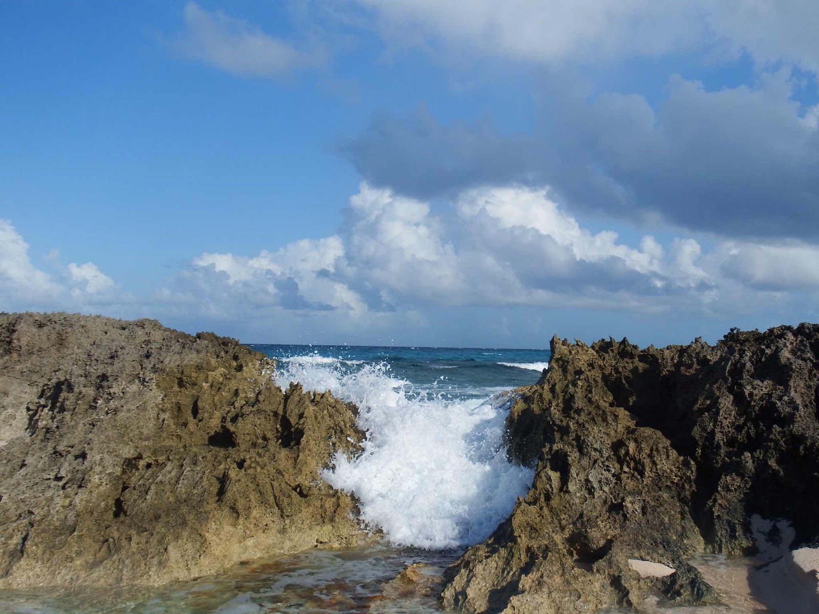
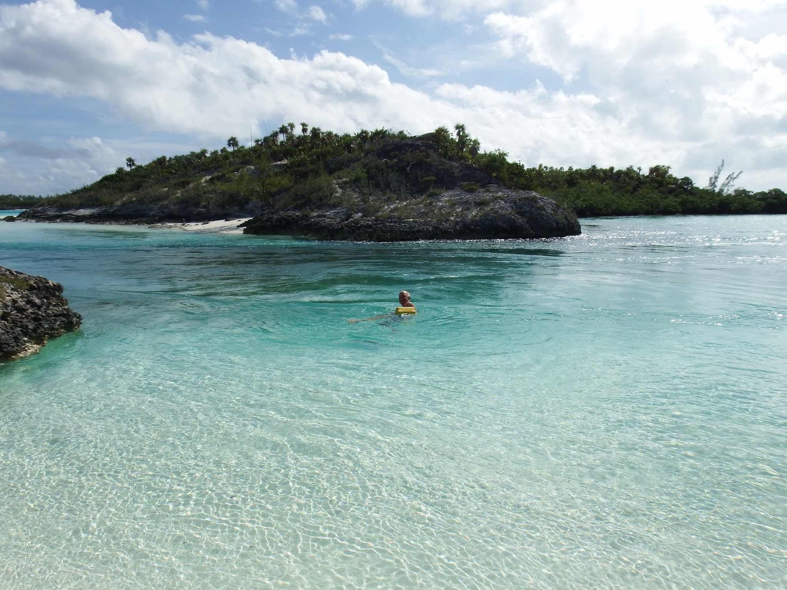
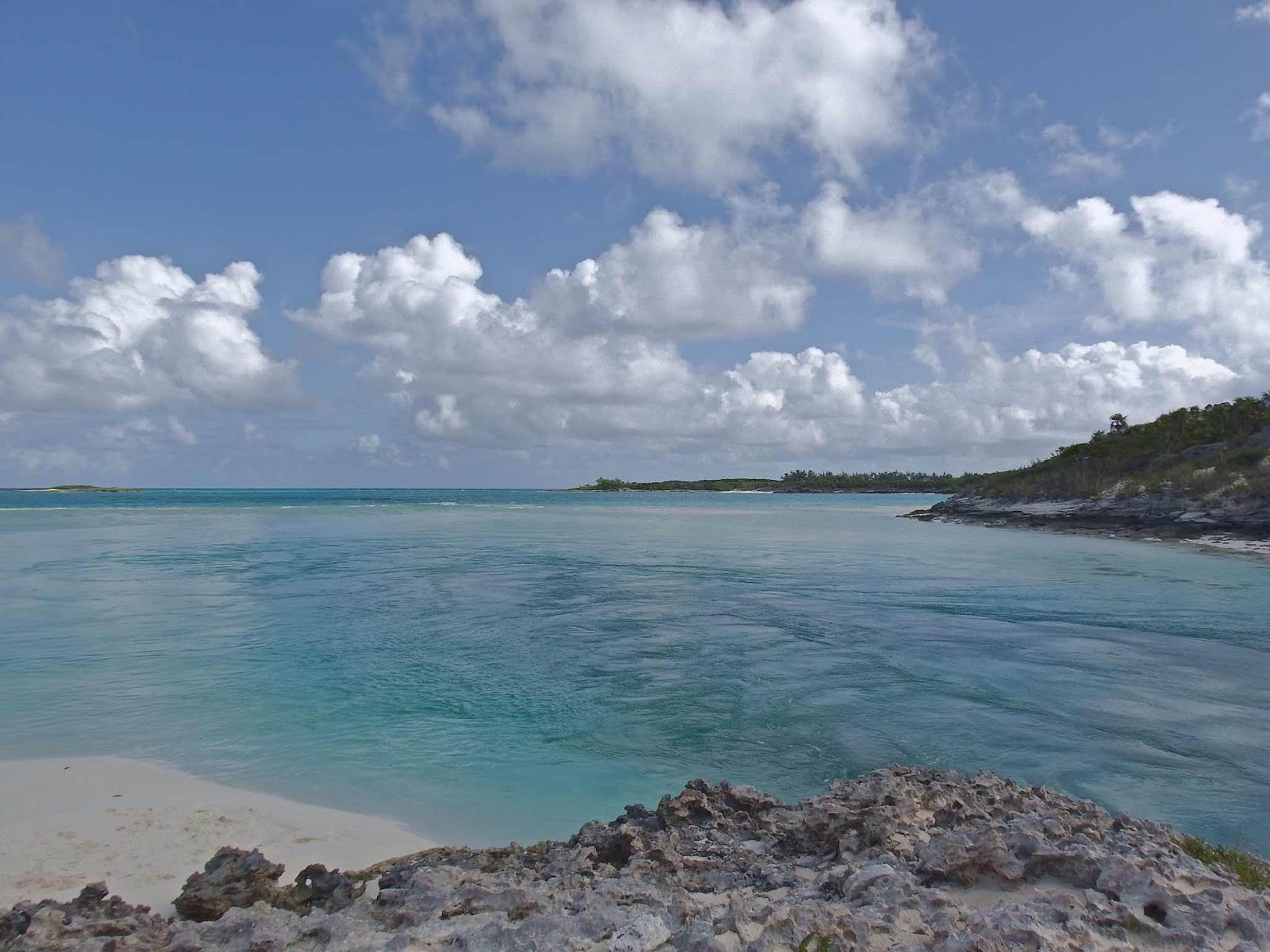
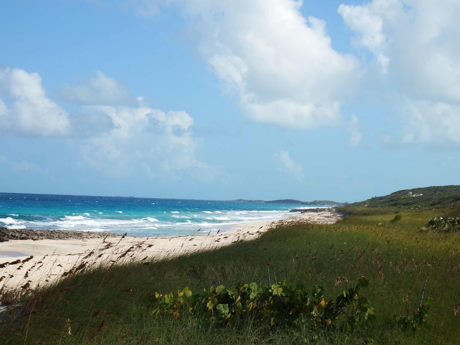
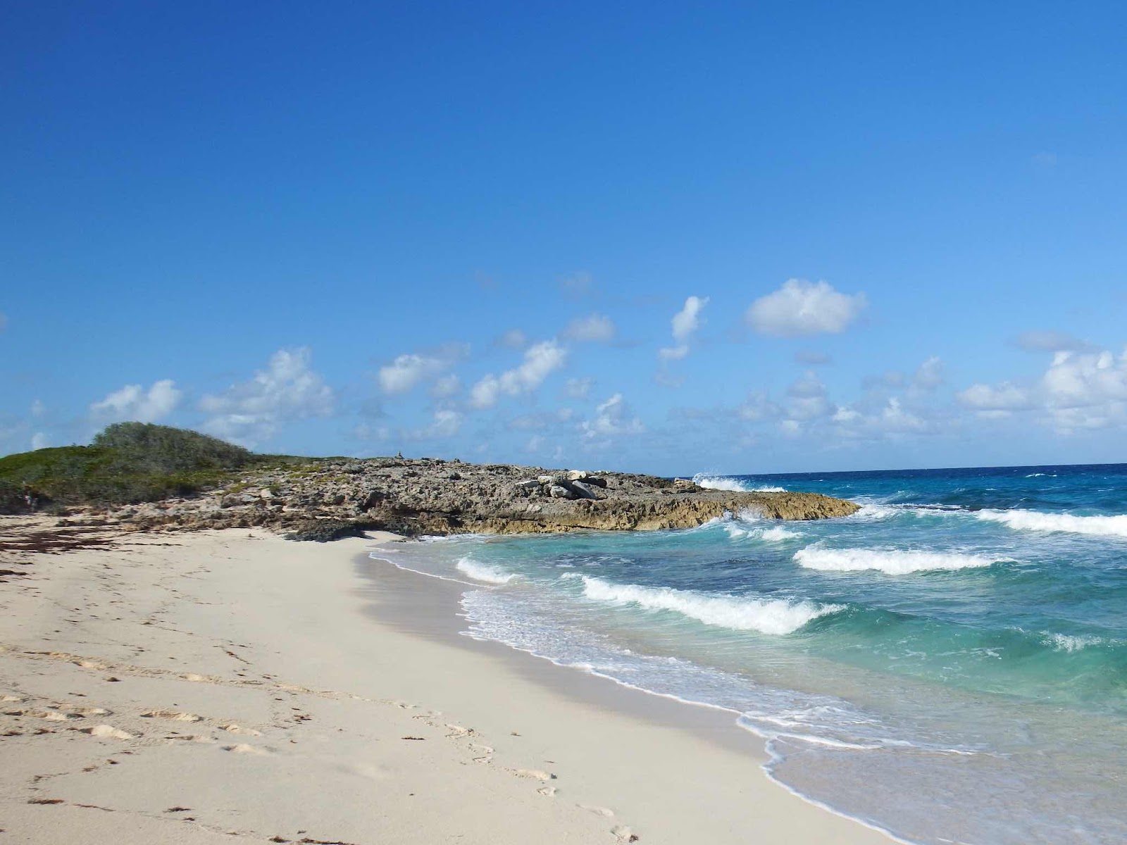
This beach offered so many opportunities for great pictures.

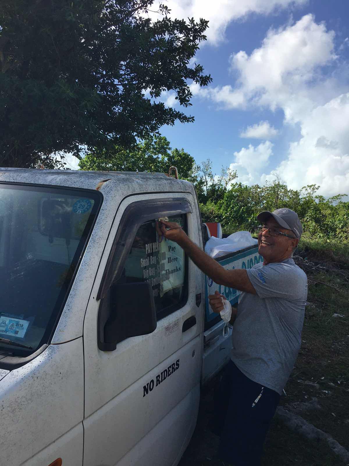
Clearly, the town has embraced to migration of the cruisers.  One enterprising resident parks his truck near the dinghy dock so cruisers can dispose of trash.  The charges are listed on the window, and you slip your money through the crack.  The drivers seat is usually piled with cash.  The grocery store has also grown to accommodate the large cruising community.  The store is very large and well stocked satisfy North American (both US and Canadian) preferences. 

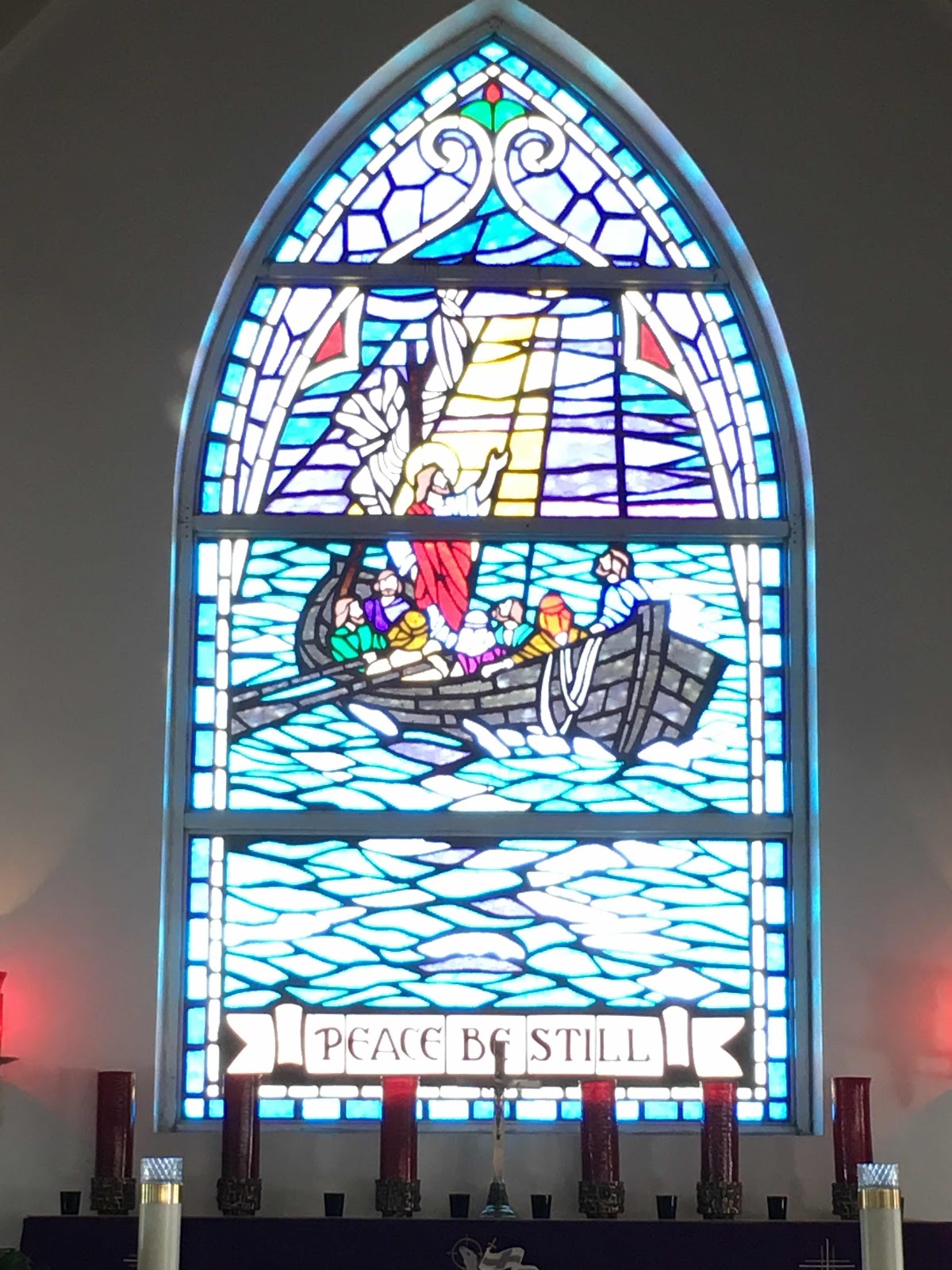
The church has beautiful stained glass that is appropriate for the community.

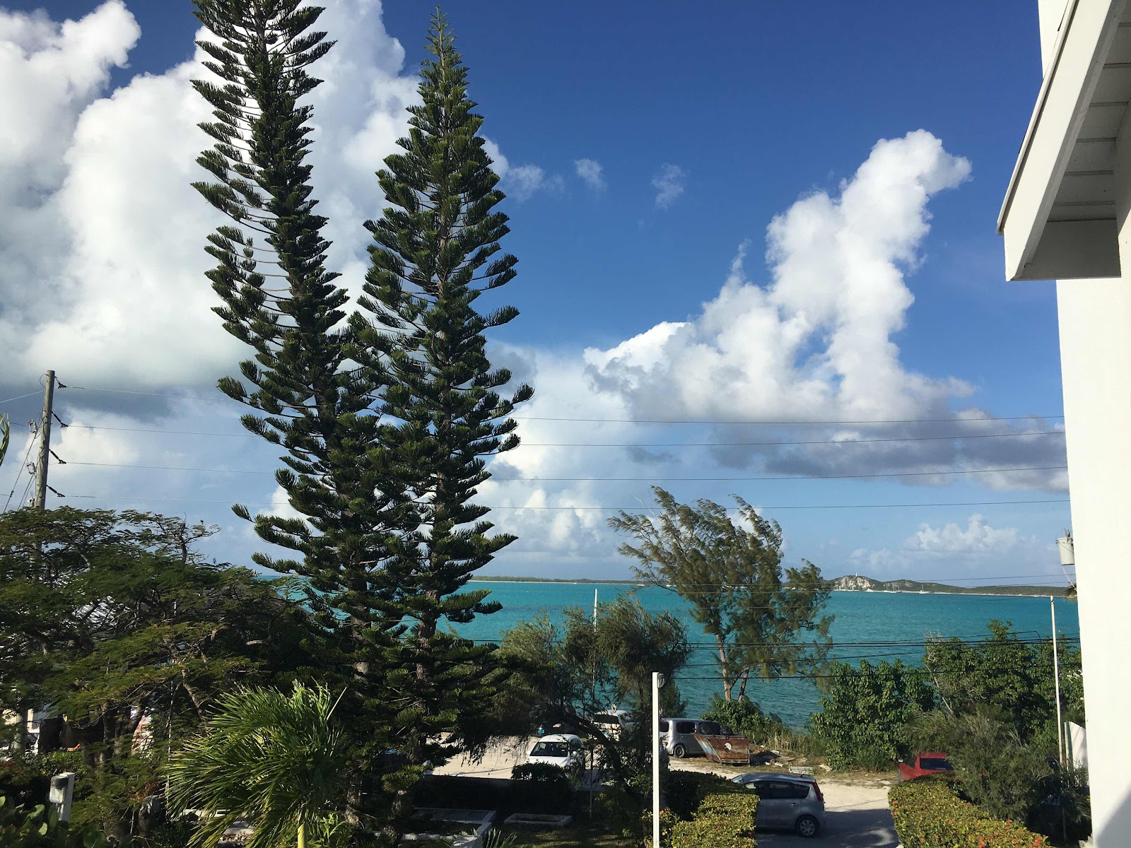
The view from the hilltop church is stunning.

On our last evening before departure (after Eddie and Gail treated us to an amazing lunch at Kamari Resort) we took the short hike to the high point overlooking our anchorage, to take in the view one last time.
You can see our boat in the distance (not the big one).  There are three main anchorages here, and we are anchored in the least favorite…in case you are wondering why you see so few boats.


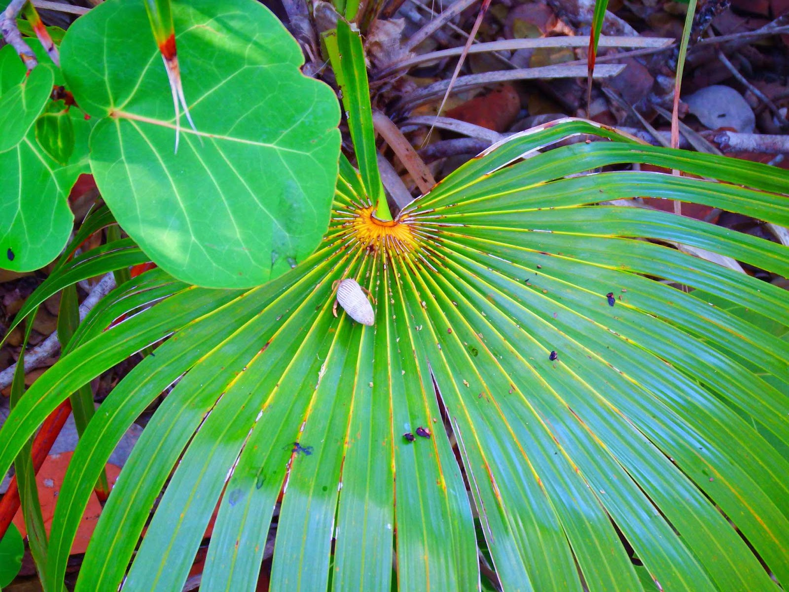
I didn’t know hermit crabs climbed trees.

Goodbye our friends.  There have been many things we have enjoyed about cruising with Gail & Eddie, but the thing I will miss most is having snorkel buddies who are always ready to jump in!  I love that all four of us are water babies down to our core!

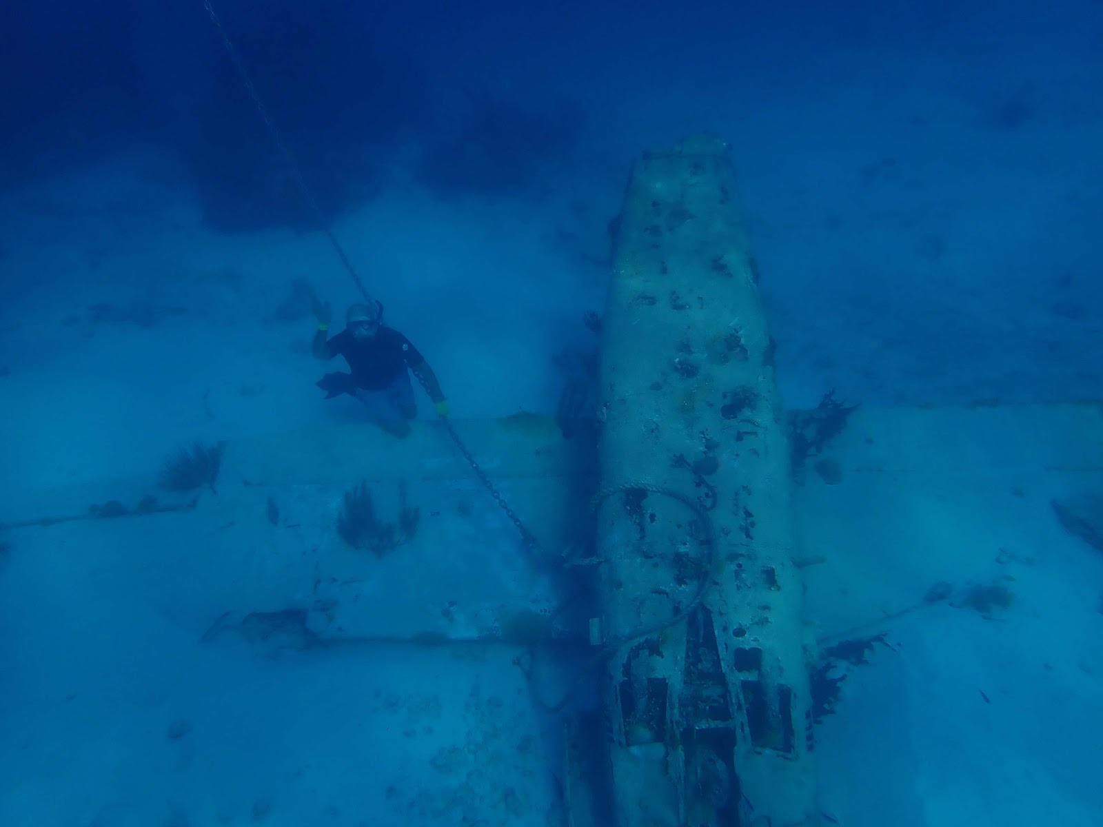
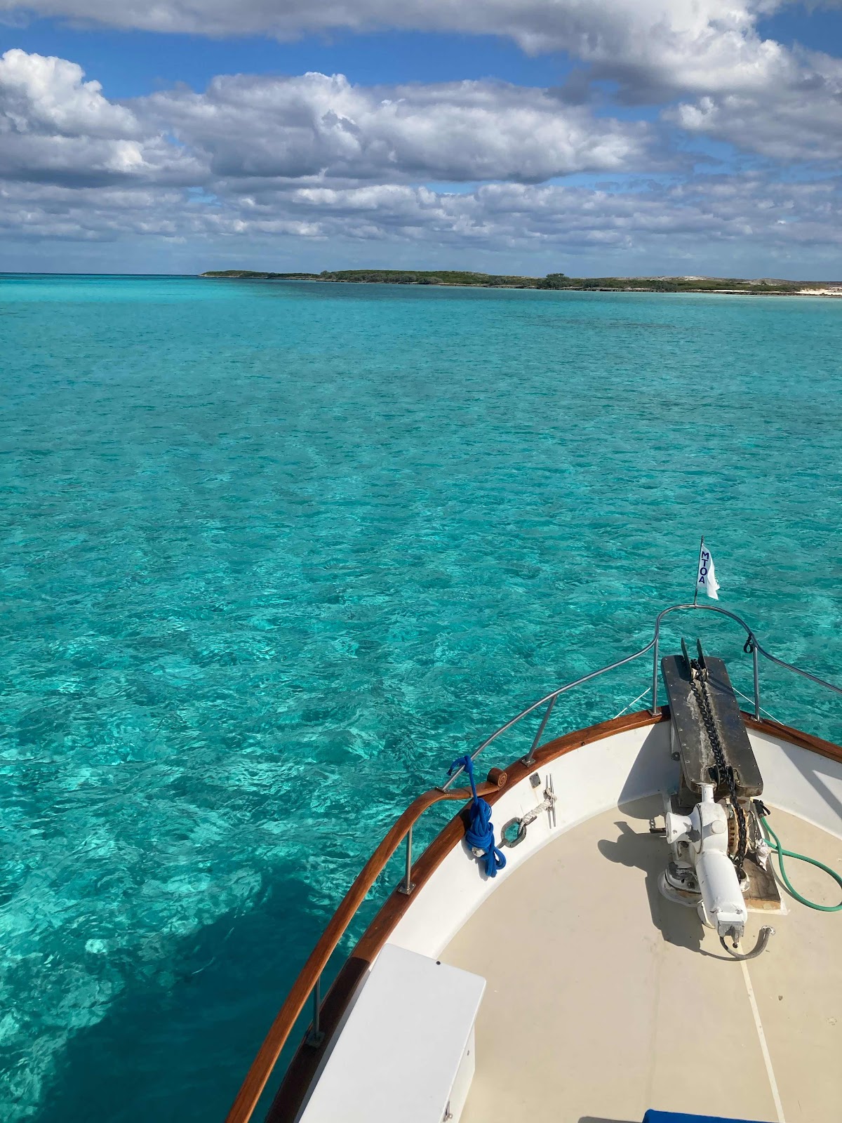
As previously mentioned, our trip to Columbus Monument (just north of Calabash Bay was glorious!

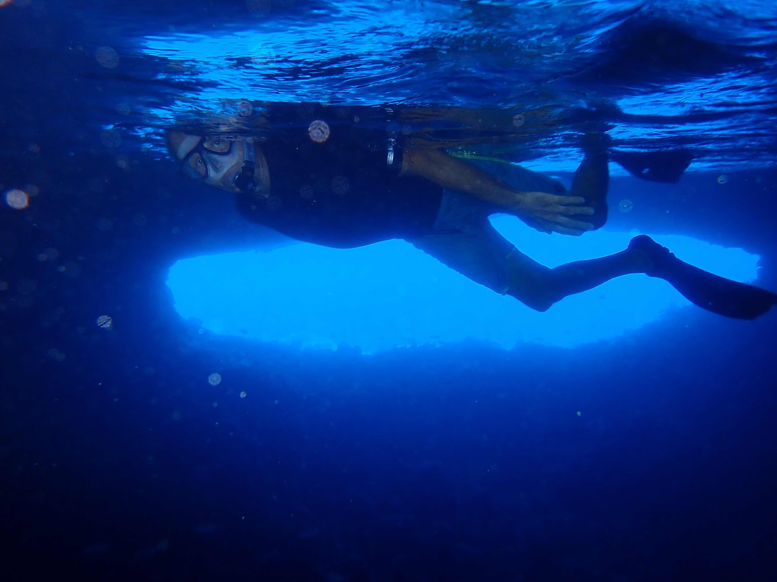
As soon as we anchored (after getting a few drone shots) we grabbed our snorkel gear and jumped off the back of the boat.  If you enlarge this picture, and look closely, you can actually follow the anchor chain right off the bottom of the picture.  That is amazing when you consider the drone is approximately 130 feet in the air, and the water is 18 feet deep!
Immediately after dropping the anchor this huge ray swam past the boat.  It was at least 4 ft across.

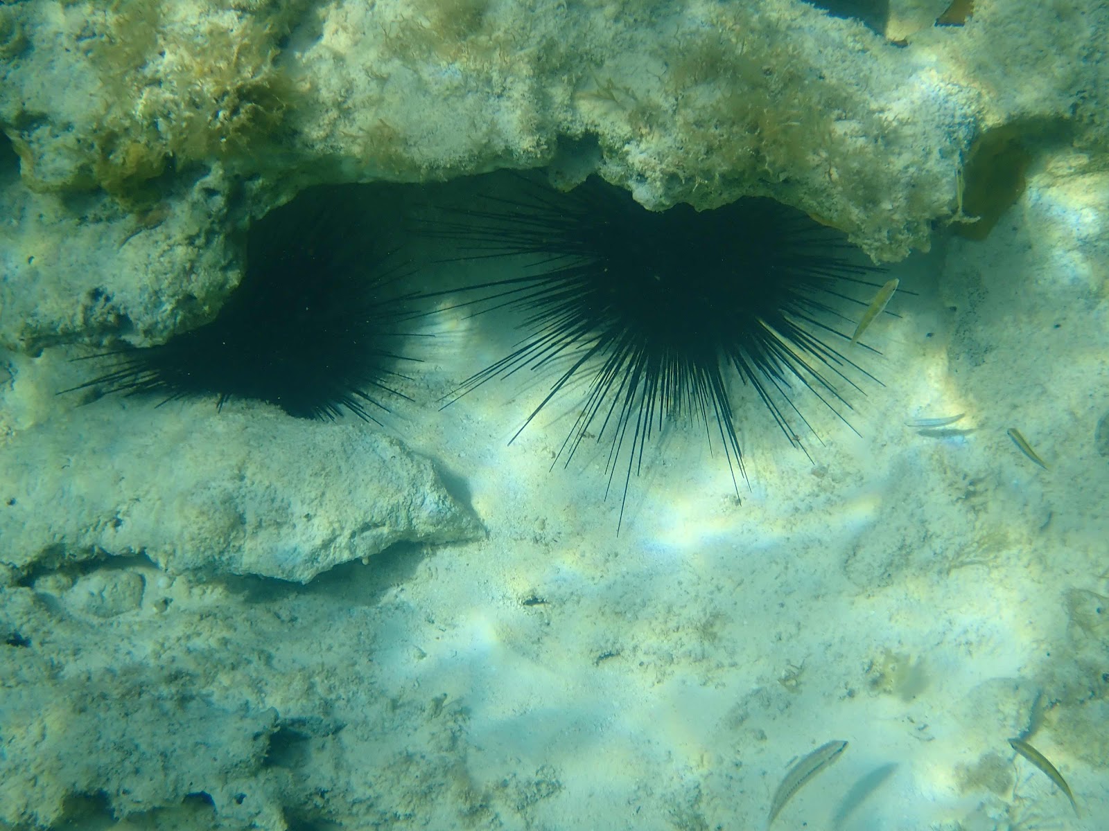
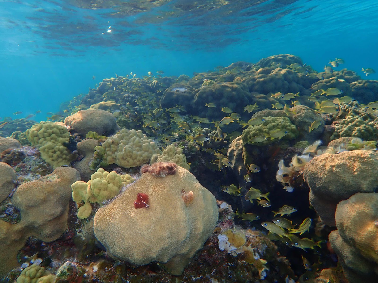
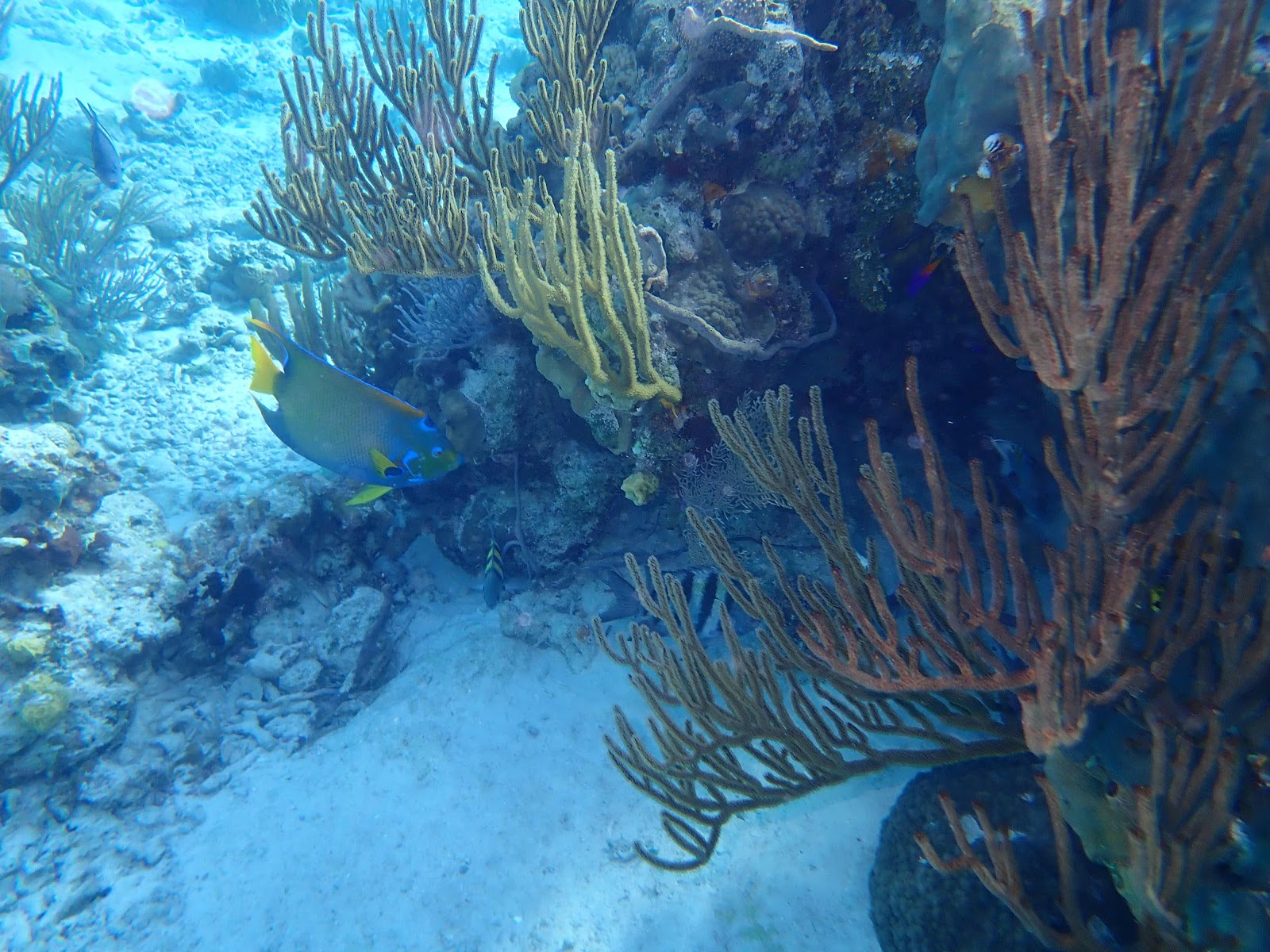
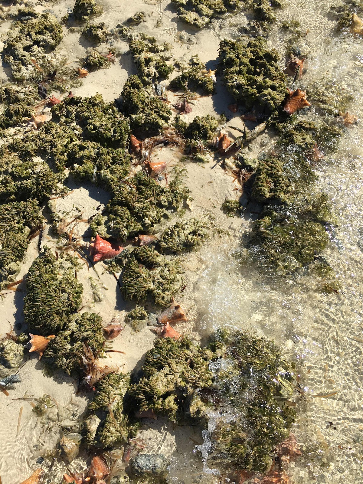
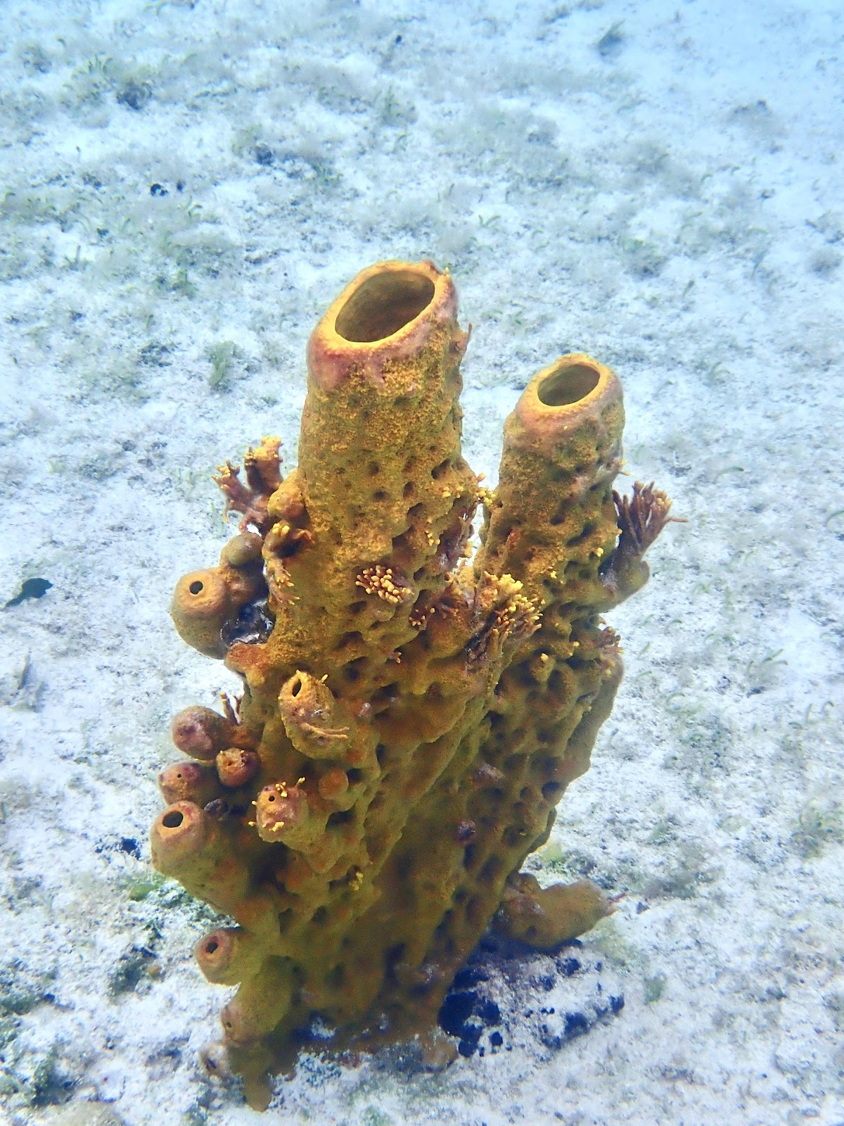
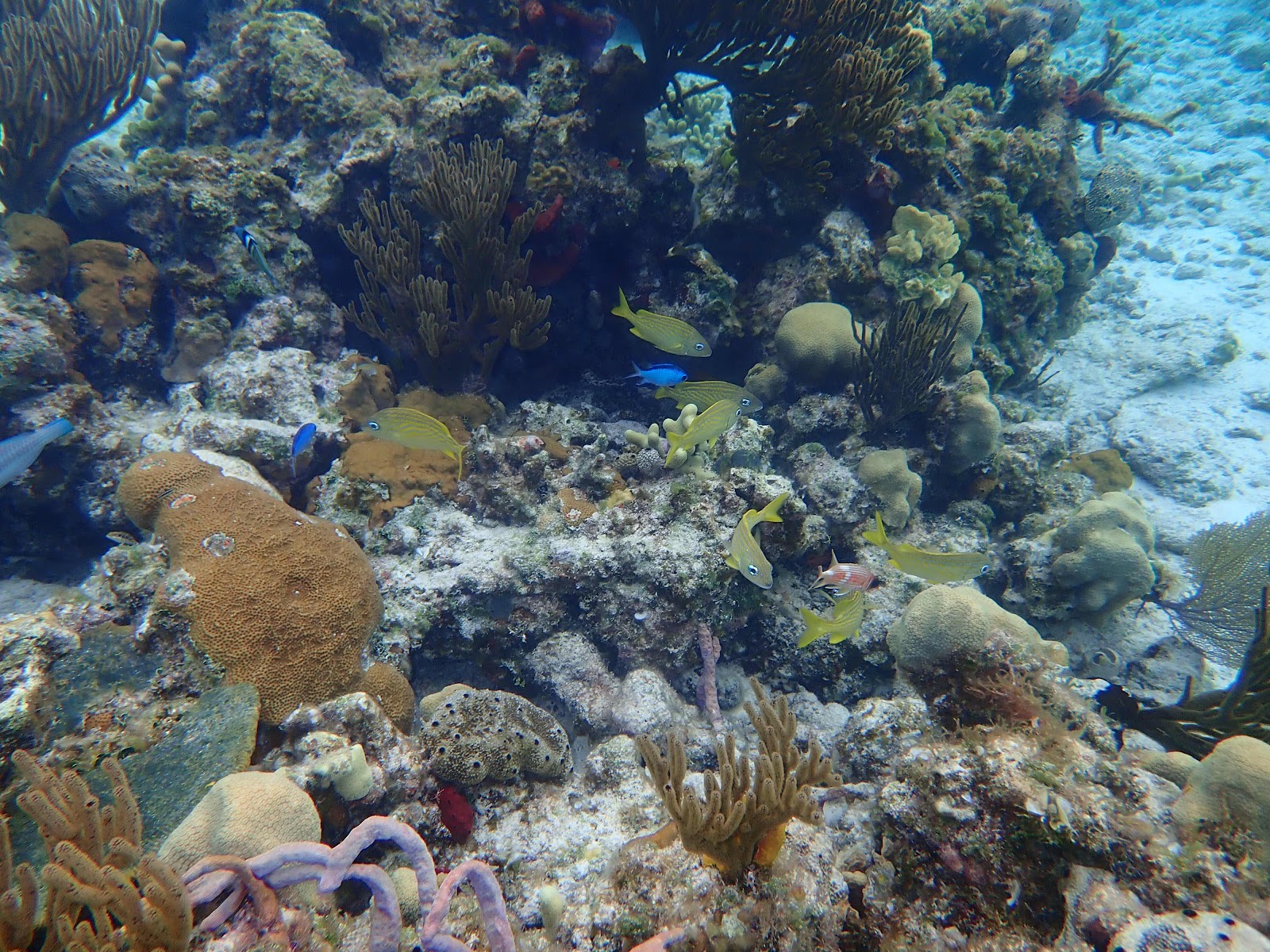
There wasn’t much coral along this beach, but there were a lot of large holes that contained a variety of fish and huge urchins.

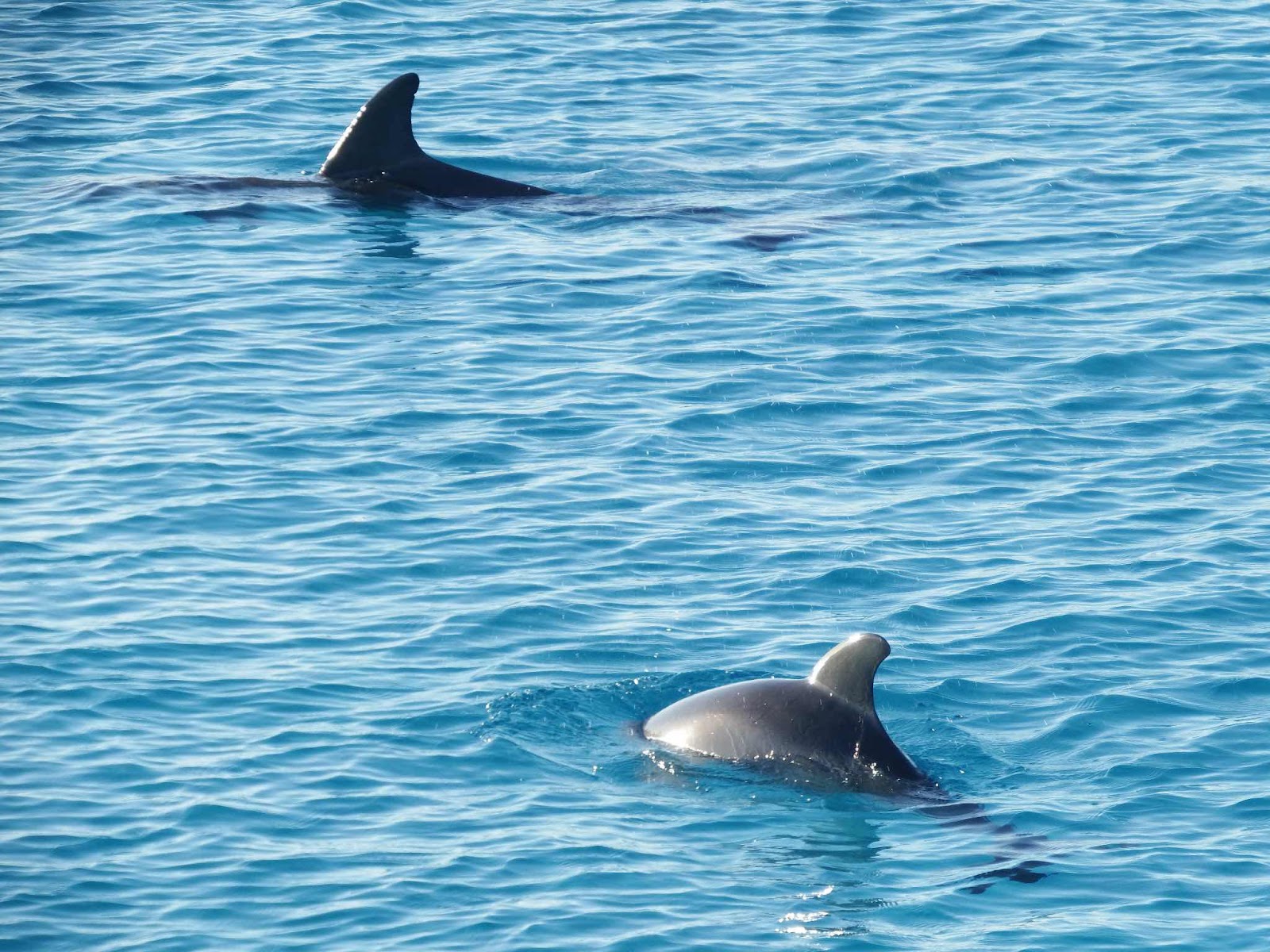
The first dolphins I’ve seen since leaving Florida.  A mother and baby were fishing around the boat.  This baby was very small!

We waited a long time for this perfect day, but our wait paid off!

The next day we rounded that point and went to the ‘dark’ side (where the water is 2,000-3,000 ft deep) for the 45 mile (miserable) leg to Clarence Town…where once again we are waiting for a perfect day.

We hope everyone has a very Merry Christmas and a Happy New Year.

Future post will need to be extremely abbreviated, as this post took 8 hours (not 8 straight hours, but frustrating) to get online today…ugh!


Tuesday, December 14, 2021

Exuma Express

We have made good progress working our way down the Exuma Islands chain, which is 120 miles long and contains 365 islands.  After leaving Spirit Cay, we ventured about 10 miles south to Shroud Cay.  Shroud Cay is in the northern boundary of the Exuma Land & Sea Park, a 176 square mile “ecological preserve and wildlife refuge”.

After anchoring on the west side of the island, we took a dinghy ride through the mangrove channel that connects to the east side of the island.


We passed this research boat tagging a green turtle. They estimated this turtle to be 8 years old, but told us that this species isn’t sexually mature until their mid 40’s.  Wow, that’s a long time to survive, before they are able to reproduce.  Can you imagine how different this world would be if humans couldn’t reproduce until they were 45??

Here is the inlet to the ocean…beautiful!  The current is quite strong here, so the plan is to beach the dinghies on the strip of sand to the left…without getting swept out between the rocks.


Well, we didn’t want the boat to get swept out, but it is part of the ‘experience’ to ride the current.  Eddie and Gail went first, and Keith was right behind.

There’s Eddie and Gail, swirling in the current.

This was a fun ride, and after a few times through I learned to use the current to take me out, and around a few spins, then bring me right back to the sandy spot at the bottom left of this pic (the eddies were generally spinning counterclockwise).  The first time through I learned the hard way not to let the current carry me all the way to the sandbar.  The sandbar does stop you from washing out to sea, but it is a long, hard slog through knee deep water that is moving swiftly!

The next day we took a temporary detour north a few miles to find good cell service so Eddie could have some parts flown into Staniel Cay.  Norman Cay offered good cell service, and a beautiful place to anchor.

Navigation by water color is very important!  We always try to anchor in bright blue water with a clear sandy bottom, to ensure we don’t damage any coral.  We try to avoid the dark spots (which could be rocks, grass, coral…🤷🏼‍♀️) and the light spots (which are usually sandbars).  At this anchorage we could see several dark spots a few hundred feet from the boat, and we decided to investigate the one on the right side of this picture.   We grabbed snorkel gear and headed over in the Whaler.

And to our surprise…this is what was producing the ‘dark’ spot.  Wow!! I think this is the most amazing reef we’ve seen.  The biodiversity was absolutely incredible, and there was no current at that time so we were able to float and explore at our leisure.  

Yellow Stingray

Spotted Moray Eel


The fish appeared to be electric with the angle of the sun overhead.

And…we did our part to preserve and protect this reef.  We ended up snorkeling two ‘dark spot’ reefs, near the boat that day, and Keith caught a total of six lionfish.  Lionfish are an invasive species that are causing great harm to reefs.  They eat a lot of small tropical fish, and because of their venomous spikes…they have few predators.  We used scissors to clip off the spikes so that I can safely fillet them.  However, this time we missed a spike that stabbed my finger, and I will testify that the venom is no joke!!!  My finger tip (about an inch around the jab) was on fire for several hours…then partially numb for a few more hours after the pain subsided.  I doubly enjoyed eating this batch!

Our next stop was O’Brien’s Cay…

Snorkeling the ‘Aquarium’ at O’Brien’s Cay. There were two mooring balls to make visiting the area easy.  Again, the current was crazy strong…you can see Gail holding onto a noodle that is tied to Zoom.  We also had lines tied to the Whaler, and it took some time before we felt comfortable letting go of the line to swim against the current.  

This reef was deeper than the last few we visited, and visibility wasn’t as good.

There were some friendly fish who seemed disappointed when we didn’t feed them.

Drug smuggler’s plane wreck at O’Brien’s Cay.  This was another place where the current was fierce!  They have a mooring ball at the surface, attached to that chain, to tie your dinghy.  In order to get this picture I had to swim hard into the current to get past the plane, then Keith pulled himself down the chain.  This plane is approximately 20 feet deep.

In a previous picture I explained why you should avoid taking your boat over ‘dark’ spots, and here you can see that light spots are also to be avoided.  It is very easy to see the sandbars in this crystal clear water.  We are now heading to Staniel Cay with two agenda items for this visit.  First, we will visit the legendary Thunderball Grotto, which is an underwater cave made famous by two James Bond movies. After our snorkeling excursion, we will visit the town so Eddie can pick up his engine parts.  

The travel advice is to visit Thunderball at low tide to make the entry and exit easy.  However, we did not have that option, as it was high tide when we arrived.  High tide means you must swim underwater, into a tunnel, to get into and out of the cave. Since we planned our trip at high tide we thought we could take advantage of the ‘slack’ time before the current changed directions…we thought wrong.


Is that the James Bond double I see?  Getting in wasn’t too difficult.  There were actually three entrances, and we entered through the one that required the shortest underwater passage (that was pure luck).

Once you came up inside, the cave looked like a big dome about 20-30 feet over our heads.  There were several holes in the rock overhead allowing large shafts of light to enter the cave and the water.


The current inside was still very strong as water came in the two openings on the west side, and went out the one larger opening on the east side.


There were a lot of fish who clearly expected to be fed.  Again, we were a disappointment.  Exiting was much more difficult than entering, as we had to swim (underwater) against a strong current coming through a narrow tunnel, and once outside it was a difficult swim, against the current, to get back to the Whaler.  

The next day we decide to make an 8 hour run for Georgetown. Forecasts predict 20+ mph winds out of the east for several days, kicking up 7-9 foot seas.  We are looking for protection and convenience since we will be trapped for so long.

This leg of the trip took place on the east side of the islands, in what proved to be rough, but tolerable conditions…that deteriorated as the day progressed.  I would like to report that we made it unscathed, but that is not exactly true.  A few hours in, we received a radio call from Seaquel…”we just experienced a power loss in the port engine, there was a squeal and the engine shut down”…. Noooooooooooo! We slowed our speed to stay close by, and Seaquel came into Elizabeth Harbour on one engine.  I am saddened to report that at this time it appears as though we are losing our buddy boat.  Keith and I will continue south when the weather clears, but Eddie and Gail will stay here for a few weeks, until they decide where to head for engine repairs.


Monday, December 6, 2021

Waking in Paradise

Traveling is always a tiring experience.  Whether you are traveling by car, bus, train, plane, or boat (more likely cruise ship for most of you)…putting miles behind you, and getting there can be a taxing experience.  However, once you get on the plane, or cruise ship, you might be able to close your eyes and wake up in paradise.  I knew it wouldn’t be quite that easy for us, but I thought after the 17 hours of travel I would be lazily napping at anchor off the beach of Chub Cay (pronounced ‘key’ in the Bahamas). That’s not exactly how it played out.


Our original plan was to leave Biscayne Bay at 1:00 am to be able to pass through the cut at Cat Cay in the early morning light.  The forecast was improving and the guru of Caribbean weather forecasts (Chris Parker) moved his ‘go’ call from 10:00 pm to 8:00 pm.  After discussing the possibility of passing through the cut in the dark, we decided to move up our departure time, and actually left Biscayne Bay at 6:00 pm.  As the sun was setting, we headed out.  

Does anyone really think two hours will make much of a difference in conditions?  We will never know the answer to that question, but I do know the Gulf Stream was very rough from 8-11 pm.  Rough enough that for the second time in the past two and a half years I was VERY seasick.  Both times have been in the Gulf Stream in the dark. Unfortunately, my helm duty (9-12) coincided with the rough conditions so sleeping through it was not an option, but conditions were much improved by 11:00 and the final 12 hours of the trip were very nice.  My 3:00-6:00 a.m. helm shift was fabulous, with no visits to the outside rail!

We arrived at Chub Cay before noon, and I could envision a nap in my hammock as soon as the anchor was down.  Unfortunately, that’s not how it played out.  We tried numerous times to set our anchor, but could not get it to hold…UGH!  Eddie and Gail had no problem, so I couldn’t understand what was happening.  Eddie dove on his anchor and reported that he was snagged on a rock, but there was very little sand on top of a very hard bottom.  Finally, Keith and I decided to wave the flag of surrender, and called the marina to add a night to our reservation. We were planning to check into the marina on Monday anyway, to make the process of clearing Customs and Immigration easier.

Little did we know that they would make us go to Customs as soon as we docked, and with boats coming and going (with incredibly loud bow thrusters) a nap was not a possibility! If only I had ventured out for a walk (once we were checked in and legal), I would have come upon this very nap-able beach!  We did take full advantage of these beach chairs the next day.

After a good nights sleep we off-loaded the bikes to explore the island.  These bikes have really expanded our world!

And almost instantly my soul was restored…a day later than expected, but now paradise was all around us!! We came upon a secluded beach that appeared to be a conch nursery.  Every conch shell in this picture (I counted 30) had a live creature inside, and there were hundreds of them on this beach. This might be one of my all time favorite pictures!

Once we got away from the marina, Chub Cay turned out to be a real gem. Don’t get me wrong…the marina was VERY nice, but this is where my heart sings!

Wednesday mornings departure was scheduled for ‘O dark 30’ to travel 75 miles to Highbourne.  Seaquel’s silhouette in the sunrise was spectacular!

The reality of where we are, and the beauty of this place, really started to settle in our minds while anchored at Highborne.

Our next stop was just 12 miles south to Spirit Cay, where Eddie and Gail have friends who have lived here as caretakers, of this privately owned island, for 20 years.  WOW! Can you imagine living here?  We joined Bob and Mary, in their amazing island home, for dinner that evening. It was a remarkable experience meeting such interesting and welcoming people!

We decided to stay an extra day to snorkel the local reefs.

I had to get a picture of these freaky eyes, which was no easy task!  We decided to snorkel a stretch that ran a half mile on the north end of the island.  We were only a few hundred feet off the shore, but the current was screaming out to sea. Luckily, Eddie having experience as a dive master, suggested that one person should stay in the boat while the rest of us did a drift snorkel.  It was AMAZING!!  There was so much to see, but we were drifting so fast that I spent a significant amount of time swimming against the current.  It took me 4 attempts to get a picture of this fish.

The sponge and coral structures were incredible!


Bowl coral seem to thrive here!

There were small communities of tropical fish, but I’m thinking most were tucked into cracks and crevices waiting for the tide to slack.

Keith wanted to be towed back to the boat so he could look for conch.

Clearly he hasn’t lost his touch, because in the distance of about half a mile he collected two helmet conch, one horse conch, and 3 queen conch.  The queen conch became a delicious cracked conch dinner, but the others were returned to their original (close to original) locations.


Goodbye Spirit Cay, and thanks to Bob and Mary for sharing their piece of paradise!


The Continuing Saga

  Well, another month has passed since my last post, and I must report that our trying times have continued to haunt us.  Not sure if we sho...