We have made good progress working our way down the Exuma Islands chain, which is 120 miles long and contains 365 islands. After leaving Spirit Cay, we ventured about 10 miles south to Shroud Cay. Shroud Cay is in the northern boundary of the Exuma Land & Sea Park, a 176 square mile “ecological preserve and wildlife refuge”.
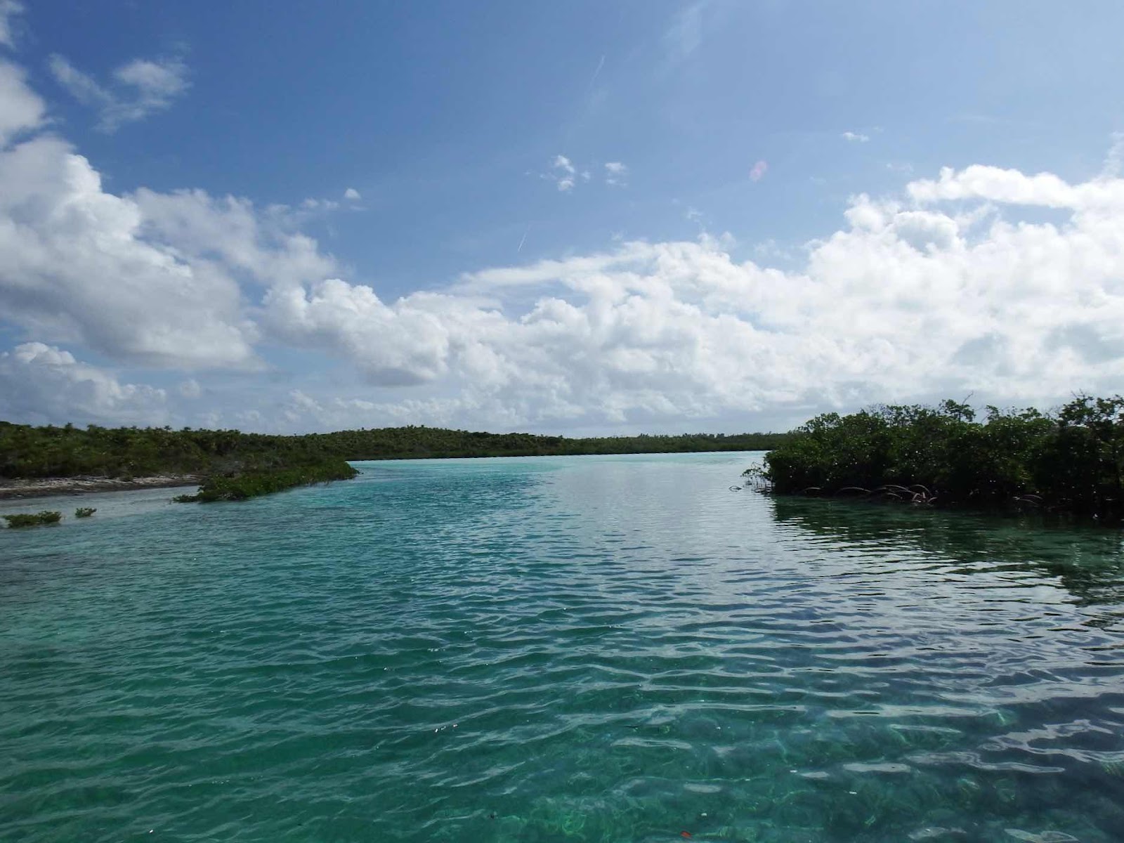
After anchoring on the west side of the island, we took a dinghy ride through the mangrove channel that connects to the east side of the island.

We passed this research boat tagging a green turtle. They estimated this turtle to be 8 years old, but told us that this species isn’t sexually mature until their mid 40’s. Wow, that’s a long time to survive, before they are able to reproduce. Can you imagine how different this world would be if humans couldn’t reproduce until they were 45??

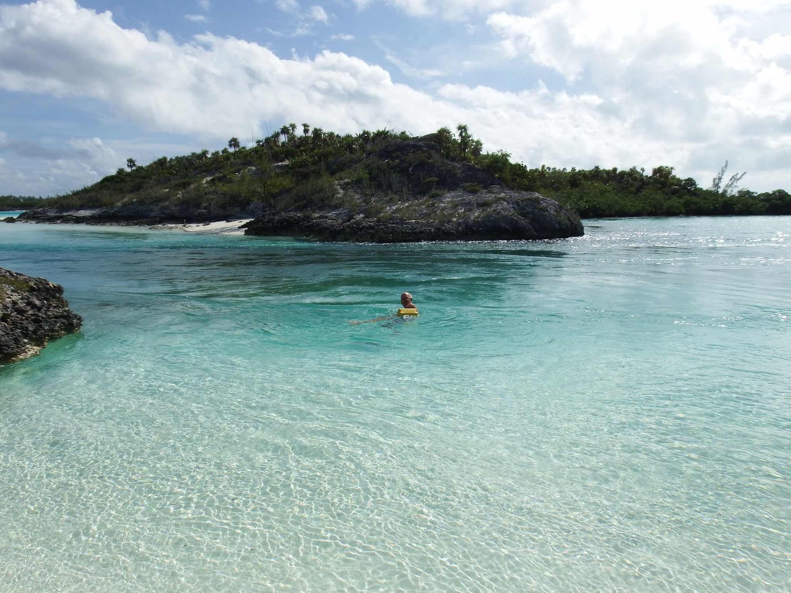
Well, we didn’t want the boat to get swept out, but it is part of the ‘experience’ to ride the current. Eddie and Gail went first, and Keith was right behind.

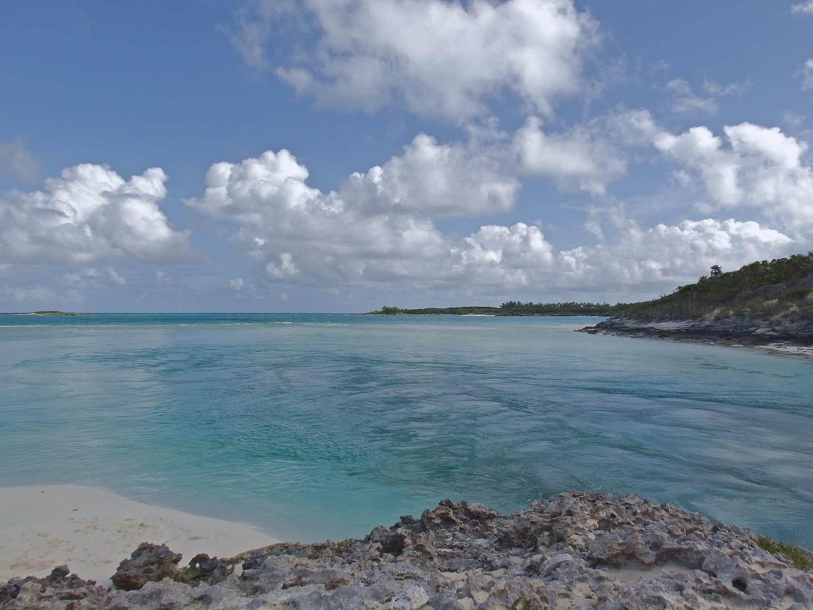


Here is the inlet to the ocean…beautiful! The current is quite strong here, so the plan is to beach the dinghies on the strip of sand to the left…without getting swept out between the rocks.
Well, we didn’t want the boat to get swept out, but it is part of the ‘experience’ to ride the current. Eddie and Gail went first, and Keith was right behind.
There’s Eddie and Gail, swirling in the current.
This was a fun ride, and after a few times through I learned to use the current to take me out, and around a few spins, then bring me right back to the sandy spot at the bottom left of this pic (the eddies were generally spinning counterclockwise). The first time through I learned the hard way not to let the current carry me all the way to the sandbar. The sandbar does stop you from washing out to sea, but it is a long, hard slog through knee deep water that is moving swiftly!
The next day we took a temporary detour north a few miles to find good cell service so Eddie could have some parts flown into Staniel Cay. Norman Cay offered good cell service, and a beautiful place to anchor.
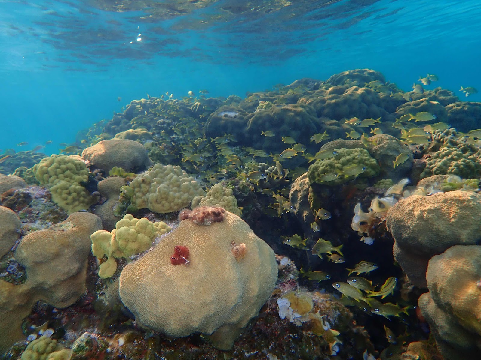
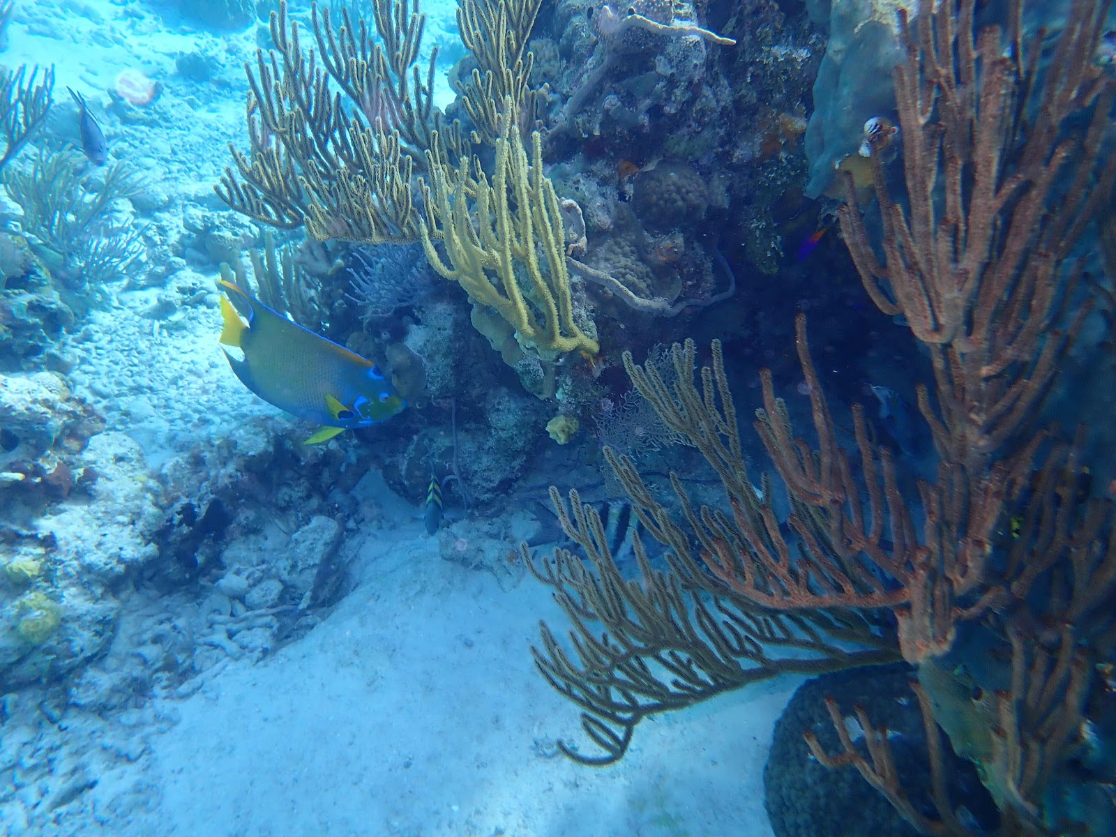
Navigation by water color is very important! We always try to anchor in bright blue water with a clear sandy bottom, to ensure we don’t damage any coral. We try to avoid the dark spots (which could be rocks, grass, coral…🤷🏼♀️) and the light spots (which are usually sandbars). At this anchorage we could see several dark spots a few hundred feet from the boat, and we decided to investigate the one on the right side of this picture. We grabbed snorkel gear and headed over in the Whaler.
And to our surprise…this is what was producing the ‘dark’ spot. Wow!! I think this is the most amazing reef we’ve seen. The biodiversity was absolutely incredible, and there was no current at that time so we were able to float and explore at our leisure.
Yellow Stingray
Spotted Moray Eel
The fish appeared to be electric with the angle of the sun overhead.
And…we did our part to preserve and protect this reef. We ended up snorkeling two ‘dark spot’ reefs, near the boat that day, and Keith caught a total of six lionfish. Lionfish are an invasive species that are causing great harm to reefs. They eat a lot of small tropical fish, and because of their venomous spikes…they have few predators. We used scissors to clip off the spikes so that I can safely fillet them. However, this time we missed a spike that stabbed my finger, and I will testify that the venom is no joke!!! My finger tip (about an inch around the jab) was on fire for several hours…then partially numb for a few more hours after the pain subsided. I doubly enjoyed eating this batch!
Our next stop was O’Brien’s Cay…
Snorkeling the ‘Aquarium’ at O’Brien’s Cay. There were two mooring balls to make visiting the area easy. Again, the current was crazy strong…you can see Gail holding onto a noodle that is tied to Zoom. We also had lines tied to the Whaler, and it took some time before we felt comfortable letting go of the line to swim against the current.
This reef was deeper than the last few we visited, and visibility wasn’t as good.
There were some friendly fish who seemed disappointed when we didn’t feed them.
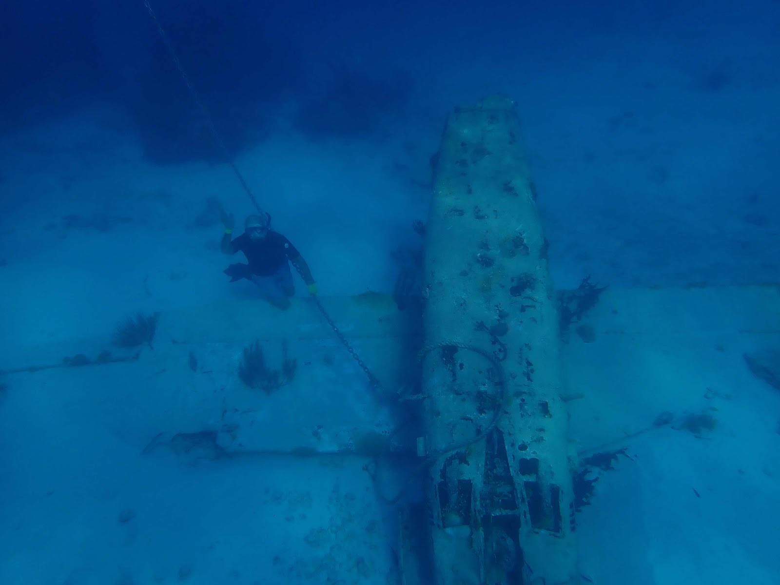
Drug smuggler’s plane wreck at O’Brien’s Cay. This was another place where the current was fierce! They have a mooring ball at the surface, attached to that chain, to tie your dinghy. In order to get this picture I had to swim hard into the current to get past the plane, then Keith pulled himself down the chain. This plane is approximately 20 feet deep.
In a previous picture I explained why you should avoid taking your boat over ‘dark’ spots, and here you can see that light spots are also to be avoided. It is very easy to see the sandbars in this crystal clear water. We are now heading to Staniel Cay with two agenda items for this visit. First, we will visit the legendary Thunderball Grotto, which is an underwater cave made famous by two James Bond movies. After our snorkeling excursion, we will visit the town so Eddie can pick up his engine parts.
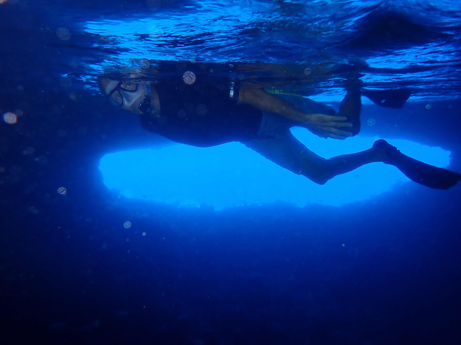
The travel advice is to visit Thunderball at low tide to make the entry and exit easy. However, we did not have that option, as it was high tide when we arrived. High tide means you must swim underwater, into a tunnel, to get into and out of the cave. Since we planned our trip at high tide we thought we could take advantage of the ‘slack’ time before the current changed directions…we thought wrong.
Is that the James Bond double I see? Getting in wasn’t too difficult. There were actually three entrances, and we entered through the one that required the shortest underwater passage (that was pure luck).
Once you came up inside, the cave looked like a big dome about 20-30 feet over our heads. There were several holes in the rock overhead allowing large shafts of light to enter the cave and the water.
The current inside was still very strong as water came in the two openings on the west side, and went out the one larger opening on the east side.
There were a lot of fish who clearly expected to be fed. Again, we were a disappointment. Exiting was much more difficult than entering, as we had to swim (underwater) against a strong current coming through a narrow tunnel, and once outside it was a difficult swim, against the current, to get back to the Whaler.
The next day we decide to make an 8 hour run for Georgetown. Forecasts predict 20+ mph winds out of the east for several days, kicking up 7-9 foot seas. We are looking for protection and convenience since we will be trapped for so long.
This leg of the trip took place on the east side of the islands, in what proved to be rough, but tolerable conditions…that deteriorated as the day progressed. I would like to report that we made it unscathed, but that is not exactly true. A few hours in, we received a radio call from Seaquel…”we just experienced a power loss in the port engine, there was a squeal and the engine shut down”…. Noooooooooooo! We slowed our speed to stay close by, and Seaquel came into Elizabeth Harbour on one engine. I am saddened to report that at this time it appears as though we are losing our buddy boat. Keith and I will continue south when the weather clears, but Eddie and Gail will stay here for a few weeks, until they decide where to head for engine repairs.


No comments:
Post a Comment