Thursday, March 31, 2022

Excellent Adventure 2

Today is March 31, however, the adventures contained in this post are from the week of March 9. Yes, once again I am a little behind in posting, but that’s probably a good thing because we are currently back in the US working our way up the Intracoastal in Florida, and since you’ve seen this leg of the journey several times it’s alright that I’m still working to share some of our Bahama adventures.  

Before going back in time, I will give a brief ‘real-time’ summary of our crossing.  
We left Spanish Wells, Eleuthera at 10:30 a.m. on Monday, March 28 with an itinerary of covering 220 miles in 27ish hours, straight through to Port St. Lucie, Florida.  Again, the weather forecasts (and Keith’s jury duty summons) were the driving factors behind this decision.  We were supposed to have calm conditions for 36 hours before a strong south wind moved in for several days.  The trip started out great, but the calm winds did not hold for the entire trip…and conditions deteriorated rather quickly…
The three things that best describe my 10:30 p.m. to 1:30 a.m. helm duty are,
1) peace
2) tranquility
3) an amazing number of stars

The three things that best describe my 4:30 a.m. to 7:30 a.m. helm duty are,
1) vomit
2) blood
3) broken shit throughout the boat 

And that is all I have to say about our crossing!

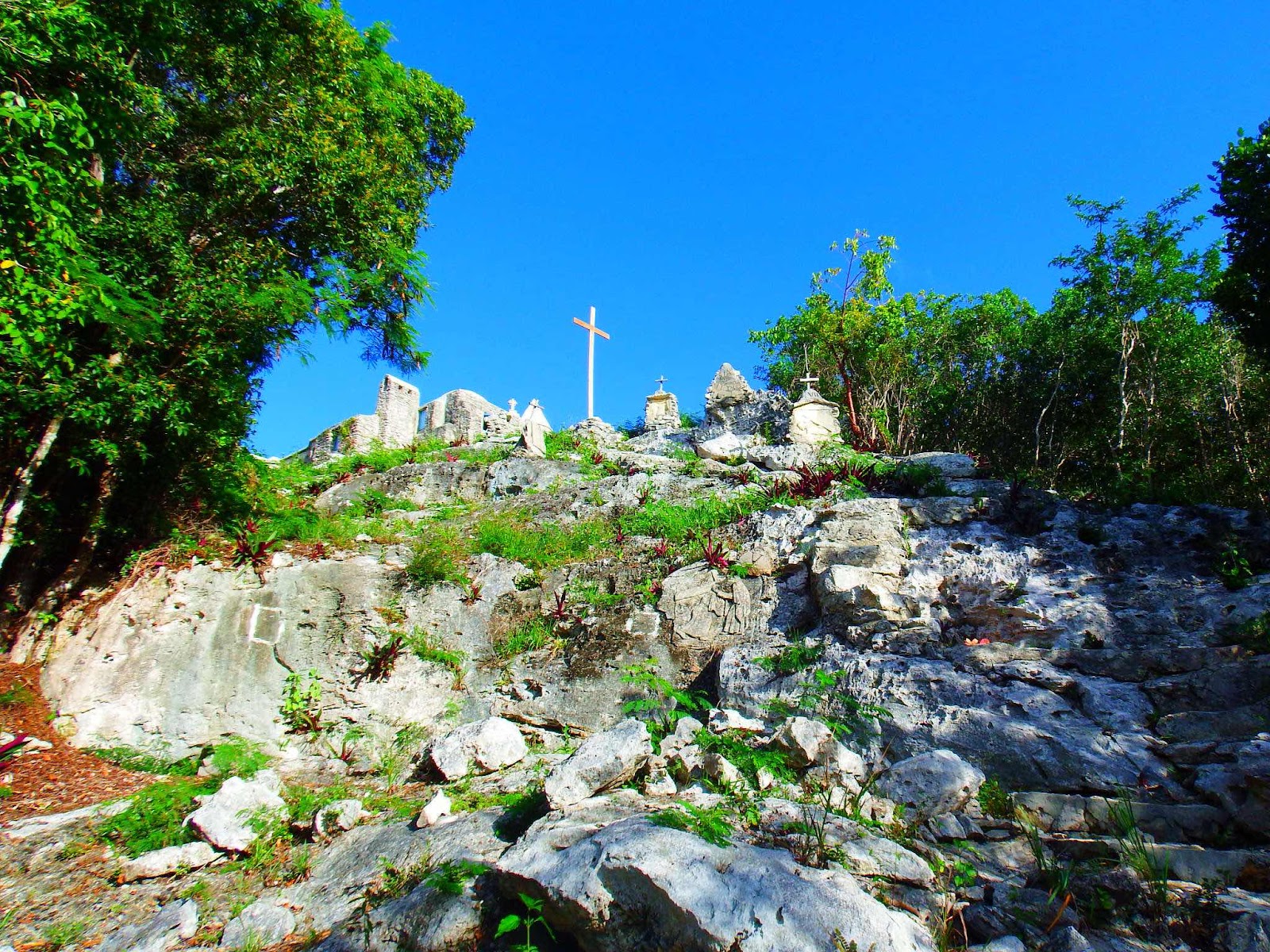
Also, this post must start with a correction to the last post.  In the last post we ‘magically’ got from the beach to the lighthouse at the end of our 3 mile walk.  Even though I pointed out that the climb looked impossible from a half mile out, on the beach.

You might remember…


Of course, we never turned around, but 2+ miles in we could see the end of the beach, but we still did not see a lighthouse…and if there is a lighthouse would we have to scale those steep cliffs to reach it?  Eddie joked, there would be steps…

This is the picture I forgot to add…

He was right…there were steps!  Bahamian steps 😁 (Thanks for the pic, Eddie)


Now, on to the week of March 9…

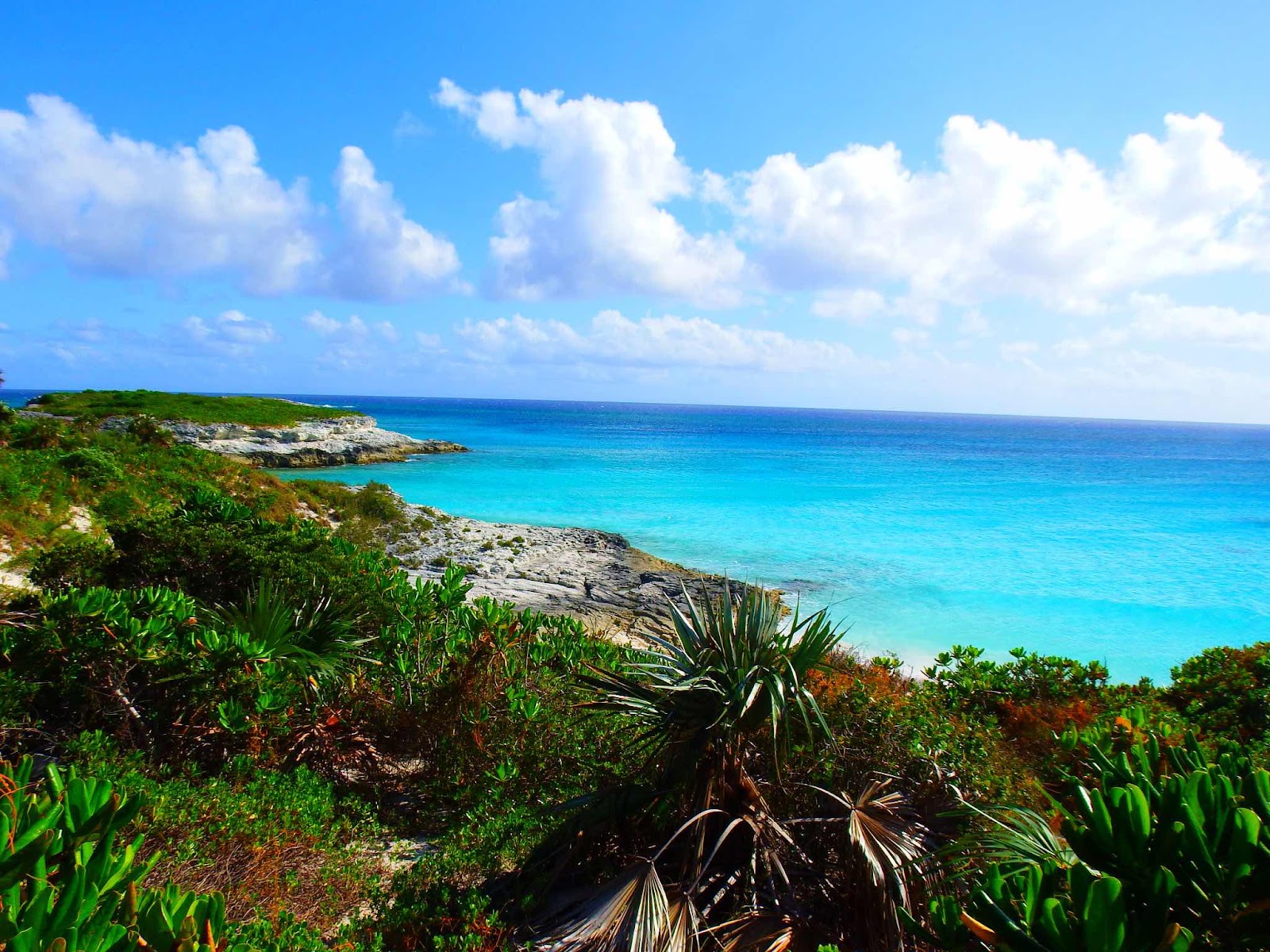
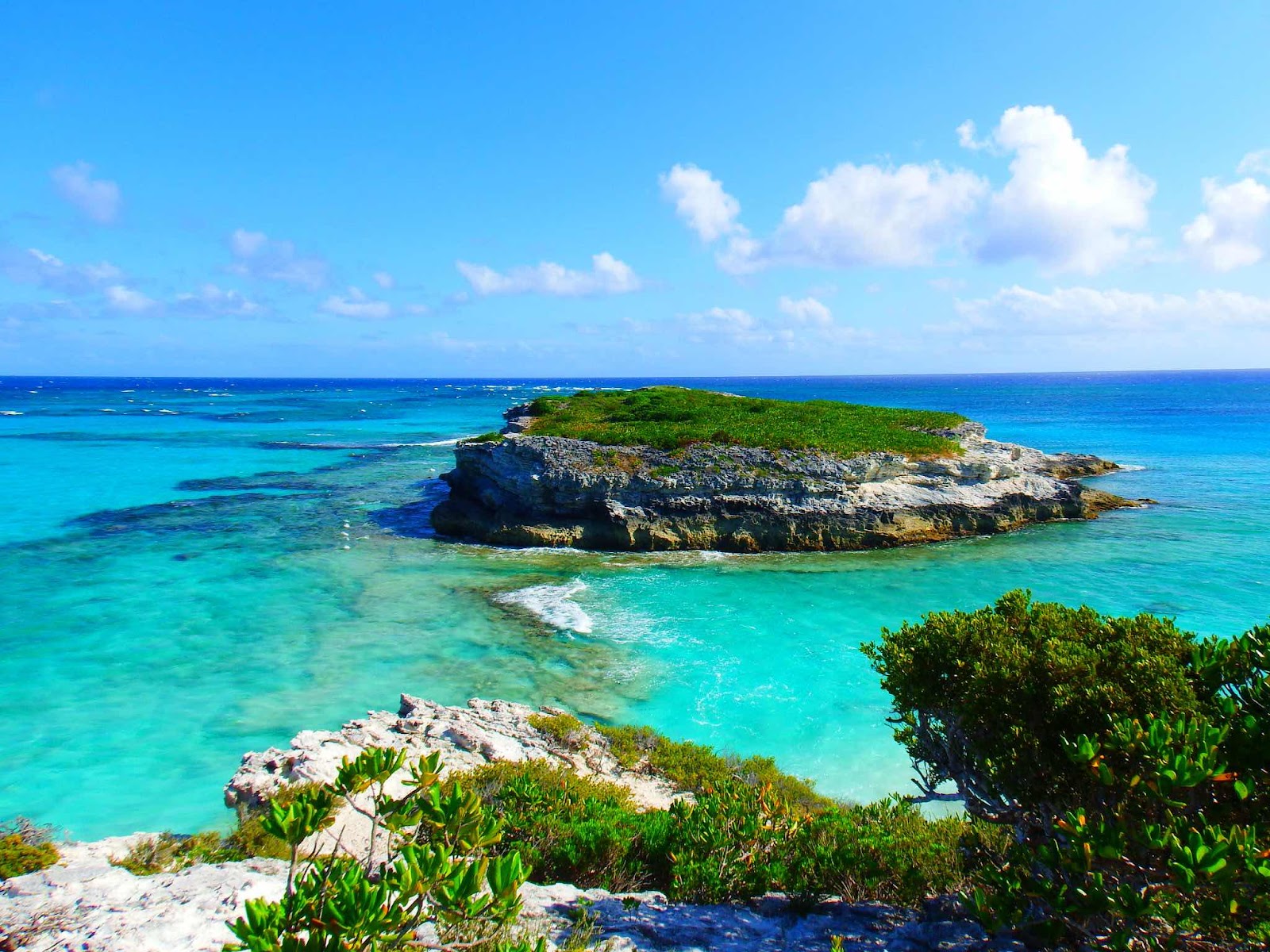
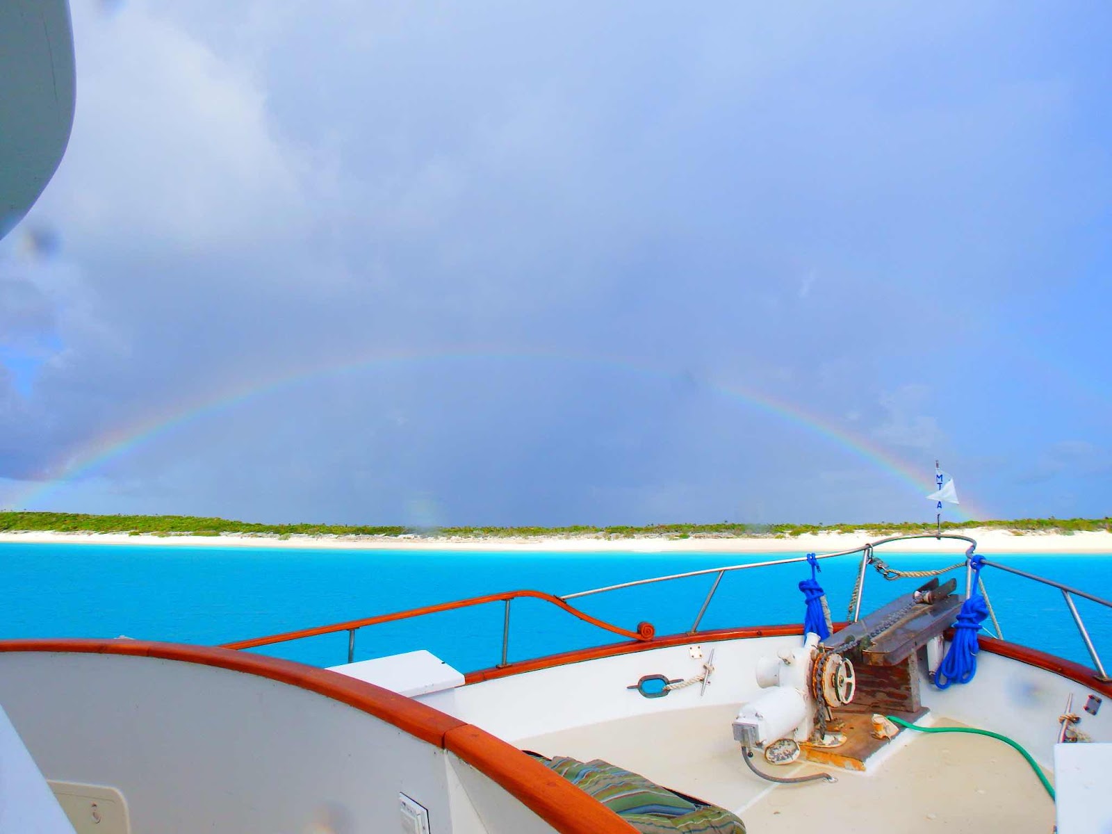
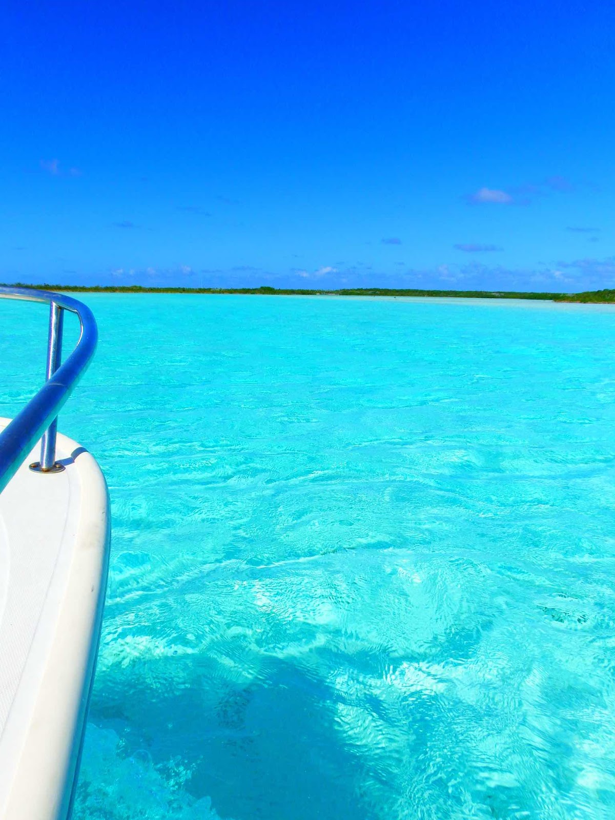
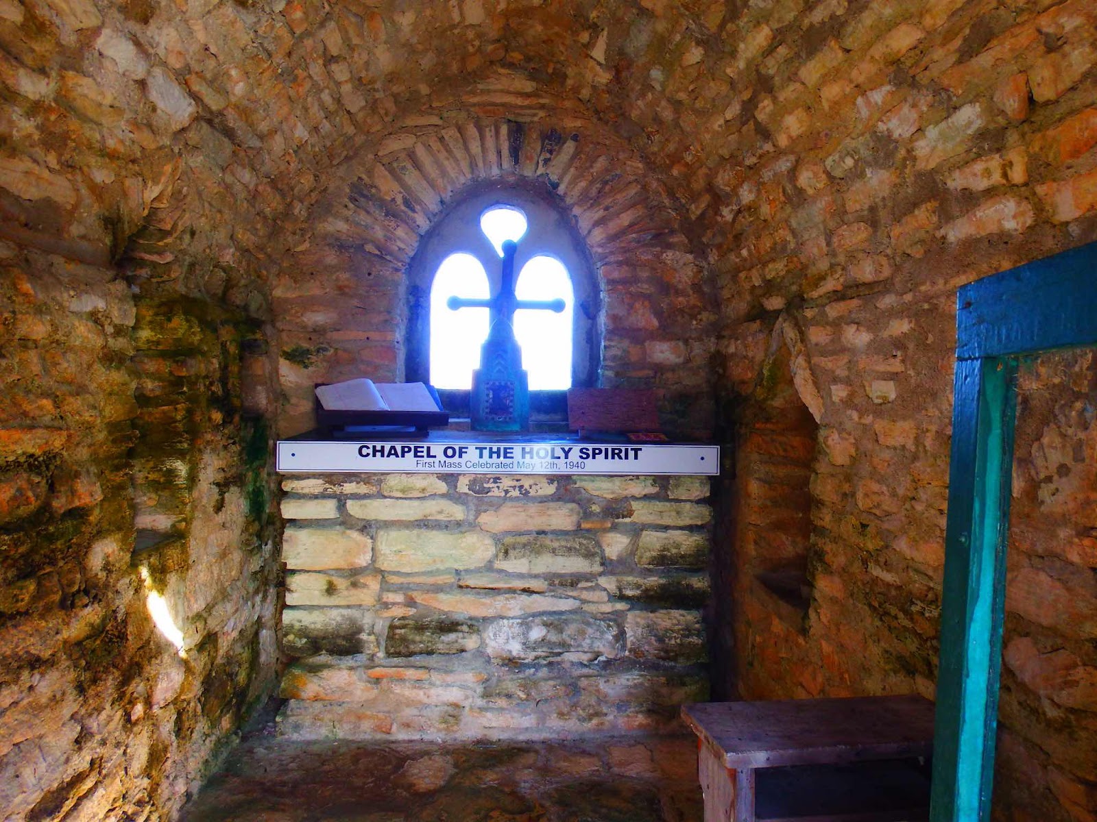
We spent a few days in Governors Harbour before, once again, looking for protection from forecasted strong clocking winds.  The only place on the west side of Eleuthera that offers real protection from west winds is Hatchett Bay.  

Hatchet Bay is known as ‘the safest harbor in the Bahamas’ thanks to a man made cut during the 1940’s that turned a lake into a harbor.


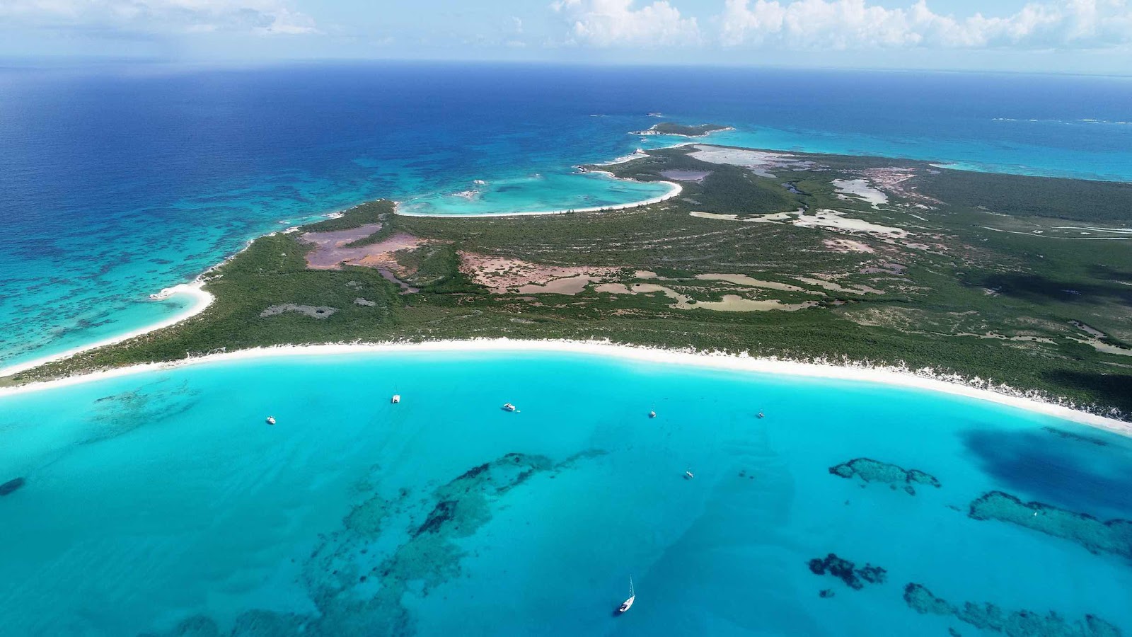
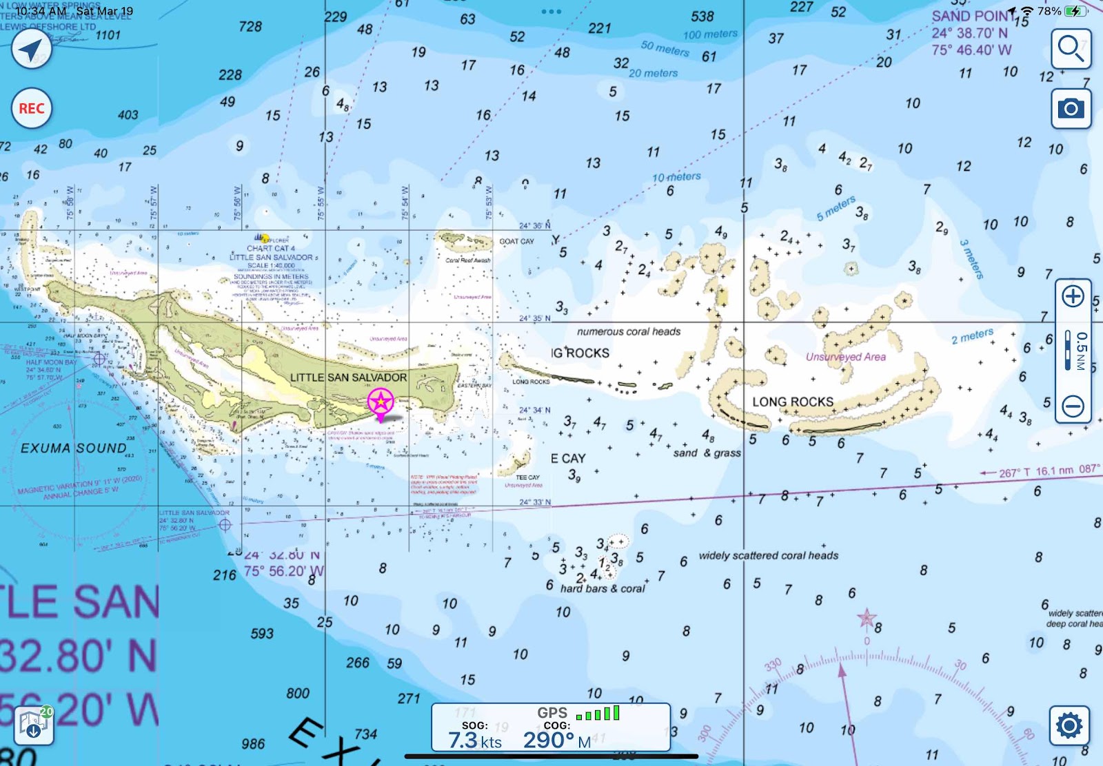
Oh my, the entrance channel looks very small, but we can see Seaquel anchored inside so it must be big enough.  Thanks to the forecasted winds, Eddie and Gail decided to stay in Hatchet Bay…yippeee…we caught up with them!

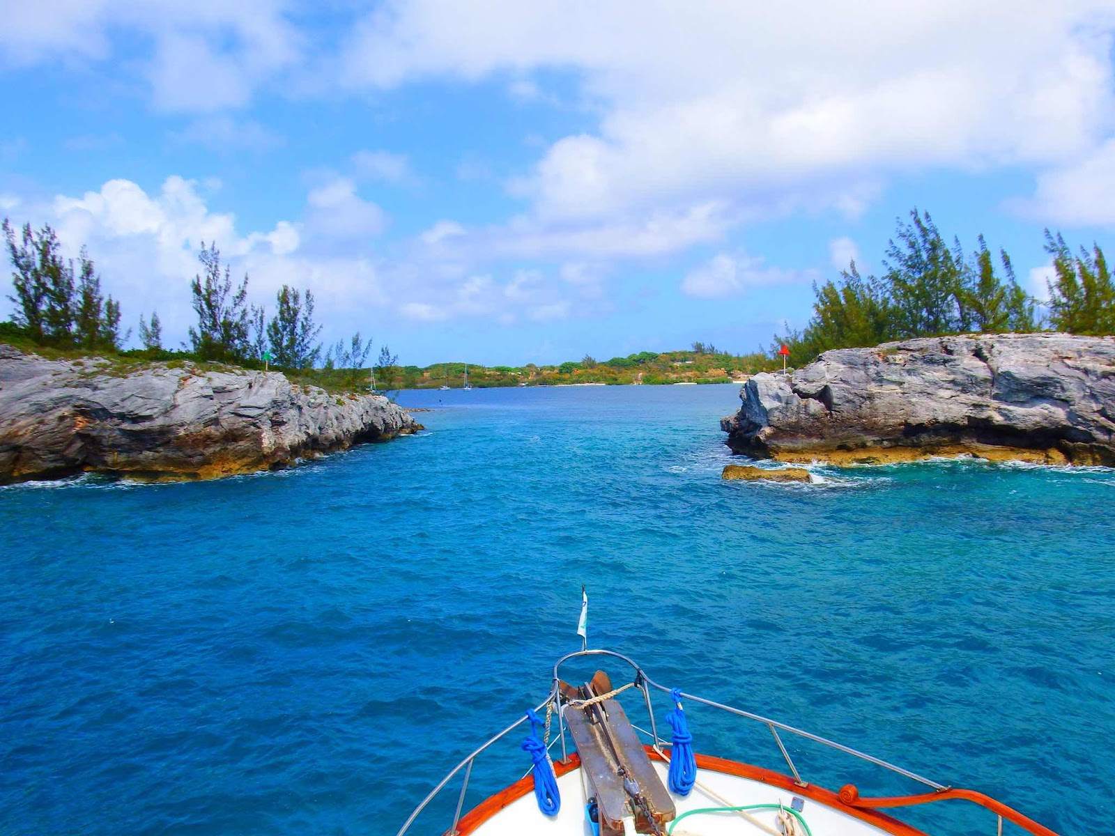
Ahhh…much better from this angle, but still seems a little skinny.

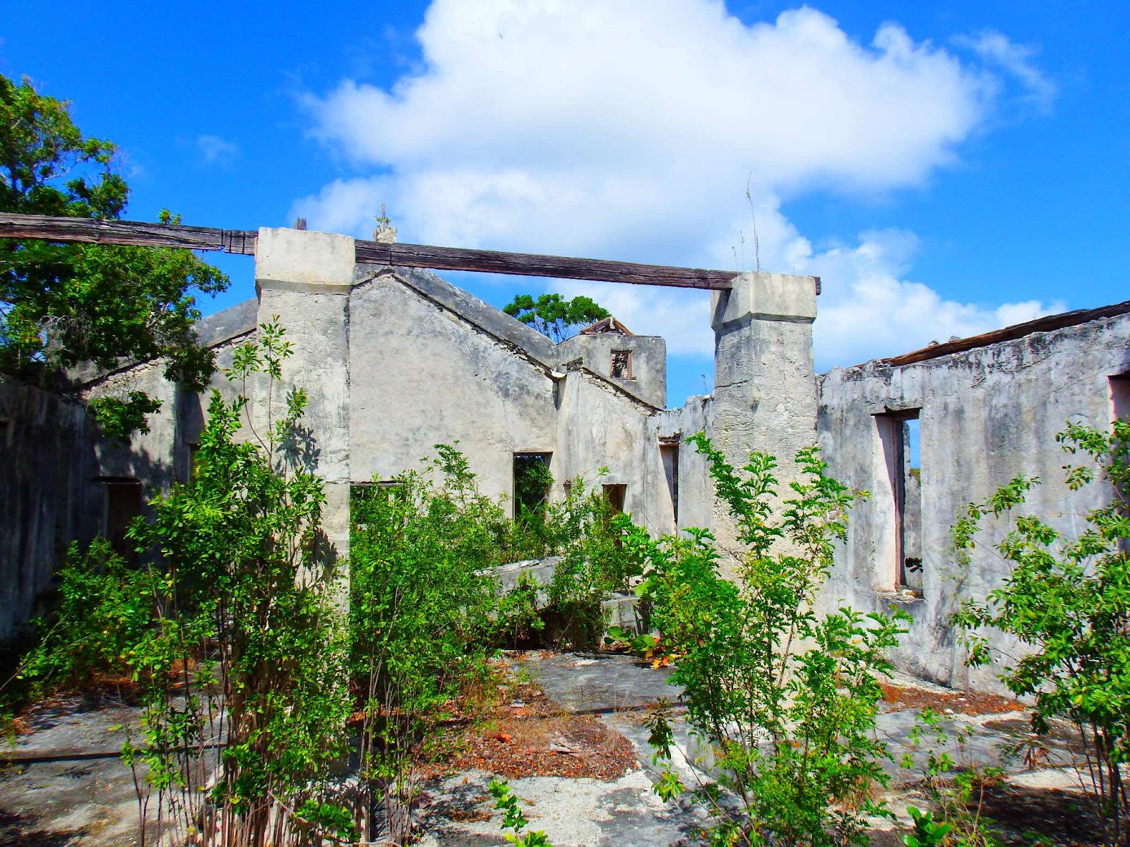
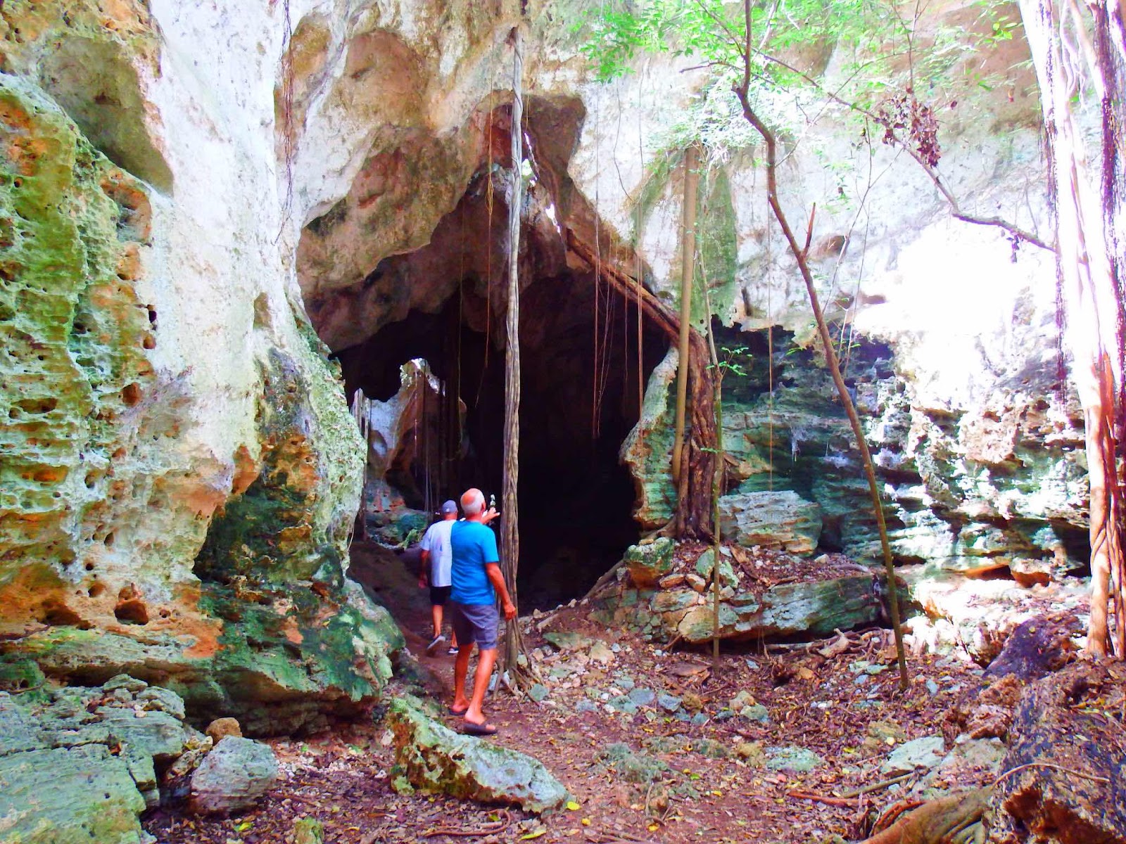
The next day we joined Eddie and Gail on a bike tour of the area.  The agenda included cave exploration, and off-roading to ‘Surfer’s Beach’ for a picnic lunch.

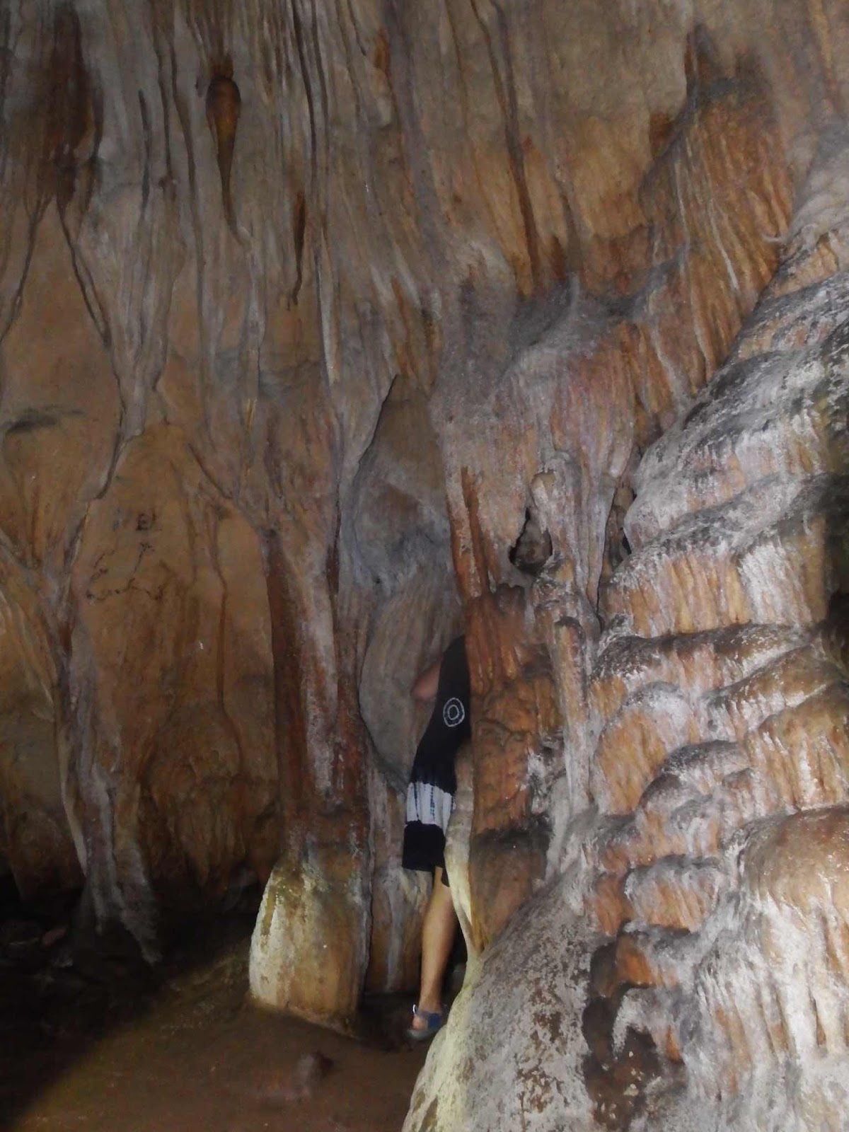
This was unlike any cave we have previously explored.  Usually, we can see natural light at all times, but this cave was different.  It was a system of underground tunnels that felt more like descending into a coal mine (thinking of you Uncle Larry) than exploring a cave. 
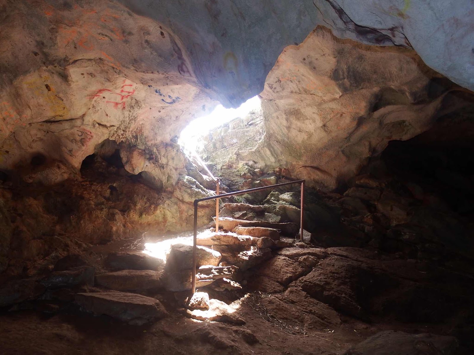
This was the entrance, and this is where the light ended.


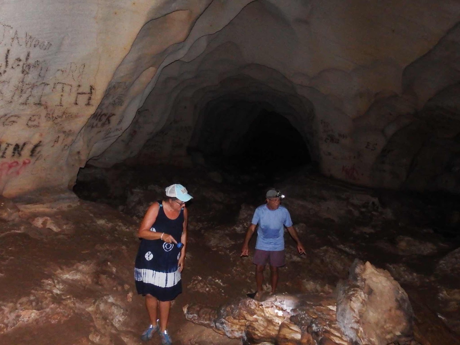
We each had our own flashlight, and quickly found ourselves climbing down a ladder.  At the time I wasn’t paying attention to the graffiti, but in this case I should have read the ‘writing on the wall’…literally!


There were some magnificent formations.

In some places the tunnel opened up into large caverns.  We thought it would be cool down here, but it was very humid and muggy.

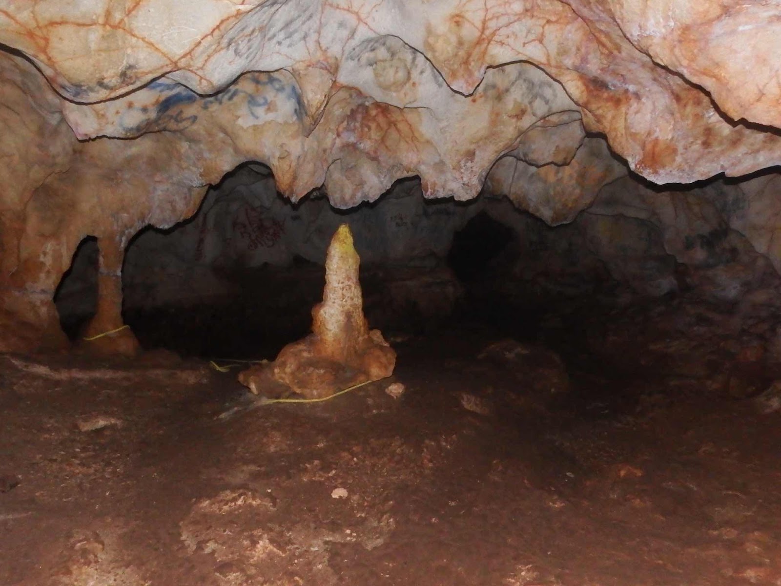
This is what was over our heads on the ‘ceiling’.

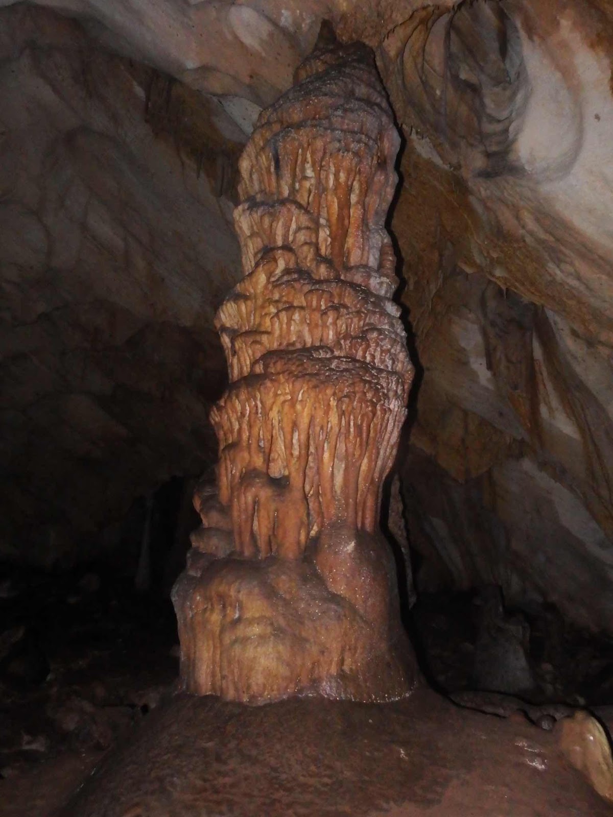
This was an amazing stalagmite…wow!

After some time we came to what looked like the end, but the yellow ropes tied to stone features led to a new discovery.

A hole with a rope ladder that led down to another tunnel with a few inches of water at the bottom.  We did our usual ‘poll the crowd’…do you want to go down there…I don’t know, do you?  We finally agreed we might give it a try if Eddie went first😉. When his feet hit the third rung, the ladder swung under the ledge, leaving his head and shoulders visible, but the rest of his body vanished.  Nope, nope, nope…I’m out! We all agreed, in our younger days we would have gone down, but today this was far enough!

Now to find our way out of here.
While I did find the exploration of this cave very interesting, I don’t think I will add spelunking to my hobby list.

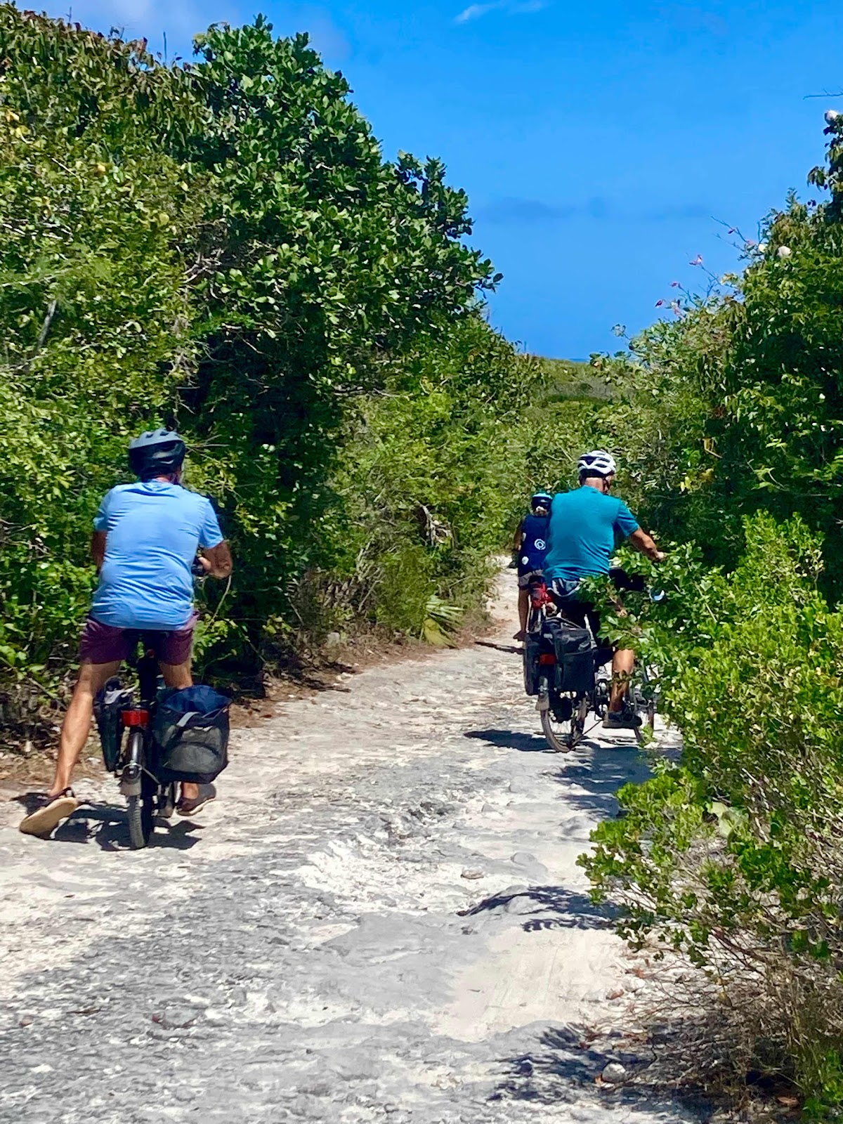
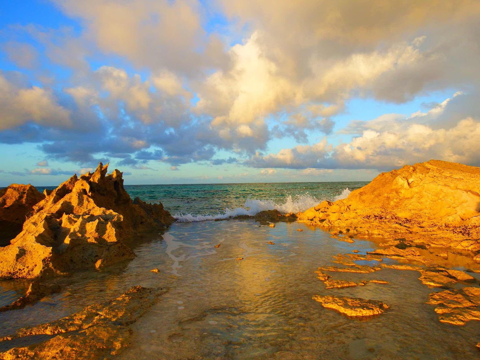
On the road again…all be it, a very rough road.

At times we had to push, pull, and carry our bikes.

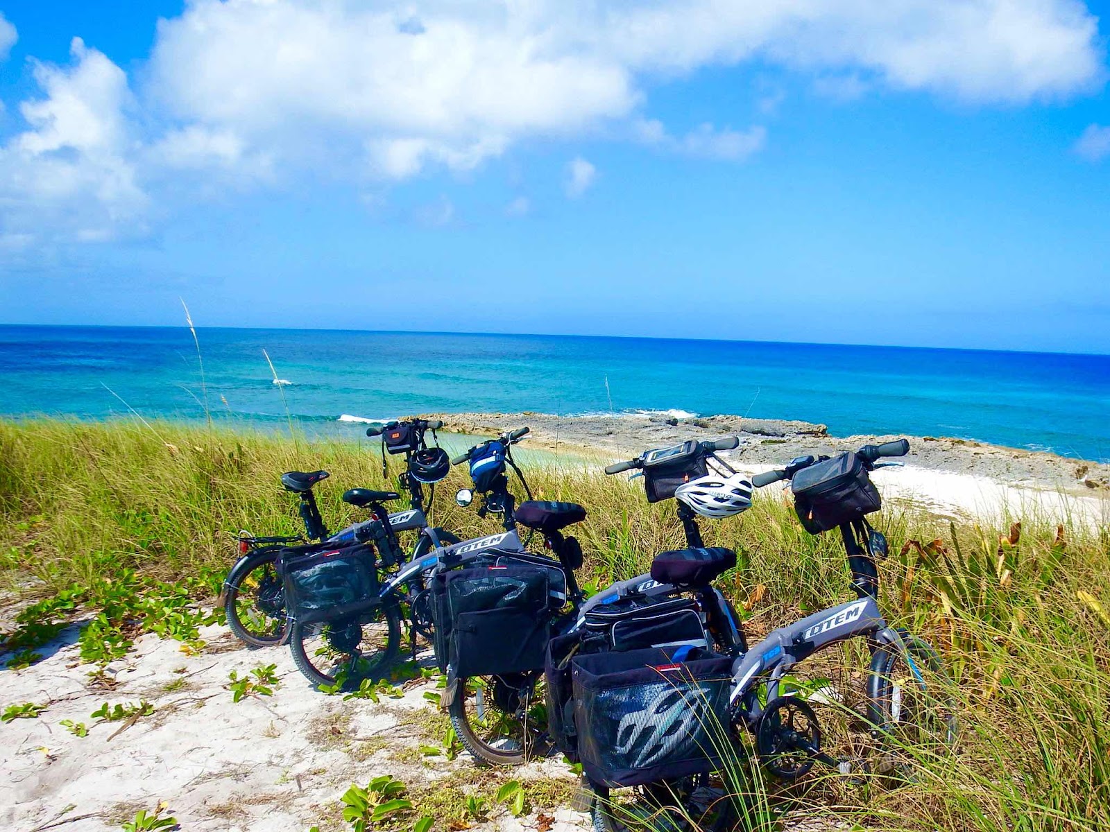
But we made it to the destination!  

Yes, we all have the same bikes.  Eddie did the legwork of researching, and once they tested the bikes, and were happy with the purchase, we just piggybacked and bought the same bikes.  They have been a wonderful investment, and have expanded our adventures exponentially.  I wanted to write an article highlighting the adventures of our ‘Totum Tribe’ and send it to the company, but Keith pointed out that they would probably cancel our warranties.

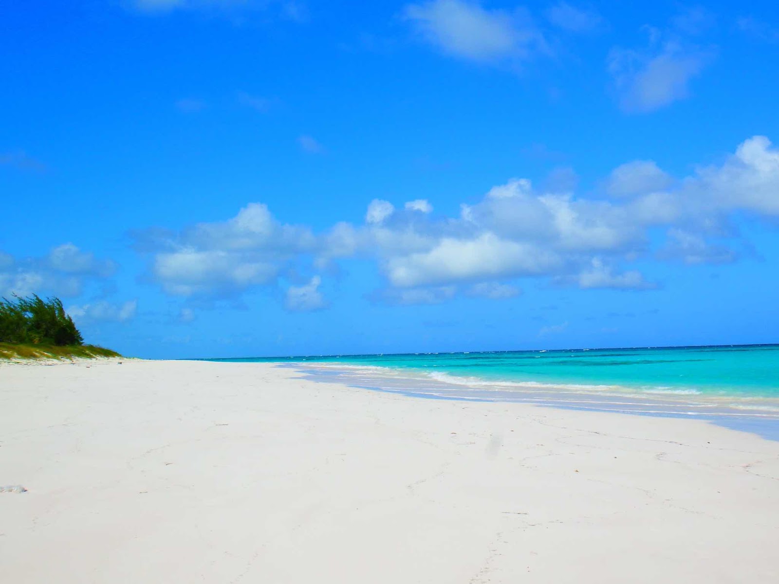
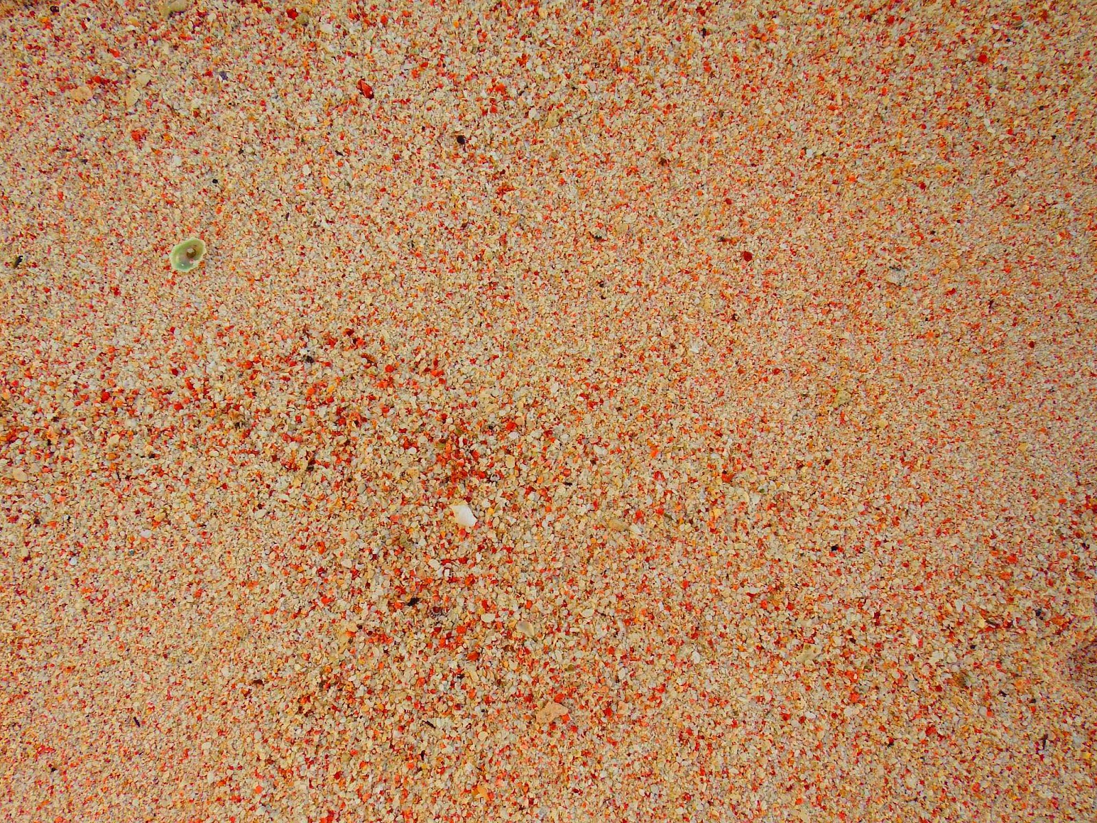
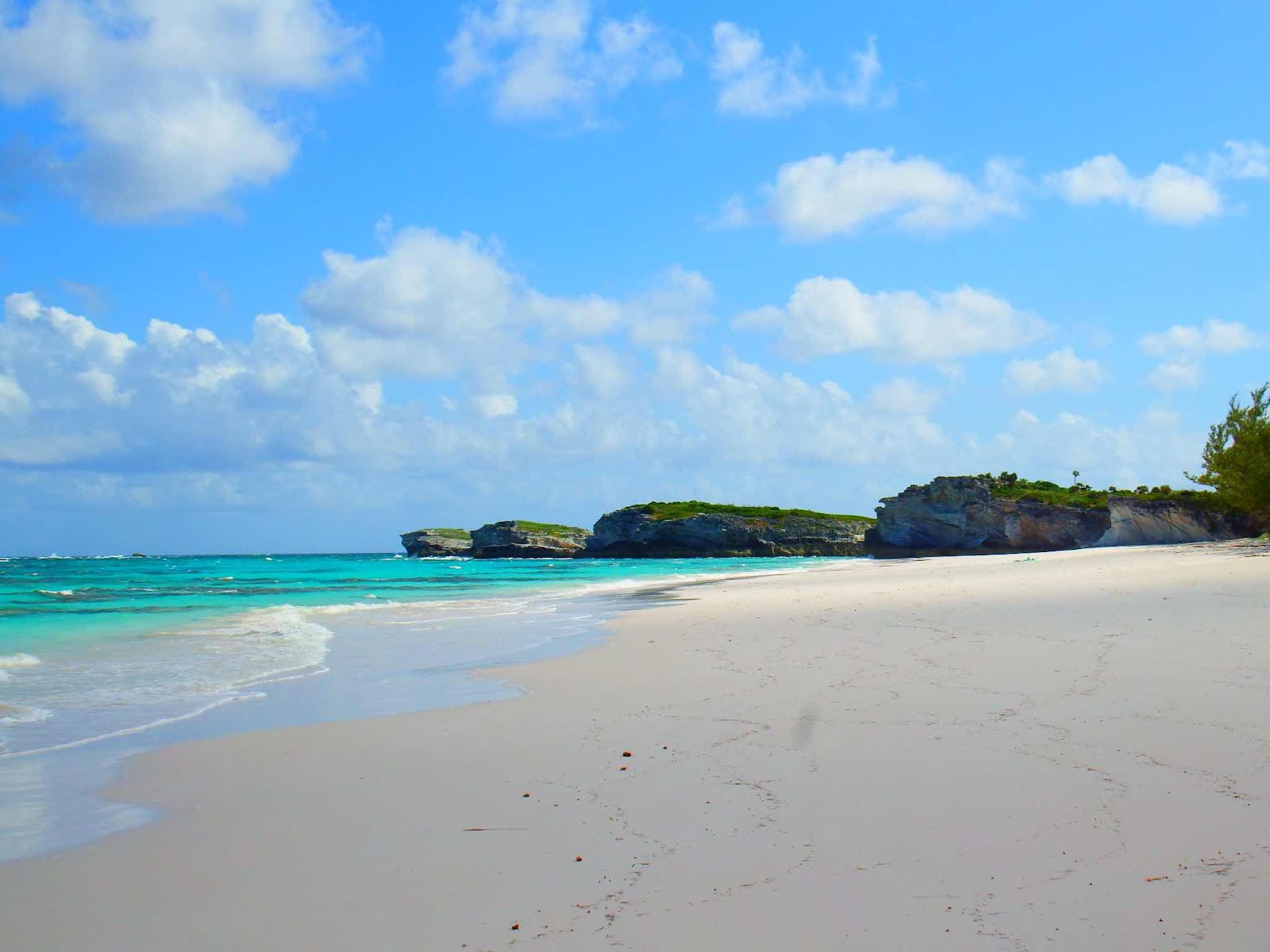
Surfer’s Beach for lunch, a swim, and a rest on the beach…before starting our 6 mile journey back to the boat. Another exhausting day that will require the help of ibuprofen to regain full range of motion!


Sunday, March 20, 2022

G & E’s Excellent Adventure

The next island on our northerly trac was Cat.  Cat island is 40 miles long, and is oriented in a northwest-southeast direction.  When we pulled into the anchorage at New Bight there were 15 boats anchored there. It felt like a return to civilization.  However, the next morning 12 of the sailboats pulled out together (some rally we guessed), and when we went ashore to try to reprovision fresh fruits and veggies we were told, “…the supply boat came yesterday so there won’t be anything left in the store today.”  So much for civilization.

So, instead of shopping we decided to climb to the hermitage…

From the anchorage we could clearly see this structure at the top of the hill, which is actually the highest point (206 ft.) in all of the Bahamas.  The guidebooks tell a story of an English priest-architect, Father Jerome, who traveled to the Bahamas to repair the Catholic Churches on Long Island, destroyed by a hurricane in 1908.  After dedicating many years to rebuilding numerous churches, he visited Cat Island in 1937, and identified the top of this hill as his retirement location.

The site was less than a mile from the beach, but the last 206 feet were a killer.  A lot of thought was put into, not only the structure, but the path that led to it, as well.    Along the path we passed the stations of the cross, including a miniaturized version of the rock pushed aside from the mouth of the Jesus’ tomb.

Once we got close, we realized that not all things are as they appear.

This is a miniaturized version of a monastery 😂.  The left side makes up the living quarters, and Keith is resting his hand on the chapel with the bell tower behind.

The retired priest lived out his days praying in this chapel.

From New Bight we continued north to Bennett’s Harbour, with the plan to hike across the island the next day to snorkel on the east side.  We got anchored fine, but the snorkeling part of the plan didn’t work out.  With a close eye on an approaching front we decided to cut our losses at Cat Island and travel 14 miles to Little San Salvador where we were hoping to spend the next day snorkeling to our hearts content along the numerous reefs on the east side.

The west side of this uninhabited island is used for cruise ship excursions, on the beach of the crescent moon bay, but the east side has no traffic.  We anchored in dead calm conditions and launched the Whaler to explore the beach (near the pink star).  We left the Whaler in the water overnight, with the plan of getting an early start snorkeling, then spending the afternoon, at high tide, exploring the interior tidal flats of the island.  The forecast was for NO wind for the next 24 hours.

Surprise…we woke up to screaming wind out of the southwest, and very large waves…ugh!  The front arrived about 12 hours early, and our grand plans for the day were flushed away.  In fact, we were in a bit of a situation, as the Whaler was in the water and the conditions were too rough for us to retrieve her.  We had to wait until 11am for conditions to calm enough for us to attempt to lift the Whaler, and now in hindsight we definitely jumped the gun on that decision.  

The waves were still pretty big, and with the Whaler hanging from a cable it has a tendency to start swing like a pendulum (or actually in this case, wrecking ball is more accurate).  When I can reach it from the swim platform I can steady it, and when Keith can reach it from the top deck he can control it, but there is a small area of ‘no man’s land’ in between when the natural forces take over…and now the Whaler is in need of a little fiberglass repair🤷🏼‍♀️.

On to Eleuthera…we stopped in Cape Eleuthera marina to get fuel, and decided to spend the night since we couldn’t make it to Rock Sound before dark.  The following day it was an easy trip to Rock Sound where we settled in for a few days relaxing in the protection of this anchorage.  Our friends Eddie & Gail were also in Eleuthera, but they were about 30 miles north of us with plans to head to Abaco so it didn’t look like we would cross paths again in the Bahamas.

Until…they sent a text to say they were renting a car and would pick us up…and so began Gail and Eddie's Excellent Adventure…

L
We started the day with some cave investigation.

Went in search of ‘ruins’ from an old town.  We are fairly certain this was the church.

Then we headed to a southern part of the island, recently purchased by Disney.  This purchase has caused a bit of an uproar with the locals, who cherished that point as one of the favorite and most beautiful places to visit.  The news was reporting that Disney had closed the road and was not allowing access…so we decided to try to get there.

We made it to the dirt road leading to the point, but we’re stopped and redirected more than a mile from the point.  When I asked the ‘security’ guard if there was any other way for us to see the lighthouse we were told to turn around and take the last right before the hard top road. That dirt road would lead us to a beach, where we could walk 3 miles to the lighthouse😳.

We decided to follow the directions and have our picnic lunch on the beach, but we weren’t certain about undertaking a 3 mile (6 total) beach walk.  We parked the car here, and followed a short path to an amazing beach.

This was a great place to have lunch…and relax.  Eddie is still practicing his rabbit ears.

After lunch we all agreed that a nice walk was a good idea, but we weren’t committed to the 3 miles…we would just see how we felt and turn around at any time.

Of course, we never turned around, but 2+ miles in we could see the end of the beach, but we still did not see a lighthouse…and if there is a lighthouse would we have to scale those steep cliffs to reach it?  Eddie joked, there would be steps…


Are you kidding me…this is NOT a lighthouse!  We were disappointed in the lighthouse,

But not disappointed in the view!

The view was amazing, and sooo worth the walk!

Our car is three miles in that direction. By mile 5 we were all dragging a bit, and by the time we planted our butts in the seats of the car there was a very audible collective sigh of relief.  Now that we have recovered, and had time to reflect, I believe a 4-5 mile beach walk is about the max to consider in the future.


Thursday, March 10, 2022

Conception

Our original plan was to jump from Rum Cay to Cat Island before the next blow moved in, but thankfully we made the decision to stop at Conception Island.  Conception Island is a 25,000 acre park established in 1964.  It is a sanctuary for migratory birds, nesting birds, and green turtles.  The island is totally uninhabited with no facilities.  You can only visit here by boat.

The northern part of the island offers amazing beaches, beautiful snorkel sites, and great protection from winds out of the east.  Right Hand is the third boat from the left.
(Drone pictures courtesy of Stefan, S/V Invia)


I know we are weirdos😁


Parts of the beach were very pink.

While at Conception we saw 9 rainbows in one day.  The pattern was amazingly consistent throughout the afternoon.  The clouds were sweeping across the island from east to west.  Once we saw the start of a rainbow we had 20-30 minutes before the rain would arrive.  Each rainbow would start as a small piece, and as the cloud got closer the rainbow would fill in and become full.

We saw six full rainbows, where both ends seemed to touch the island.

Three of the six were double rainbows…that’s how I came up with nine in one day.  The rain would only last for 10-15 minutes then the sun would return and the whole process would start again, usually within 30 minutes.  Who would imagine it was possible to see three double rainbows in one day?  This is the sailing vessel Invia…when I shared this picture with Stefan, he happily gave me his drone pictures.

The northern part of the island offered fabulous coral formations.
There were amazing ‘groves’ of staghorn coral.

We encountered numerous perfect specimen of brain coral. However, to our surprise, we encountered very few fish.


This Oyster catcher, and her partner, kept a close eye (beady red eye) on us the whole time we lounged on their beach.

The southern part of the island contains a large mangrove and tidal creek habitat that is an important nursery for fish, sharks, rays, turtles, and lobster.  If you look closely at the picture you can see an interior blue ‘river’ with an entrance at the south end of the island.

This is what it looks like at sea level.

They can’t see me…

Oh darn, they see me…

We saw more than 30 turtles in one afternoon.  This green turtle is clearly tagged.

White-tailed Tropic birds (notice the very long tail) put on a very acrobatic show as they swoop and dive around each other.

The day before we left this National Geographic vessel arrived, and were ferrying people and camera equipment to various parts of the island.  You might see an article or documentary in the near future.

Ten years ago, when this cruise was in the planning stage, my mind was full of (imagined) images of the types of places I would visit.  Conception Island is the place that made many of those images come to life!  This is living the dream!


The Continuing Saga

  Well, another month has passed since my last post, and I must report that our trying times have continued to haunt us.  Not sure if we sho...