Monday, October 17, 2022

Paducah Prepared!

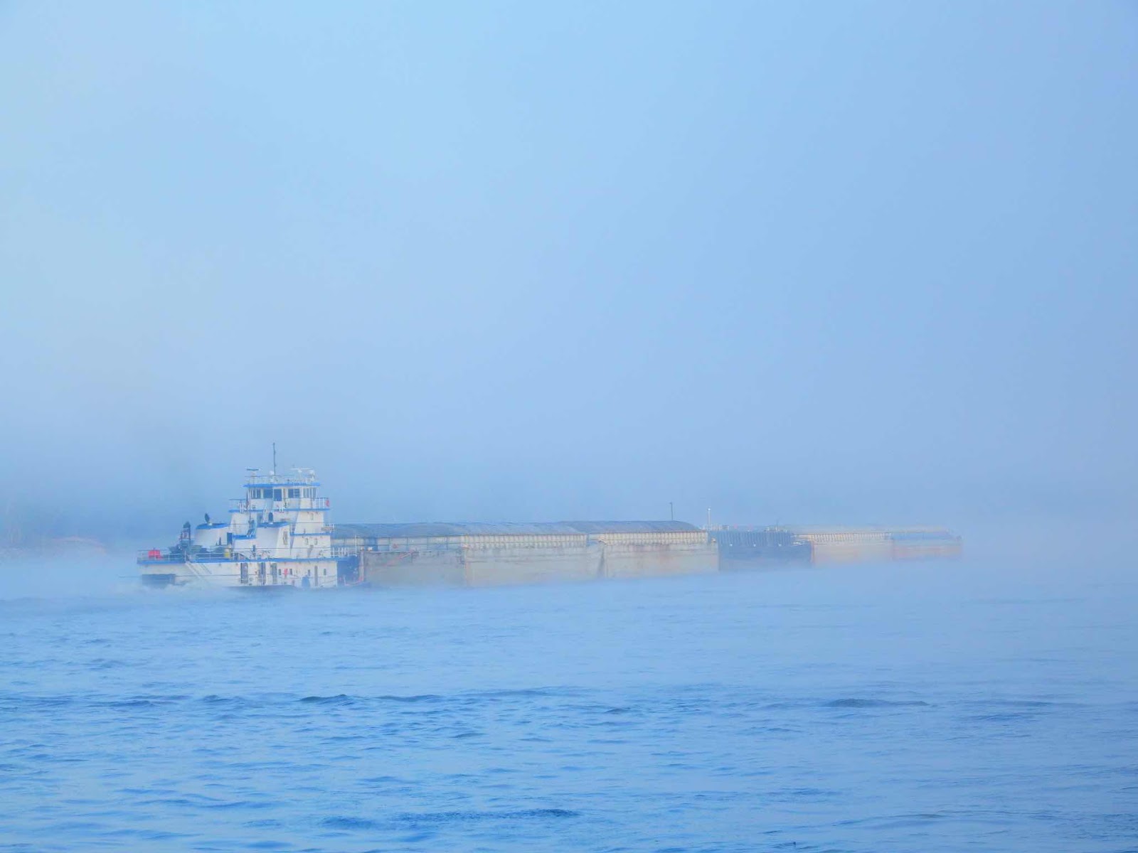
At Cairo, IL we turned to port (left) on the Ohio River.

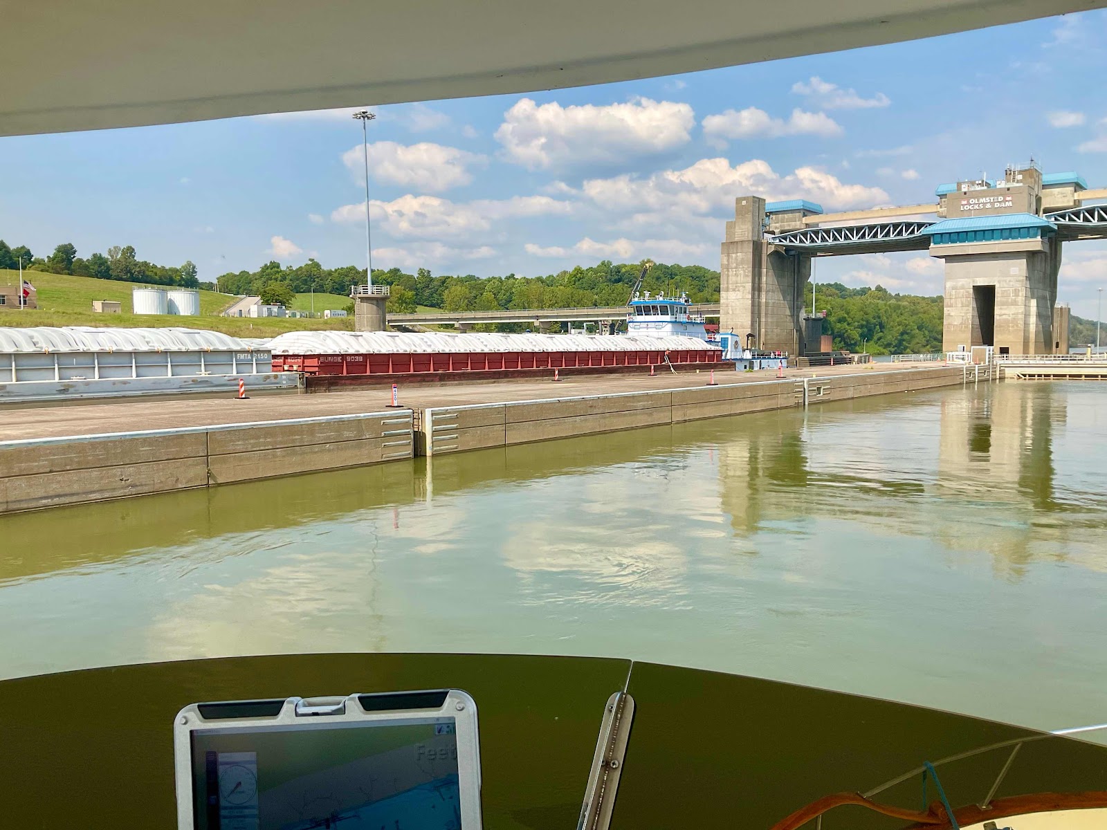
We have seen a lot of locks that have two chambers, but this is the first time we have seen both in use.

These flood gates have huge hydraulic rams.

Hello Paducah!
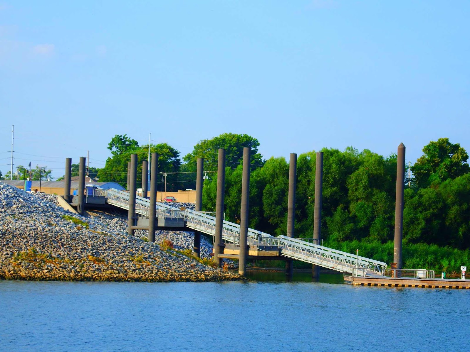
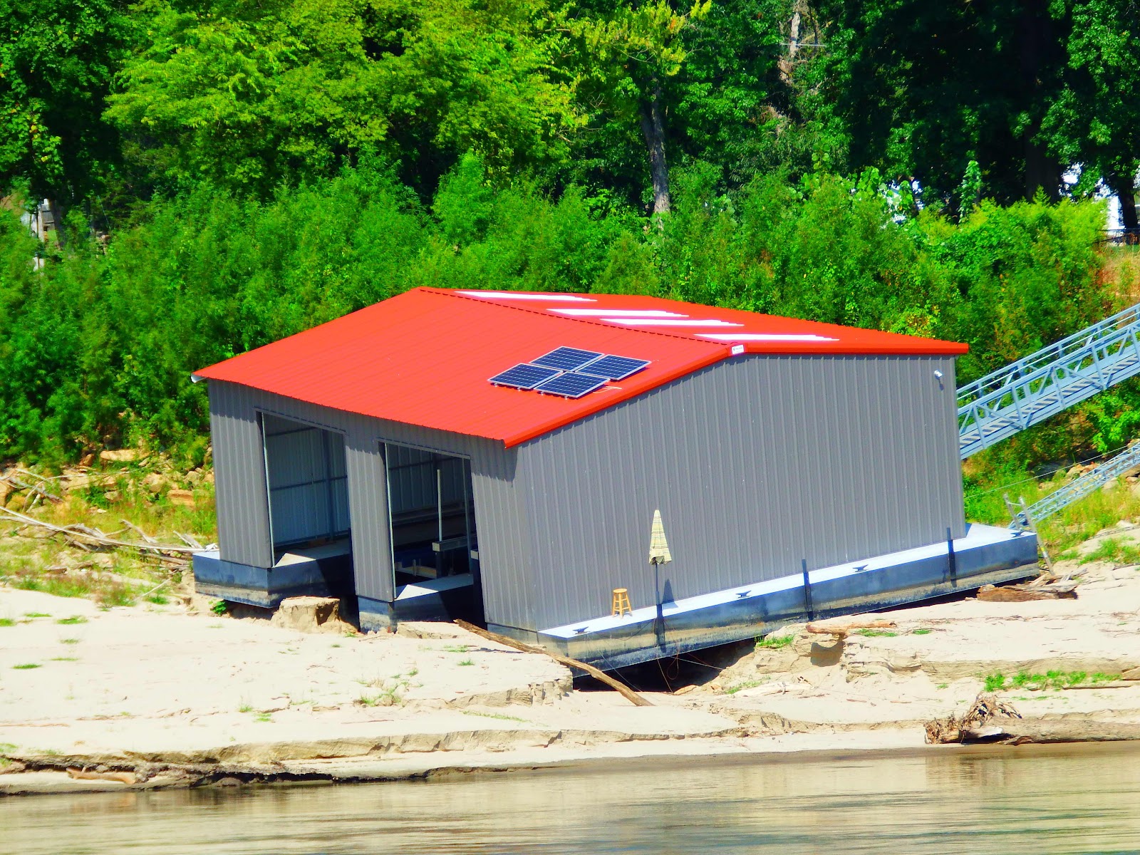
Our first glimpse of Paducah is this formidable floating dock!  Each stage of this dock system is designed to rise with the water level of the river.  This dock is made to survive flood waters 60 feet high…wow!  Also, do you notice the brown wall on the hill?  That is a flood wall constructed to protect the city.

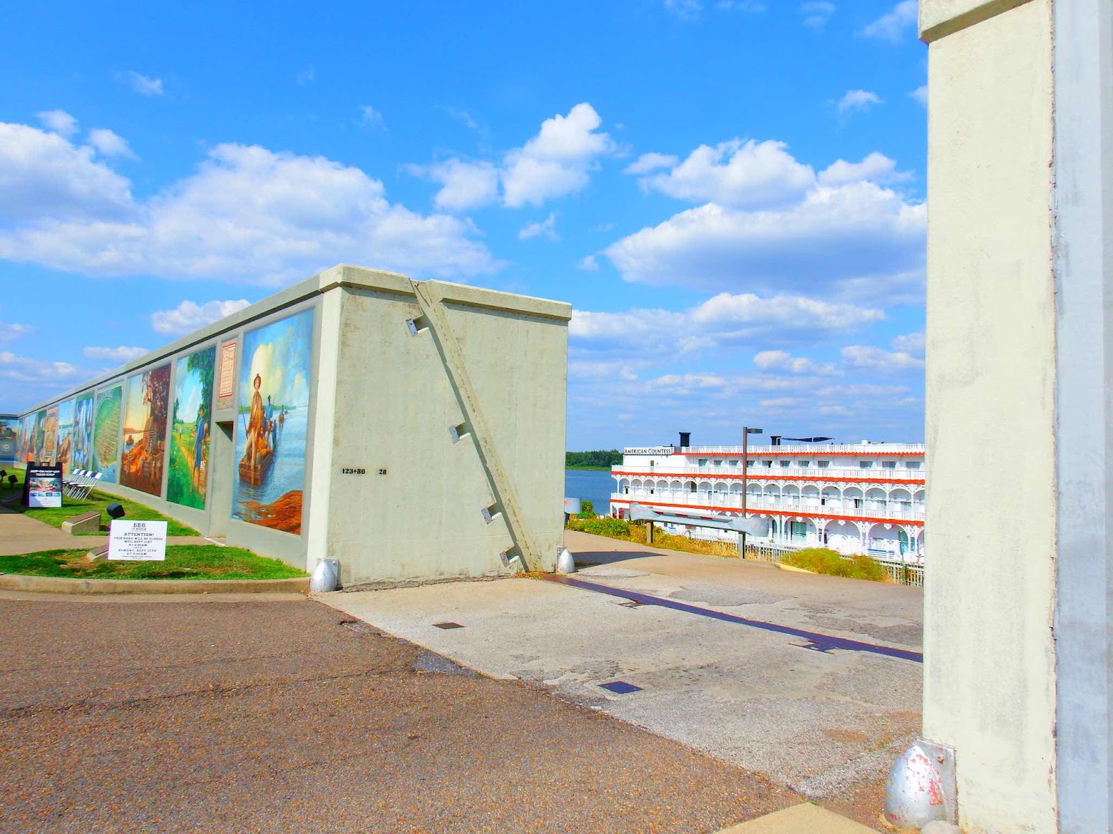
And this is a view from inside the wall. You can see a river cruise boat, and the water, about 45 feet below.

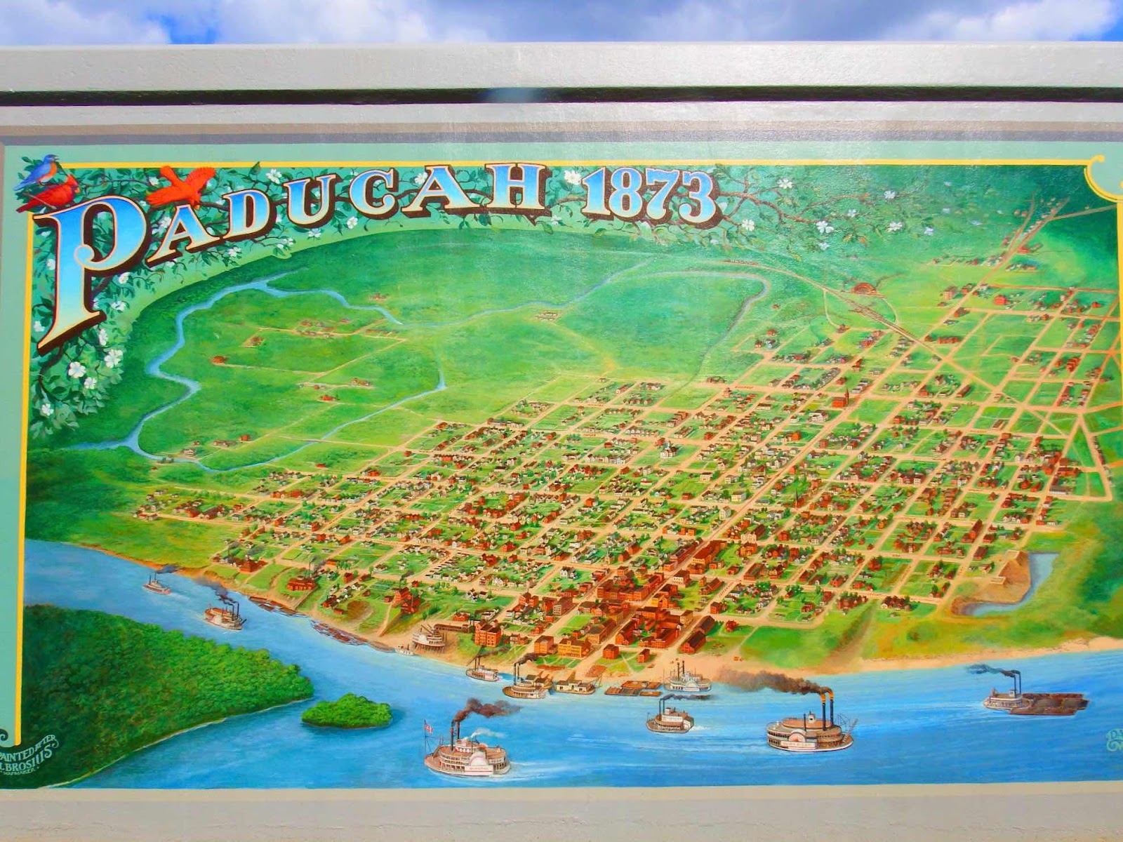
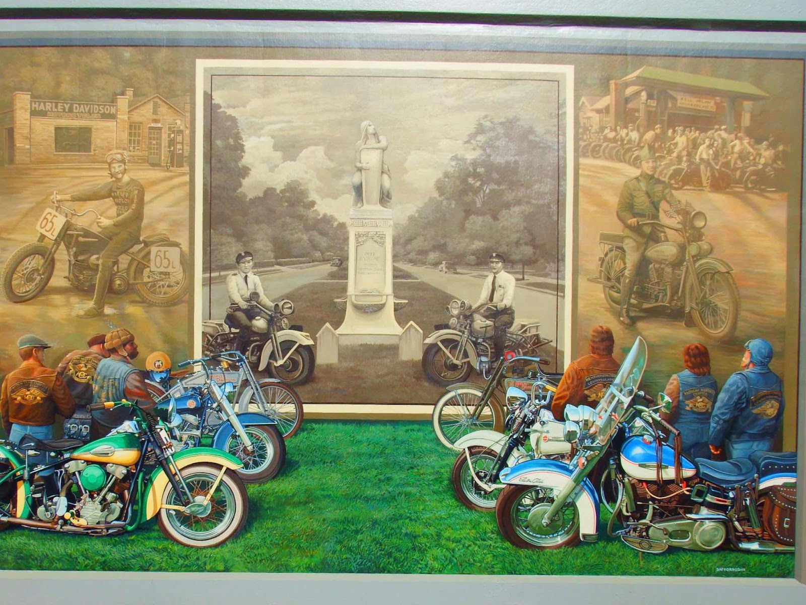
As if the construction of this wall, which took place from 1939-1949, wasn’t impressive enough…the inside of the wall acts as the ‘canvas’ for 53 murals depicting the history of the town.


0
Each mural panel has a plaque highlighting the historical significance of the piece.  The murals offer a variety of historical viewpoints, including land usage, battle/war remembrances, cultural and economic snapshots, and numerous tributes…one panel even documents the past floods that prompted the construction of the wall.


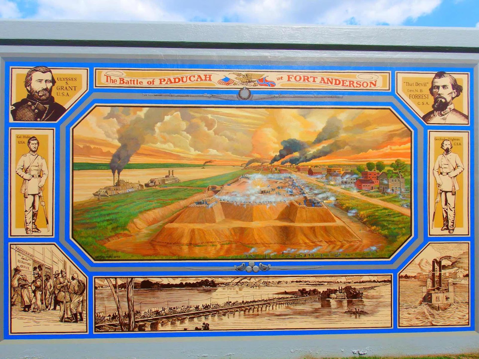
Paducah experienced 3 great floods in its history.  The years were 1884, 1913, and (the worst) in 1937, when the water level crested 60.8 feet above normal.  The latest severe flood occurred in 2011, but the wall protected the town!


Sorry for the graphic nature of this picture…

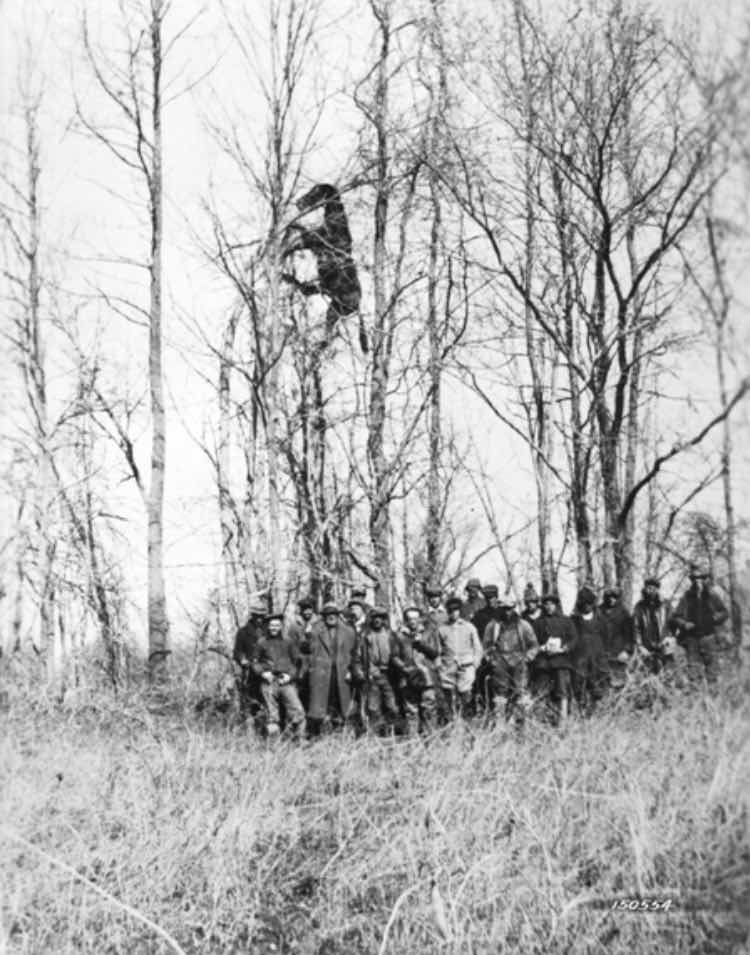
This is an historical picture from the weather.gov site, which demonstrates the extreme height the water reached during the 1937 flood…
and for my grandchildren, I’m pretty sure all of those men were able to safely rescue that horse, and he lived happily ever after in a beautiful field of flowers🫣

Our next stop…

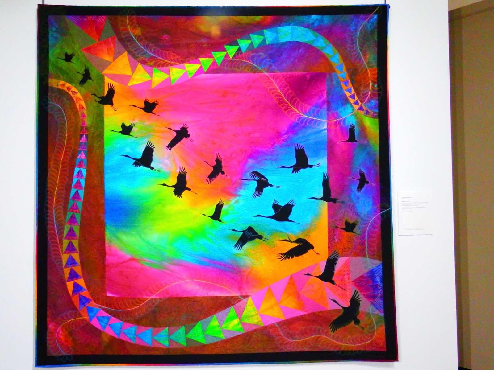
Did you know Paducah is home to the National Quilt Museum?  Did you know there was a National Quilt Museum?

This might sound like a strange place to visit (and I will admit that Keith gave me a bit of an eye roll when I suggested we visit), but the artistic creations within the walls of this building did not disappoint…and Keith agrees!
Some of the quilts looked three dimensional.

Colors were so vibrant 

And the textural appearance made it hard to believe this was actually made from fabric and sewing thread.

The way this artist constructed the reflection portion of the piece was absolutely mind blowing 🤯

WOW!  We never expected to find so much history, art, and culture in Paducah!  In addition to the new information and historical facts introduced, the colors and textures from such a variety of artistic medium transported our brains from the browns of the Mississippi to a refreshingly bright and sunny place!

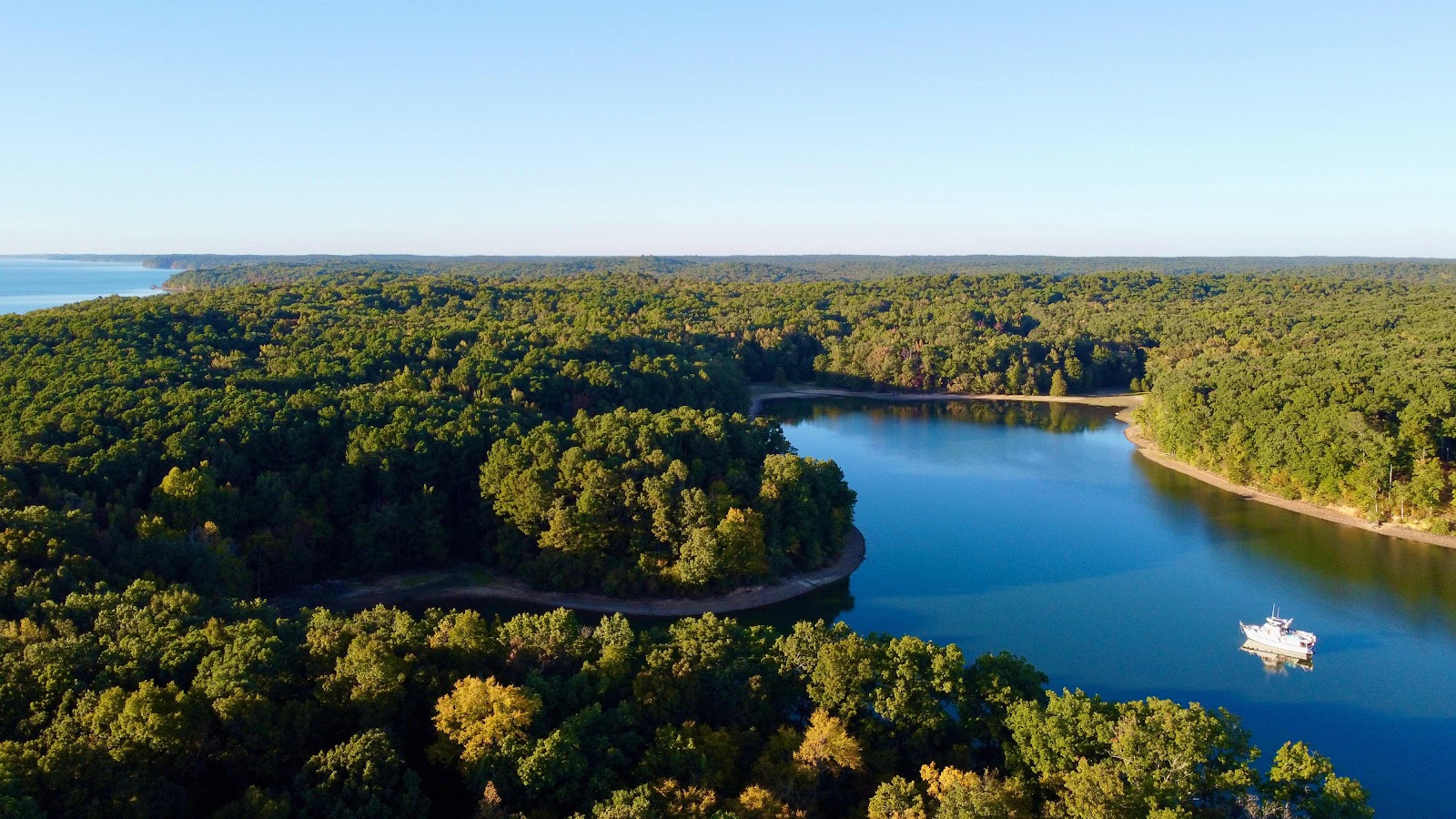
From Paducah it is only a one day trip to Kentucky and/or Barkley Lakes.  These two lakes are approximately 40 miles long and run parallel to each other in a north/south direction.  There is a 170,000 acre National Forest, called Land Between the Lakes, that (you guessed it) is located between the two lakes.

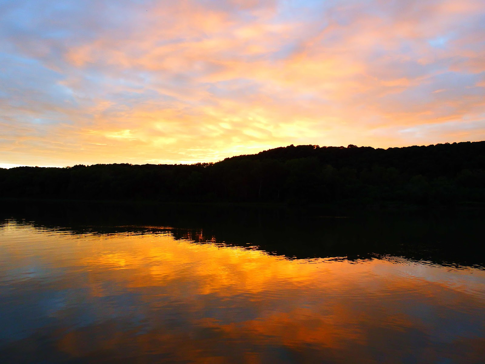
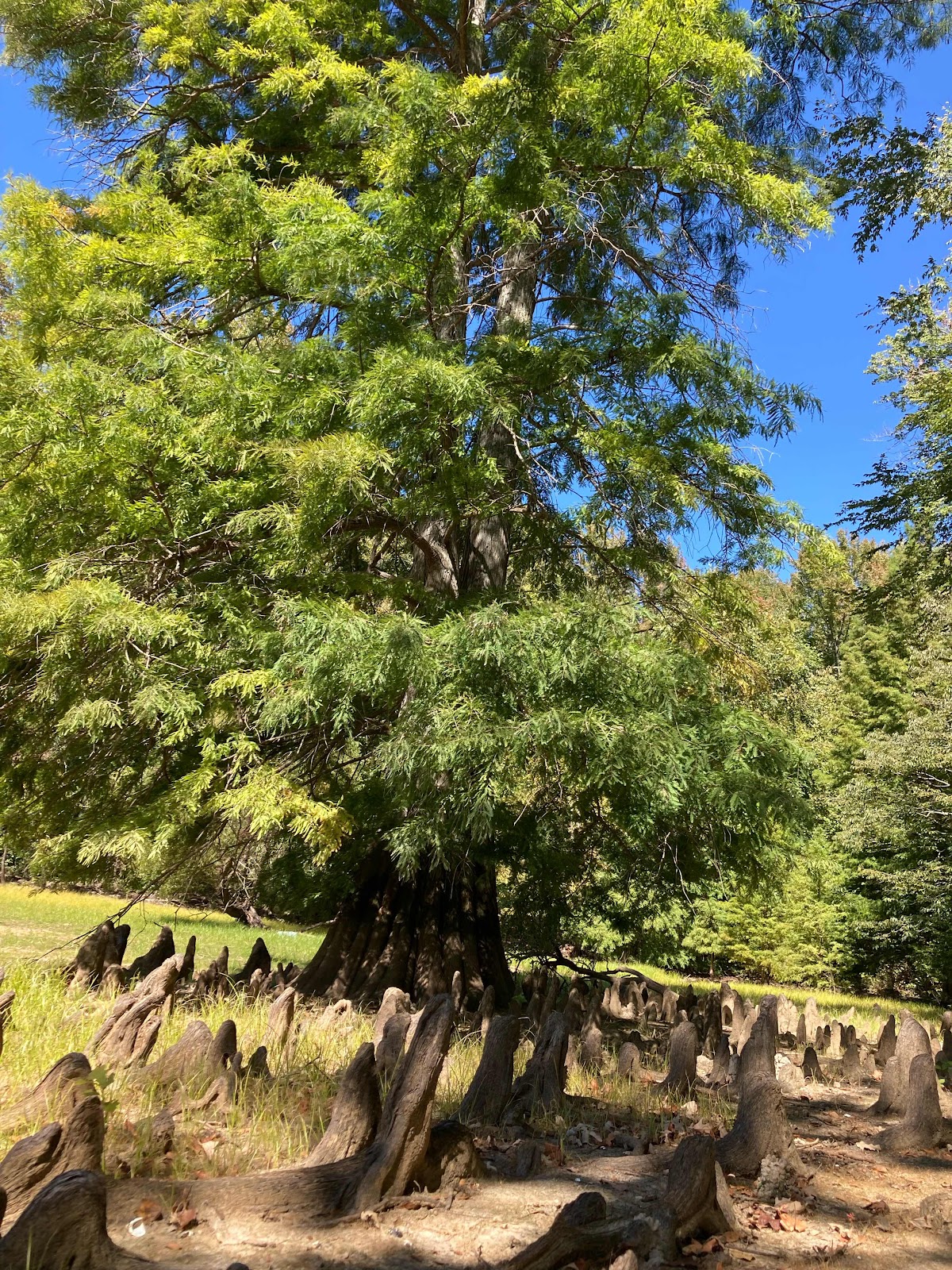
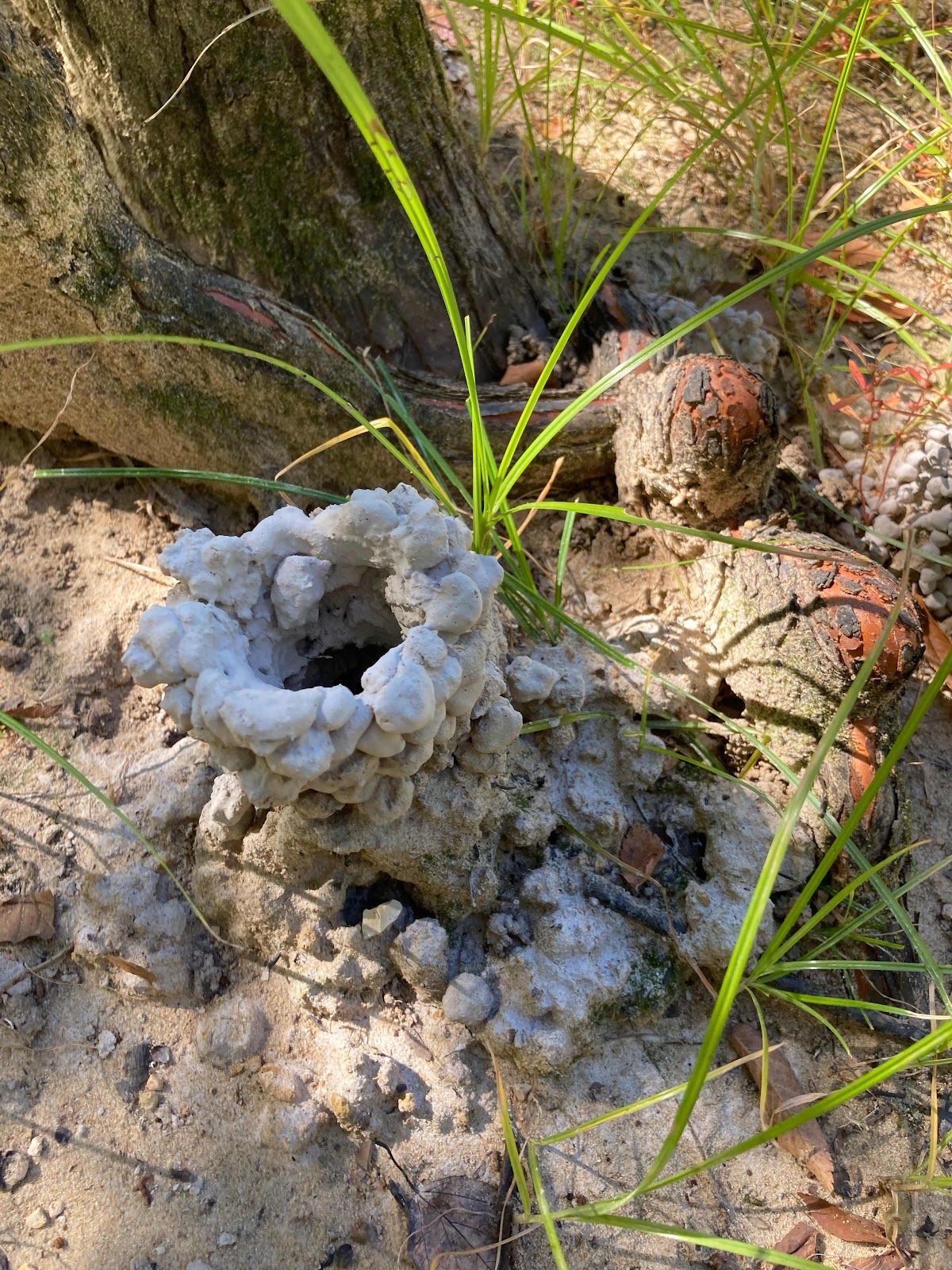
Land Between the Lakes has…
…amazingly beautiful anchorages.

…rare blue rock/glass along some of the shoreline.  This ‘rock’ was the slag byproduct of iron ore smelting furnaces from the mid 1800s.

…large bryozoans (this blob is a colony made up of thousands of microscopic animals, called zooids).

…trees with knees.

…extremely talented crayfish who build high rise masterpieces.

…reminders of how hard life was for the people who lived here in the late 1800s.  These three headstones touched my heart when we were here two years ago, and I was just as moved when I saw them again.

As we leave Kentucky Lake we are reminded that in the fairly recent past this area looked much different!


Sunday, October 9, 2022

Hello River System!

As I’ve mentioned before, cruising isn’t always rainbows and dolphins!  Sometimes it’s sewage and electrified waterways😩
On September 6, we left Lake Michigan, and entered the river system.  Most people can enter the Illinois River by following a very beautiful and scenic route (blue line) through downtown Chicago.  However, there is a fixed bridge that only has a 17 foot clearance, which we definitely could not get under, on that route.  So we were resigned to using (red line) the ‘Chicago Sanitary and Ship Canal.’  The history of this canal states, “The chief purpose of the canal, conceived in 1885, was to reverse the flow of the Chicago River away from Lake Michigan in order to halt pollution of the lake waters by the city’s sewage” (online Britannia).  

If you know me…you probably know that I am a little naïve!  I read these descriptions, while planning our trip, and thought, “oh how lucky we are not to live in the 1880’s when they used a canal to discharge sewage from a major city…yuck…disgusting…unbelievable…thank goodness we live in a more civilized century!”

Unfortunately, I learned that times have not changed much!  Also, you will notice that the two routes merge so ultimately everyone is traveling in the same water.

Ahhh, what pretty waterfalls…ugh…what is that terrible smell???  Ohhhh, those waterfall areas are sewage ‘treatment’ (I use that term lightly) discharge points🤢. We passed several of these discharge points in this canal. 

There are a lot of warnings about the hazards of touching this ‘water’ (I use that term lightly)! In addition to the sewage contamination, there is an area that has been electrified to stop the invasive Asian Carp from getting into the Great Lakes…which is a fabulous idea, just a little creepy to travel through!

This was our drumroll moment,  this fixed bridge is advertised to have a 19 foot clearance.  We measured precisely (with fuel and water tanks full) and found that Righr Hand’s highest point I’d 18’ 4” above the water😬.  That is certainly less clearance than we would prefer, but we were fully prepared to remove our hard top if necessary (which required a lot of planning and the procurement of tools and supplies.  On this particular day, a towboat captain told us the clearance was 19’ 6”…yippeee…we made it under without any additional work!

There are a lot of materials being moved along this stretch of the river.  We passed huge mounds of sand, gravel, wood chips…etc,
But what the heck is this!!  No photoshop color tampering has been done to this picture, this is the actual color of this substance🤷🏼‍♀️

There has been a lot of radio chatter about a man named Mike, who was completing the Loop on a jet ski, coming our way.  We were watching for him when he passed us on the Illinois River.  He completed the Great Loop in three months!

Personally, I have been disgusted by the water quality in the area, but the eagles don’t seem to mind.  Clearly, they are thriving here…in fact, we saw over 100 eagles on this stretch of river, more than we have ever seen in our 27,000 miles of cruising!

Oh…that’s where all of the channel markers have gotten to…maybe a huge beaver is collecting them😉

We usually try to avoid running with a pack of boats, but in this location a dredging operation had the lock hold boats so we could all pass through together.  

The river levels have been very low, which contributed to an ‘INCIDENT’ where Right Hand ran aground HARD!  I was at the helm, and was attempting to pass a tow with many barges.  I radioed the captain of the towboat, and he told me to “come ahead on the two”.  This means that he wants me to pass him so that his vessel is on my starboard side.  The channel was fairly narrow, and the water depth was only 10 feet. As I started past I could feel that we were being dragged over toward the barges.  I turned the wheel hard to port and was still being pulled sideways toward the barge (this is where I considered  aborting my attempt, but didn’t feel that was a safe option either) so I increased throttle (kinda/maybe to full) until I started to pull away, and just as I broke lose from his suction and started making headway past him…it happened!  I felt a little bump, then the bow came out of the water like a submarine surfacing in a WWII movie😖. Poor Keith happened to be visiting the head (restroom) at that moment…oops!  

Thankfully, it was very soft mud, and we were able to get off the bottom on our own, and with no damage (other than my pride).  While the charts indicated that we were within the boundaries of the channel, the lower water levels and the narrowness of the channel created a situation where the tow was actually sucking water out from under us…while I was simultaneous making my boat ride lower by increasing the throttle (we do not get up on plane😉).


Next stop, Peoria…
We anchored off Peoria, and took the Whaler to the other side of the river where a Walmart was right along the waterway.  The problem was that the embankment was very steep, which didn’t stop us from getting there…but made carrying groceries down a treacherous proposition.  No worries, we always have rope handy (when it is tied to a boat it is called line…if not, it’s rope) and we are always in ‘problems solving’ mode.

Much more efficient, and safer too!

We spent one night tied to this old/abandoned lock wall…that is now part of a ‘marina’.

The locks on the Mississippi River are HUGE!  This picture was taken when we were already 1/3 of the way in😳
Keith calculated that this lock released 20,644,800 gallons of water in order to lower us 23 feet…amazing!

We were shocked to find this as ‘common practice’ for dredging the Mississippi.  They simply dig down and shoot the spoils back into the current, to be carried down the river.  This definitely looks like job security for the dredging industry!

Sometimes the Mississippi can be an intimidating place to find a safe anchorage, but this little (relatively speaking) lock (right off the Mississippi River) is happy to let boats tie up for the night!

Guess which city we are entering…

Yep, St. Louis. Notice how we captured the moonrise inside the arch.

This tow is 6 barges wide, and 5 barges long.  It would take 1,740 semi trucks to move an equivalent amount of material!

Wow!

Everyone is aware of how much I dislike fog…

Especially when these are thrown into the equation!


Our trip down the river system, thus far, has been enlightening…to say the least, but as usual…beauty abounds!


The Continuing Saga

  Well, another month has passed since my last post, and I must report that our trying times have continued to haunt us.  Not sure if we sho...