We have traveled about 230 miles since our last post, and are currently back in the Bahamas. Most of those miles were easy and beautiful, but a few were treacherous. After saying goodbye to our guests, our next move was to get back on the south side of Providenciales before the winds returned.

Conditions really were fairly calm until we approached the point of land where the ocean swell builds up in the more shallow water.

What a great idea…we might put a helicopter on our top deck too!

It’s funny how a prediction of 5 foot waves now sounds pretty good to us. We have been watching the wind patterns for the past 6 weeks, and realized that weather windows with waves 5 ft or lower only occur every 10-12 days…so forecast to put some miles behind us. We knew we needed to be in a location that offers good protection from a NE wind before Tuesday.

The first leg of our journey was from West Caicos to Great Inagua (indicated by the green line). The first half of the trip had 3-5 ft seas out of the east (a little lower than expected), but we were gliding over the waves quite nicely for a fairly smooth ride. The red highlight indicates the area where all heck broke lose. Little Inagua and Great Inagua are separated by 7 miles. As we have seen many times before, waves build higher when they approach shore, so we were prepared for that. However, we had never experienced two shores and a funnel in between…the waves were HUGE!
I know, just a few weeks ago, I posted about the biggest waves I’ve seen…but they were big in breadth not height. They were wide and flowing like the parachute you flapped up and down in elementary school. These waves were not that!
These waves were the kind that are steep, and crashing. These waves were about 14 feet high, and dwarfed any waves we have seen before. The ordeal lasted for about an hour, during which time we didn’t attempt to move (that would have been very dangerous). I couldn’t even get to the camera to try to get a picture. All I could do was watch and call out (HOLD ON) when one was too steep or breaking on our port quarter. Once we got through the passage and behind the NW tip of Great Inagua waves went down to 1-2 ft. It was a wild ride, but the boat did great, and upon reflection I don’t think I was scared at all…adrenaline takes over.

Great Inagua is 50 miles from Cuba, and 65 miles from Haiti. This dock is used by Haitian boats to pick up items shipped by container. The containers appear to be full of old and used items, including old cooking oil collected from restaurants. These boats pick the items up and take them to individual communities in Haiti. Several people told us the boats are horribly overloaded when they leave. This boat is still in the loading process…who knows what it looked like when it finally left.

After checking back into the Bahamas, which was a 6 hour ordeal for Keith (it was his turn). We anchored in Man O War Bay, just south of the salt piles. Salt production is the major industry on Great Inagua. If you are reading this from a cold and snowy location, some of this salt might make its way to your roads. Most of this salt will either be used for roads, pools, or water filtration systems.
We hired Colin to give us the Great Inagua tour. Our tour started in the salt works…

When the brine is highly concentrated the water turns pink from carotenoid pigmentation in bacteria and algae that ‘bloom’ in high concentrations of salt.
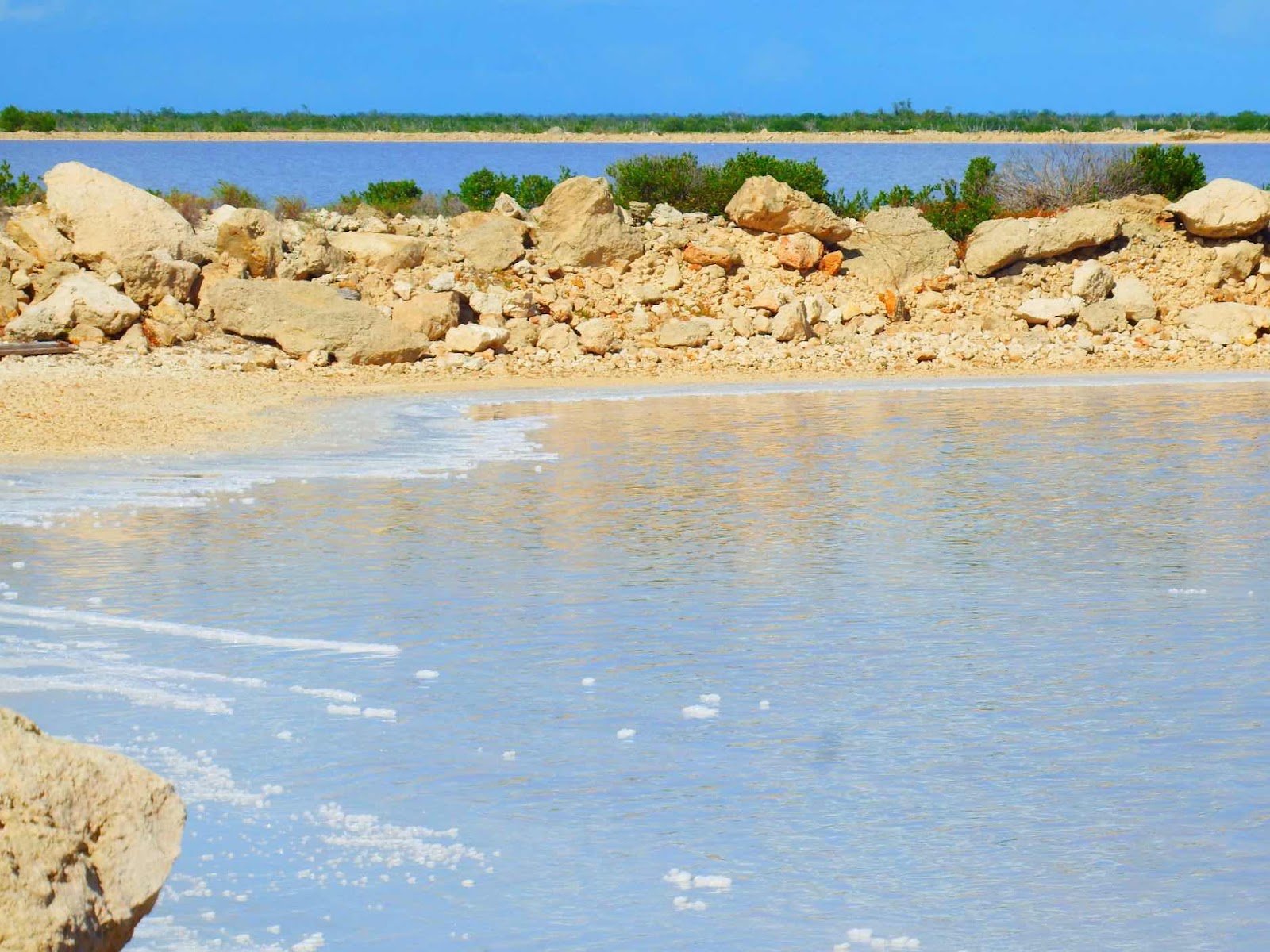
The concentration gets so high that salt crystals settle to the bottom of the pond forming sheets of salt that look like ice. Once the pond is saturated they drain the water and take a machine in to break up the salt sheets and scrape the salt into trucks. The salt is then washed (with high brine water) to remove any impurities.

Flamingos love this environment. The foam in this picture is similar to sea foam found on beaches during storms or high wind events. The foam is created in high wind, high salt, and high algae environments.
Fun flamingo facts:
> Flamingos are filter feeders that dine on algae and brine shrimp, which contain carotenoids (pink pigment)
> Their digestive systems breaks down the carotene and stores it in fat. These fats are deposited in the cells of their skin, feathers, and beaks giving them their color.
> The brightest flamingos are those that are well fed, and those seen during winter months as strong sunlight can bleach the pigment.
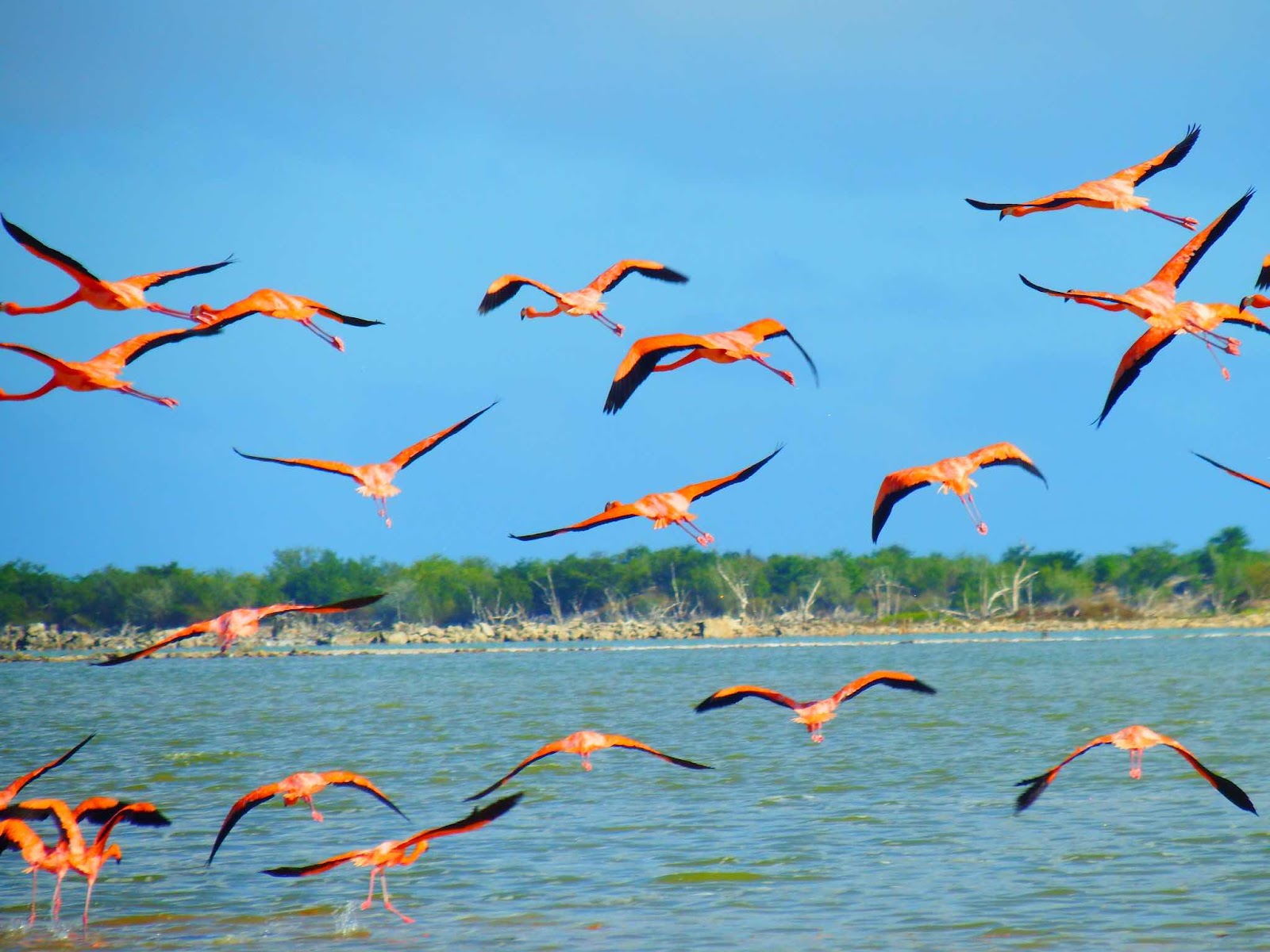
> Adult flamingos are about 42 inches tall and have a wingspan of 4-5 feet.
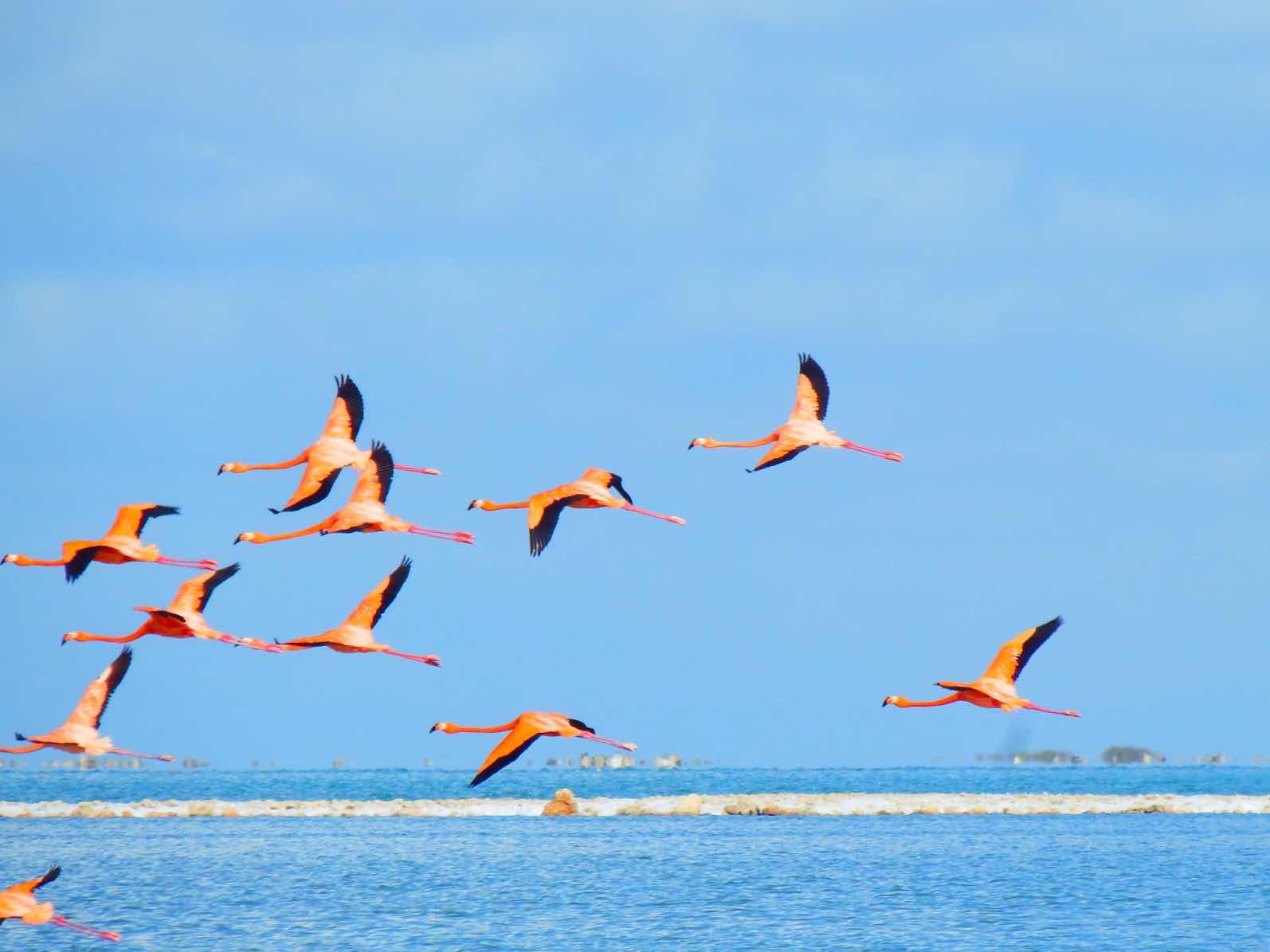
> Flamingos will often rest their head on their body to avoid fatigue of neck muscles.
> When flamingos hatch they are dark gray in color, and only become pink as they mature.
The next stop on our tour was the lighthouse…
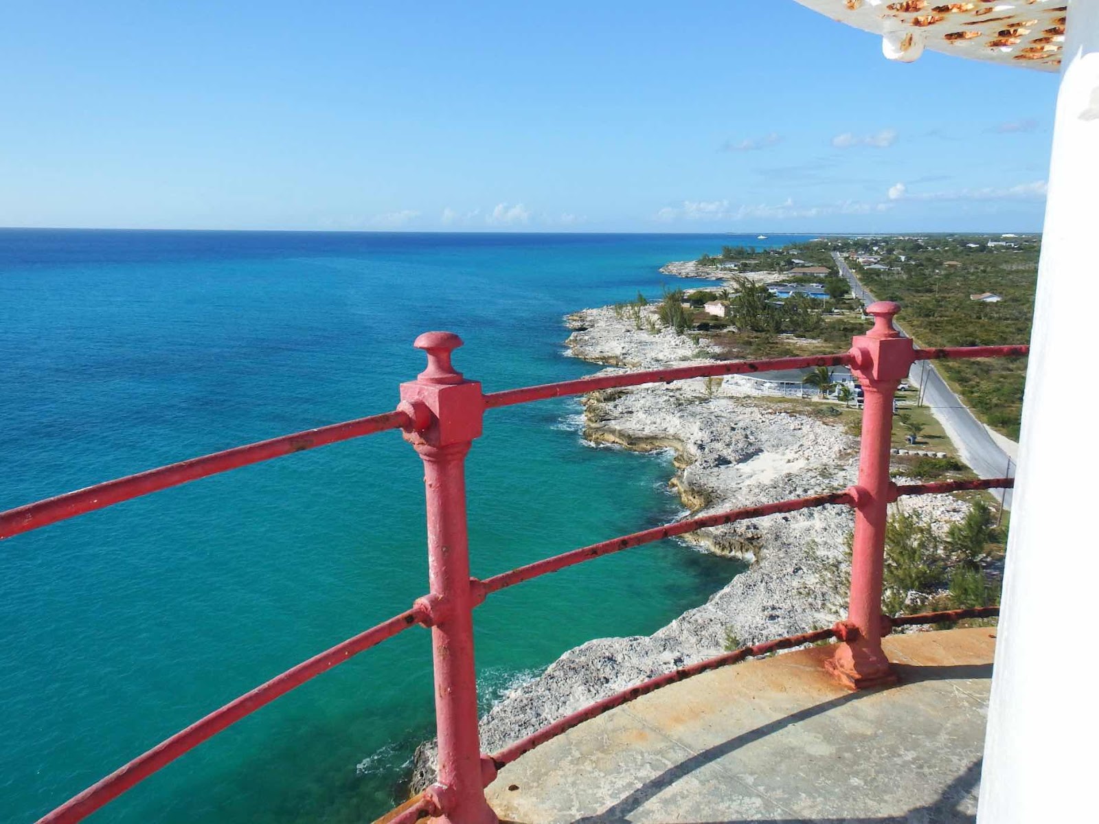
As early as 1713, there were acts of piracy when local inhabitants of Great Inagua would place lanterns along the shoreline, at night, to confuse passing vessels and cause groundings. Over the years, many vessels were wrecked in the reefs along the island’s shoreline. In 1870 the English Crown built this lighthouse to prevent further incidents. (Bahamasgeotourism.com)
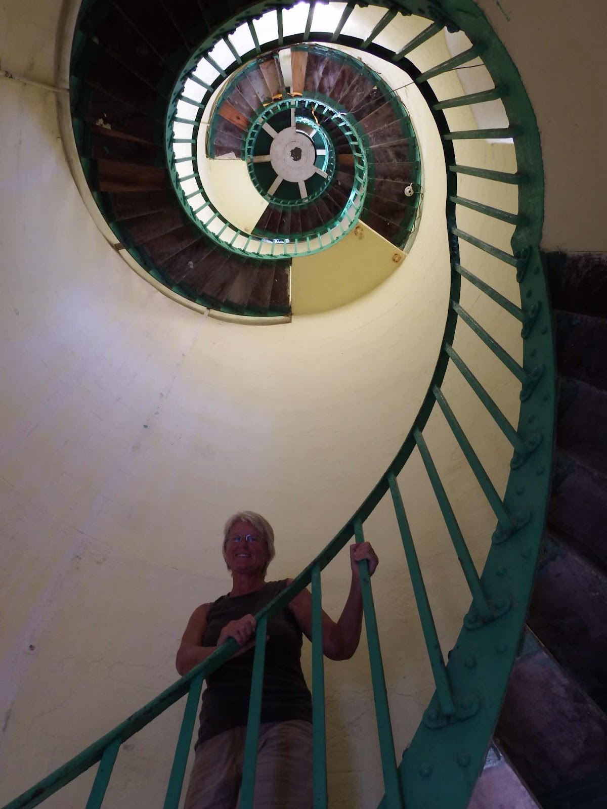
Good exercise, but if you look closely you will see a step missing…that’s a little scary.

The lighthouse provides a great view of the pump station that supplies ocean water to the salt fields. This pump station has actually created a huge inland salt water lake, which acts as the first step in the evaporation process.
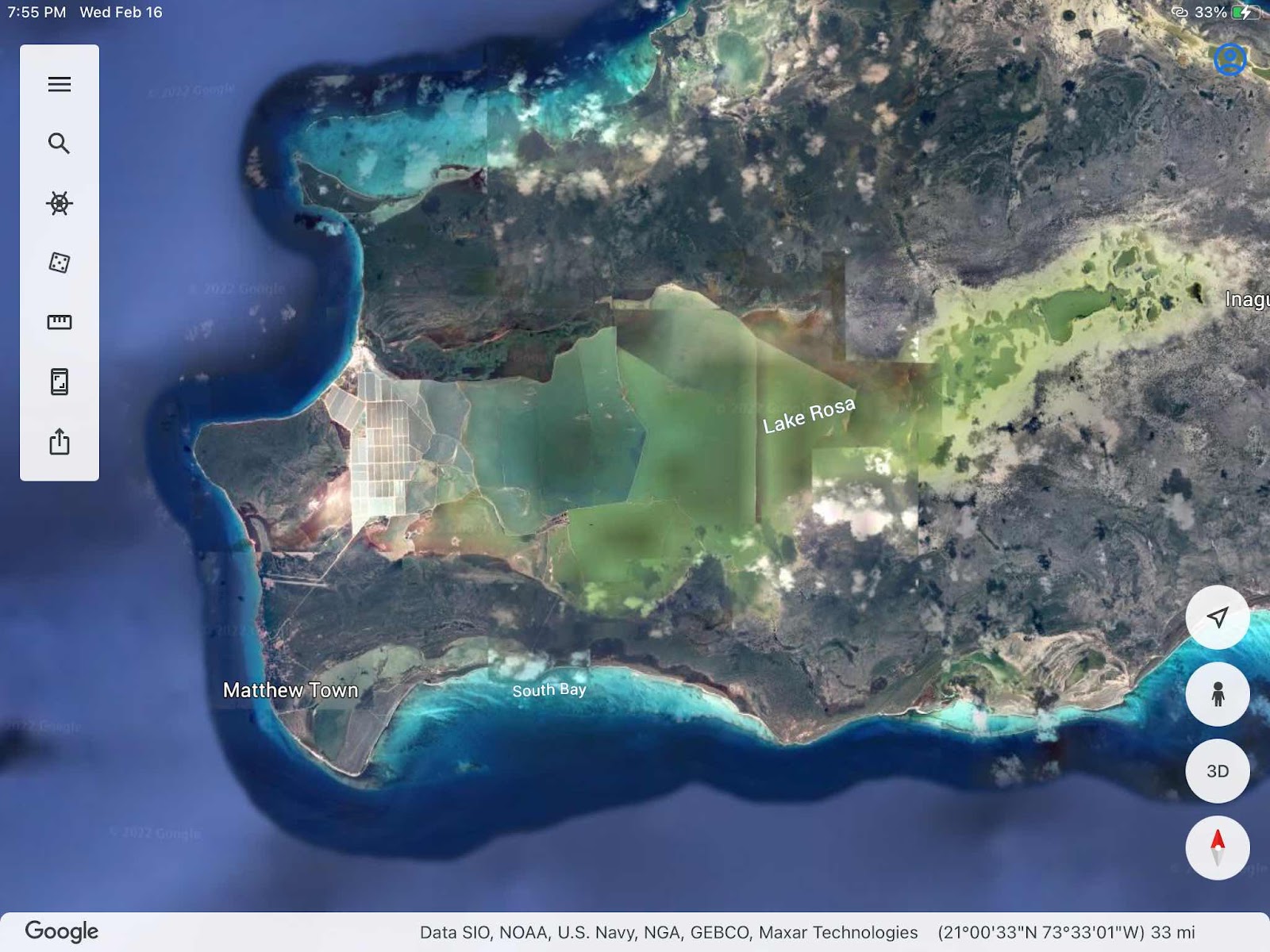
This Google earth view gives a good idea of how much of the island is used for the salt extraction process. Colin told us the salt company owns 300,000 acres. The locals are happy about the inland lake, as it provides a great fishing environment free from the ciguatera toxin. While large fish do not get pumped into the system, eggs and larvae do enter the system and grow to full size in the lake environment. Colin confirmed that even barracuda are excellent to eat when they come from the inland lake.

Meet Robert Forbes, 90, who is the last of the ‘original’ salt workers brought to Great Inagua in the 1930’s from surrounding islands. Mr. Forbes was born on North Caicos, and worked the salt flats there until the Erickson brothers (three Americans) started the salt co on Great Inagua and recruited workers with experience. When I asked Mr. Forbes if he worked the salt flats the old fashioned way, with rakes and shovels, his reply was, “for 44 years, 4 months, and 2 weeks!”
Thanks for a great tour Colin!
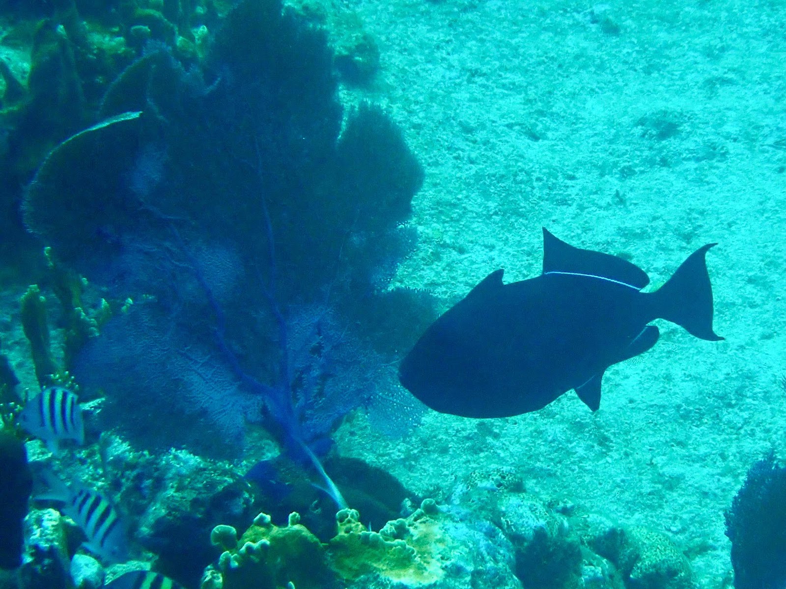
Of course, we also found time to do a little snorkeling. This is a Black Durgon. We first saw these in Grand Turk, but I had trouble getting a good picture. The fins look like a moving wave as they undulate. There is also a bright blue line along the boarder of the body and fin.
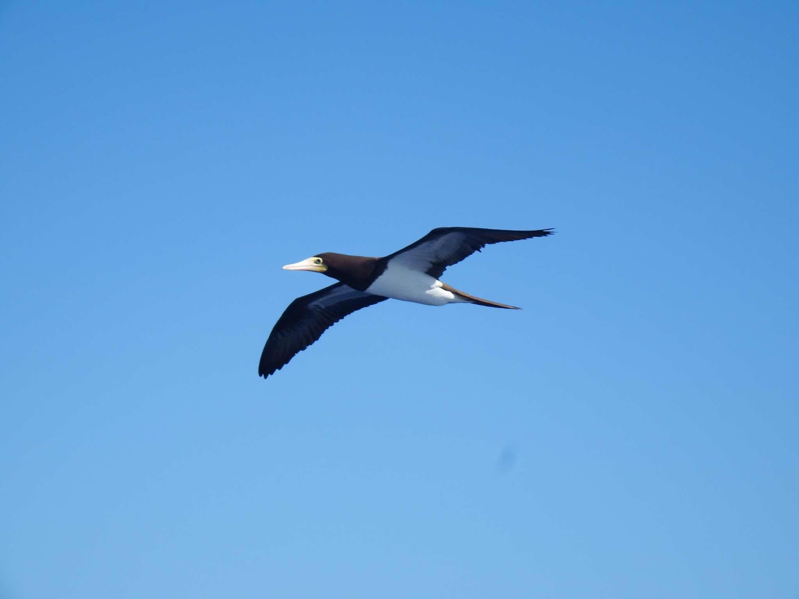
During the next leg of our trip I made a new friend. This is Earl. Earl followed me for 2 hours while I was at the helm (and Keith was asleep). Earl knows that boats scare flying fish out of the water, and Earl took full advantage of this knowledge to eat numerous flying fish! As soon as Keith came up on deck Earl flew away🤷🏼♀️

We are currently anchored on the west side of Acklins Island, waiting for the wind to calm down so we can head to Rum Cay.


No comments:
Post a Comment